 AMOCO
AMOCO
ADLER
Brief History
Amoco was the main brand name used by Standard Oil Company of Indiana (acquired by BP in 1999) for its European downstream operations. It entered Europe by buying 700 Zenit stations in Italy in 1962 from Fratelli Camangi (which had started by building a refinery in Cremona in 1954). Amoco entered Britain about the same time and a few years later moved into Belgium. With under 300 outlets, the British chain had around 2% of the market at its peak, although to justify its refining interests it supplied several jobbers using the Flare brand, and other independents such as Sabre, Oak, TAC and Beca.
Amoco was even smaller in Belgium, although some activities were carried out through a JV with Fina, and only in Italy were there a sizable number (1,000) of stations. However it was notoriously hard to make money in Italy, and Amoco sold out to the Saudi businessman Roger Tamraz in 1984 who rebranded the stations TAMOIL. The British chain was kept until early 1990 when it was sold to Elf.
Despite its earlier complete withdrawal from European petrol retailing, Amoco opened 11 stations in Poland in the mid-1990s, but these were soon sold to Texaco.
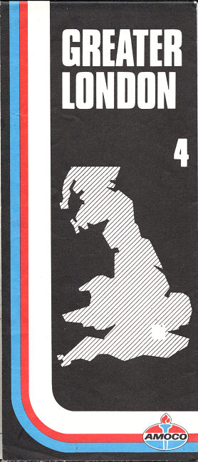
Maps: Amoco
|
|
|
|
|


The oldest Amoco map of Britain is a Geographia issue, without card covers, of the whole of the country on a single sheet and using a design that it much more typical of US maps with a "banjo" sign rising above a row of petrol pumps. The next known maps were probably produced in the late 1960s in two sections (North & South); both these 1960s designs carried the European (and Australian) logo not used in the USA. Neither is dated, in common with other Geographia commercial maps of the period, but both were specially printed for Amoco, although the latter was mounted inside card covers.
After the oil shocks, a series of 6 maps including London was produced for Amoco using the newer logo in 1975-7, unusually with excellent Bartholomew cartography.
In 1980 Amoco returned to Geographia, producing a set of 4 maps (ignoring Northern Scotland which was outside its marketing territory). Amoco donated part of the price of these maps to the Motor and Cycles Trades Benevolent Fund. The most recent known map is a single sheet from 1983, again by Bartholomew but also crediting Johnston & Bacon as originating the design in 1976. Only the card cover was specific to Amoco; the map inside is a stock issue at a generous scale of 1:625,000. The Amoco logo floats on a black background in line with the controlled background signs that it was trialling at its service stations in the early 1980s.

|
Around 1972, Amoco also sold a 94 page hardback atlas of Britain (not illustrated). Measuring 275x200mm, it had blue cloth covers overprinted in gold with the newer Amoco logo and the title "motoring atlas"; it is not known if there would originally have been a printed dust cover. The atlas itself was a stock Geographia production with most maps at 8 miles to the inch, and enlarged area maps of main conurbations. |
|
|
The Amoco map of Italy shown left was produced in, or soon after, 1964 by Vallardi. It covers the whole country at 1:1,250,000, which leaves little space for additional features other than a panel advertising Amoco Super Permalube motor oil. |
|


It is possible that the small Belgian chain may have sold occasional titles. (Amoco's small Australian chain produced maps and they were one of the most consistent US issuers right up to 1980.)
Although not from Europe, follow this link to see The Amoco Map of Space Mysteries, a graphic map produced in 1958 for Amoco's US operation.
Maps: Adler
|
|
Adler was a German independent owned by Amoco noted for smart service stations and a diamond sign not unlike that of DX in shape; it grew rapidly from 50 sites in 1964 to the 396 sold to Elf in the 1976. Amoco may also have had a handful of stations under its own name in West Berlin. Adler maps of Germany can be found but are uncommon - the sectional map (left) of Südwestdeutschland dates from 1969, using cartography by Ravenstein at 1:400,000 and was one of 4 sections, each costing DM0,95. The map of West Germany's Rhein-Ruhr region (right) probably dates from the mid 1960s. |
|


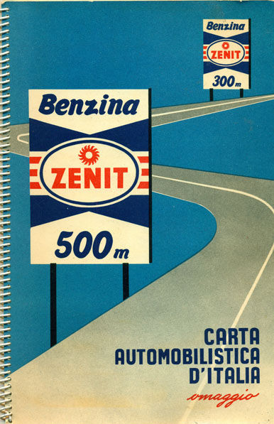
Maps: Zenit
|
Zenit Italiana was established around 1952, when a small wholesaler called Fratelli Camagni decided to build a refinery in Cremona, Italy. This opened in 1954, and although they were mainly involved with heating oils and industrial fuel oils, they acquired a few small gasoline distributors in the area. In 1961/2 they were acquired by Amoco, so presumably the name disappeared soon after. |
 |
Adler image courtesy Dave Leach (R); earliest UK image courtesy Jon Roma; 1967 Italy map, 1978 UK atlas and Zenit atlas courtesy Richard Horwitz

Text and layout © Ian Byrne, 2000-14
All original copyrights in logos and map extracts and images are acknowledged and images are included on this site for identification purposes only.