Oil Company Road Maps from Spain |
Brief History
The Spanish petroleum industry was only briefly open to major international companies such as Shell, Standard Oil and France's Desmarais Frères (which used the brand Automovilina), before a national petrol distribution monopoly was established in 1927 - Campsa, the Cia Arrendataria del Monopolio de Petroleos SA. After Spain's accession to the European Community, the state was required to divest itself of the monopoly and in 1992 opened up the downstream petrol markets to competition. However the split was made on the basis of refining capacity, and another former State owned company, Repsol, ended up with around 60% of the market including the rights to the Campsa brand. Around 30% of the market went to Cepsa (in a joint venture with Elf, now part of Total) and 10% to BP following its purchase of Petromed.
Over the past 25 years or so, other companies have entered the market including Shell (which has since sold its assets to a local company DISA, that is still licensed to use the Shell branding), Esso (which later sold its chain to Galp), Agip (with its Portuguese partner Galp), and Tamoil. These have been joined by a number of local names such as Meroil, Petrocat and Esergui, which uses the AVIA co-operative's brand.
Maps - domestic issues
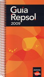 |
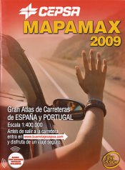
The two largest marketers in Spain are Repsol and Cepsa, and both sell branded road atlases. Renamed from the Campsa Guia in 2009, Repsol's Guia comes as part of an expensive box set, with the spiral bound atlas also including hotels and restaurants and separate guides to wines & tourist routes. The maps are at 1:300,000 and each page folds out. |
 |
|
|
|
|
Ordinary sheet maps are much less commonly seen. No maps issued by oil companies are known from before the establishment of Campsa. |
 |
 |
Maps - touring service issues
As Spain was a popular holiday destination, most of the larger European oil companies included small scale maps of the country (usually linked with Portugal to cover the entire Iberian peninsula) for their touring service. Indeed, the Fina map shown below says "The PETROFINA Group, through the intermediary of its INTERNATIONAL TOURING SERVICE takes pleasure in offering this road map to FINA customers, with best wishes for a pleasant journey."
"Although the FINA brand is not represented in Spain, do not forget that wherever you see the FINA shield displayed in other countries, you may be assured of efficient and courteous service."
 |
  |

|
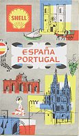 |
The eight maps above represent the variety of non-domestic issues of Spain and Portugal that can be found from the main era of touring services. From L-R they are: |

|
 |
 |
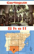
This final map is exceptional, as it comes from a series of eight Shell "cartoguia", similar to the French or Greek cartoguides, and dating from 1968. It is presumed that these were on sale in Spain, possibly at service stations that sold Shell lubricants, but they may have only been available through booksellers, or even French or other Shell stations. After the end of the main touring services, Spanish maps were in even greater demand from Northern European motorists, so included in a number of paid-for map series: |
|
 |
 |
 |
 |
 |
From left to right above these are:
• Pollet (stickered onto stock map), 1984, Spectrum/RV Reise (Belgium), 1:800,000
• Shell (Die General Karte), 1996, Mairs - Stuttgart (Germany), Costa Brava at 1:200,000 - part of a series of maps that included six holiday areas within Spain, including areas inaccessible to motorists such as Tenerife, Gran Canaria and Mallorca. This series was widely sold across Europe - the copy shown above was imported by World Leisure for sale in the UK at £5.50.
• Aral, 1997, Busche (Germany), 1:1 million - generally sold as part of a boxed set of Aral maps of Europe
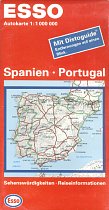
• Esso, 1998, Hallwag (Switzerland, but for Esso Germany), 1:1 million
• Q8 (jointly sponsored with Het Laatste Nieuws), no date (ca2001), de Rouck (Belgium), 1:1,100,000
Text and layout © Ian Byrne, 2004-13
All original copyrights in logos and map extracts and images are acknowledged and images are included on this site for identification purposes only.
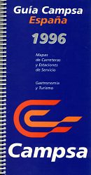
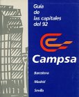 Campsa itself does not appear to have ever sold sheet maps, but around 1981 the Campsa Guia (guide) was started as a tall format spiral bound atlas and guide to the country, with a map section followed by a gazetteer featuring hotels and restaurants. In 1987, there were 34 folding maps to cover the country at 1:500,000, using cartography by Almax Editores. By the 1996 (fifteenth) edition it had grown into a thicker volume with 95 pages of fold-out maps by Falk at 1:300,000, plus over 350 pages of gazetteer. Later editions included supplements for restaurants and CD-ROMs for interactive route planning, as well as deluxe versions with vinyl covers or a presentation box; the name was changed to Repsol (above) after 2008. The 1992 supplement was a small format guide with basic maps to "the three capitals": Barcelona (Olympics), Madrid (European city of culture) and Sevilla (Expo 92).