Road maps from Greece |
Introduction
Greece gained its independence in modern times as far back as 1830, but remained - in European terms - backward with a largely peasant economy until after World War I. Between the wars a series of coup d'etats and internal dissension, followed by wartime occupation by the Germans, led to the country remaining underdeveloped. In 1947 an attempted Communist takeover was thwarted, but this raised its profile with the Western powers, who helped shore up its economy as a bastion against the Communism prevalent in the Balkans. This led ultimately to it joining the European Community in 1981 and over the past 25 years the economy, boosted by mass tourism, has grown rapidly.
In energy terms, Greece lacks significant natural resources, and before World War II relied heavily on oil from Romania; its limited downstream petrol sector was seen as being of interest only to those firms with Balkan refineries, such as Shell and Petrofina. After the War, it became the South-Eastern outpost in Europe for the free market, with chains of service stations being operated by Shell, Mobil, BP, Caltex/Texaco, Fina, Esso and Total. This left little space for national brands, although Mamidakis (Mamidakis) maintained a reasonable sized chain.
By the 1980s, oil companies looked at their operations solely on economic merit, especially as Greek-owned refineries began to be constructed. Esso sold out to Hellenic Petroleum (Eko-Elda - who also now own Mamidakis) and Fina to BP. Independently owned chains grew rapidly in size in the 1990s, including JetOil, Elin (Elin, formerly Elinoil) and Avin, which is largely owned by Saudi Aramco. At the end of the decade, Mobil's assets passed to BP, as elsewhere in Europe, and Texaco withdrew from the market by swapping its chain for a much smaller number of Shell stations in Britain. In the 2000s, smaller firms continued to take on new sites, with especially rapid growth from brands such as Aegean, Dracoil, Revoil and Cyclon - there are now around ten independents with over 100 retail outlets each. Most recently, at the end of the decade, the remaining international majors sold their chains - BP's 1200 outlets going to Eko in 2009, and Shell's 700 strong chain to local refiner Motor Oil (Hellas), owner of the Avin chain, in the following year.
Maps
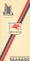
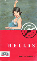
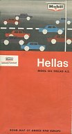
The oldest map here is probably from the early 1950s and was produced for Mobil Oil Hellas by Geometrographic Institute of Greece "Puzol". Despite the logo on the cover, Mobil did sell petrol in the country at the time under its Mobilgas brand, and its service stations are shown on the Attica side of the map, drawn to the scale of 1:200,000. The rest of the country is on the reverse side at 1:400,000. The map, printed on slightly low grade paper, was pasted into light card covers, along with a 16 page place name index for the two sections. All text was in Greek only, unlike the later maps from the 1960s shown below. An earlier Mobilgas issue that marks mule tracks as well as motorable roads is also known, but is very hard to find. |
|
|
|

|
|

|
|
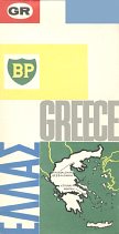
BP's map at 1:1,000,000 from the following year (1964) used the same cartographic team, but is stylistically quite different and features place names in both scripts. Copies of the BP map distributed through the London Touring Service included a leaflet inserted listing the addresses of 21 round the clock (24 hour) BP filling stations.
Esso's 1965 map is in keeping with its international style, but surprisingly only uses Greek script for smaller towns and villages. It was prepared in London by George Philip & Son at a scale of 1:1,000,000. Earlier Esso maps had not given Greece a separate sheet, but included it with Yugoslavia as a small scale inset on Esso's Austria map.
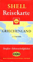
The final map is a German Shell issue, prepared by Mairs of Stuttgart in 1968 and widely sold through Shell stations and bookshops across Europe.
Sectional & Special Maps
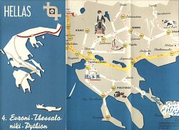
The Shell Touring Service map shown here is slightly older than the maps above. It comes from a series of four titles produced for Shell around 1959 by the Geometrographic Institute of Greece "Puzol". Three (nos. 1, 3 & 4) showed the main tourist routes from Athens to Corfu or the Yugoslav border at Euroni, and from Euroni to the Turkish border at Pythion. The second map was a Grand Tour of the Pelopponese. Each was exceedingly simple cartographically, oriented without using North at the top of the map, but included a list of the main towns and archaeological sites on route in English. |
|

|

|
Corfu had been popularised by Gerald Durrell's books, and attracted mainly British holidaymakers from the early 1960s. The Shell map shown here came from Kerkira (Corfu) in 1965 and has a rather basic map of both the city and island by K Florias. Next is a 1967 Mobil map of the island with a delightfully homespun cover of a toy Mobil garage and two toy cars. The toy garage is Manessi Bros.' and the map says "phone 3-70 and a driver will call to collect your car for servicing at Corfu's new Mobil Service Station" - in 5 languages! The map is quite basic, but includes tourist information in English, French, German and Italian and a list of hotels and casinos in English and Greek. |

|

|
In 1970, Shell issued a uniform series of 5 maps, again by K Florias. Section 5 covered all of Greece on one side, with detailed maps of the islands of Crete, Corfu and Rhodes on the reverse, plus plans of the archaeological sites of Dilos and Knossos. The 1980s (?) Mobil sectional map 3/4 has excellent cartography by D. Tsopelas and was sold as a set of 4 maps in a rigid PVC wallet with an insert booklet listing all hotels and selected campsites. |
Texaco was however the co-sponsor of this map of Samos, prepared primarily for Hertz in the mid-1990s. I. Mathioylakis & Sia produced the map at 1:100,000 with town plans & tourist information in 5 languages on the reverse; inside it carried adverts for Texaco's CleanSystem3, and listed Hertz locations. |

|

|
Maps are also likely to have been produced for Caltex, Fina, Texaco and just possibly Total, from the older international brands. Although no maps have been seen from other Greek brands such as Mamidakis, Elin, Jet Oil, Avin, Aegean, Eteka, Revoil, Silk Oil, Cyclon, Elpetrol, Dracoil, KM Oil or Petroïl, all have been large enough to issue maps. Please send me an e-mail if you can help me with these, or with any other brands of petrol shown on Greek road maps.
Text and layout © Ian Byrne, 2004-14
All original copyrights in logos and map extracts and images are acknowledged and images are included on this site for identification purposes only.
