Road maps from Iceland |
Iceland's downstream petrol marketing industry started in January 1928 when Olíverzlun Íslands (Olís) opened its first filling station in Reykjavik, the capital. Later that year, Shell became the first international brand on sale, but Esso did not follow until 1946. Two years later Olís entered into a joint venture with BP which lasted until 1974 when it bought out its British partner. In 1989 Texaco's Danish subsidiary acquired a stake in Olís and in 1995 it passed into the control of the HydroTexaco joint venture.
The Icelandic market remains divided between the three main companies Skeljungur (which licenses the Shell brand), N1 (formerly Esso) and Olís. Esso was traditionally strong in rural areas through relationships with local co-ops, and in April 2007 N1 was created by merging Esso's local distributor, Olíufélagid, with motor retailer Bílanaust, creating Iceland's largest petrol station chain with over 100 outlets. Olís has recently developed a new ÓB (ódýrt bensin) identity for use at unmanned discount stations. Per capita, Iceland has one of the highest numbers of petrol outlets in Europe, as the population density is low leading to many single pumps surviving in remote communities. At the opposite exterme Shell opened Europe's first hydrogen retail filling station near Reykjavik in 2003, coincidentally the same year that it sold its minority interest in Skeljungur, which supplies around 69 Shell stations and 23 unmanned discount stations under the Orkan identity.
 |
 |
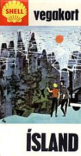
 Shell map: courtesy Jon Roma |
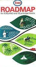
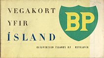
Iceland has a strong cartographic tradition producing high quality maps. It is likely that Olís has also issued branded maps, although none are known to me. The three examples above all date from the 1960s. The Esso map was reversible, with the other cover in Icelandic; as Reykjavik is omitted from the twelve towns there was probably a separate Esso map of the capital. The town maps are unusual in that they are aerial photos with street names overprinted on them, but the main map has full relief colouring. The BP map also shows full relief and covers the island at 1:600,000 using cartography based on work from Geodætisk Institut.
Please send me an e-mail if you can tell me more or if you have a spare Olís map that I can add to this site!

All original copyrights in logos and map extracts and images are acknowledged and images are included on this site for identification purposes only.