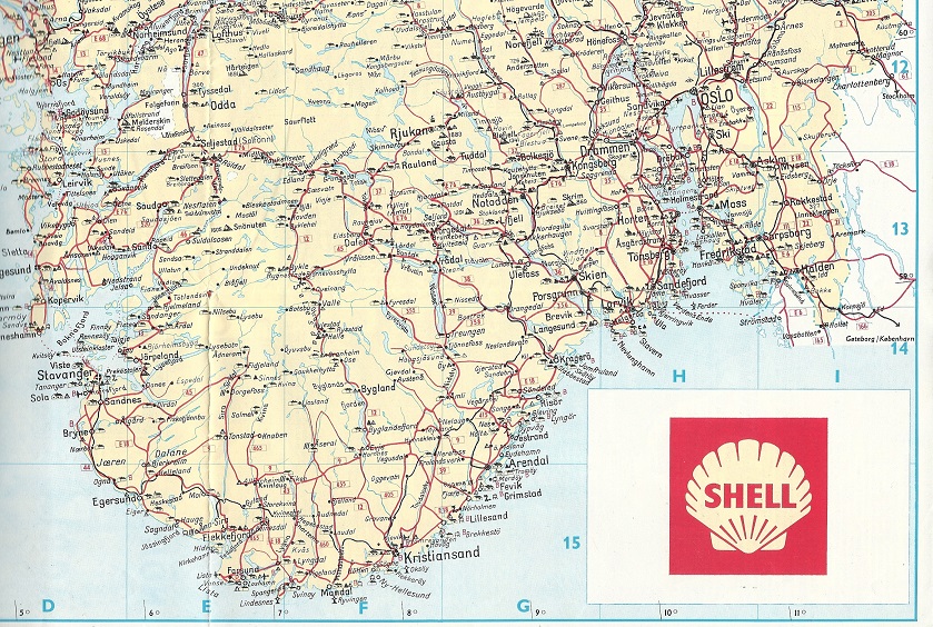
Petrol Company Road Maps from Norway |
Before the Second World War
Norway has always had a relatively large number of filling stations for its population, reflecting its low population density, and the need for every remote community to have at least one public service station. Before the war the market was dominated by Esso Standard, Shell, MIL-BP (which was formed when BP made its first move outside the UK by buying the domestic MIL company in the 1920s), NOR Bensin and, probably, Texaco. NOR Bensin was acquired by Mobil after the war.

|
This map was not issued by a single oil company, but funded by the three largest Norwegian brands: B.P.-Mil, Shell and Standard. Entitled "Motoring in Northern Europe", it was published by Nordisk Turisttrafikkomité which grouped the tourist boards of Denmark, Finland, Norway and Sweden and was produced by Scott-R in Norway at a scale of 1:3 million, using a rather unusual colour scheme of red roads on an orange landmass. The rear had twelve panel of tourist information: one each for the four countries in English, French and German, accompanied by a black & white photo. |
 |
 |

|
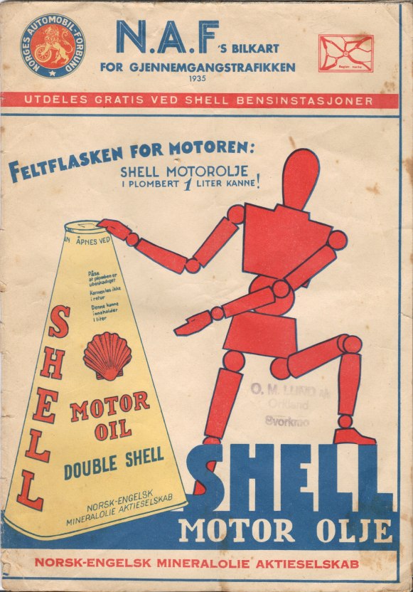
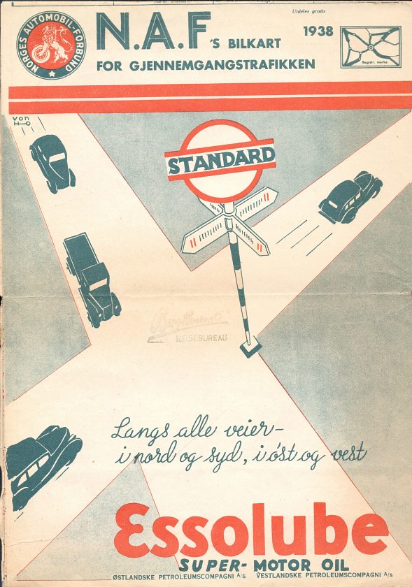
In the 1930s Shell and Standard (Esso) sponsored an A4 size road map of Norway produced by NAF, the Norwegian automobile club using cartography by P.M.Bye of Oslo. Although these carried third party advertising, each states that it was available for free distribution in Shell or Standard petrol stations, as appropriate, in the latter case by the Norwegian companies Ost- and Westlandske Petroleumscompagni A/S. Each version unfolds to a two colour map six times the cover size printed on quite poor quality paper. Shell's 1935 version covers just Norway and includes 61 inset town plans marking Shell stations and other leading businesses. Standard/Esso's 1938 and 1939 maps extend to both Norway and Sweden. and around the margins have inset town plans for 152 localities showing, inter alia, the Standard service stations. It is assumed that only one of the companies sponsored a map in any given year, but it's not unimaginable that there could have been both Shell and Standard versions in the same year, as only a few copies of the maps are known.
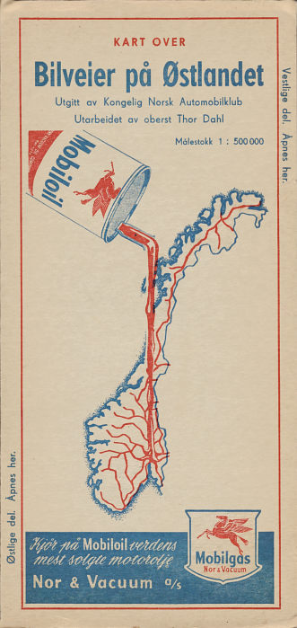
Although Mobil sold no fuel in Northern Europe before the War, it aggressively marketed its lubricants. In particular Mobiloil advertised on KNA automobile club maps from the late 1930s to the 1960s. It used the attractive designs shown here on the rear of a 1936 map of West Norway (near right) and a 1938 map of South Norway (centre right) when compared to the plain front cover (below). |
 |

|
 |
|

The map on the far right is post-war, and shows an updating of the oil can theme; the red arteries being filled are recognisably the main roads in the country. The logo in the bottom right has also changed; it now says "Mobilgas Nor & Vacuum" reflecting Mobil's entry into the fuels as well as the lubricants market, following the takeover of Nor Bensin. Unusually, this series of maps has identical front and rear covers, rather than a KNA front and advertising rear, but there is still an insurance company advert on an inside cover. There were probably four sections at 1:500,000 - the Eastern section is shown, and goes just as far South as Oslo. Dated 1954, it was also sold in the UK by Geographia for 6/6d (32½p) as "Eastern Valleys" by applying a sticker with English language details over the Norwegian title on one cover.
From to war to the discovery of North Sea Oil
After the period of wartime occupation, the main companies returned to the market, but were soon joined by Mobil which had been an important marketer of lubricants for many years and - in 1959 - Fina. Small chains were also established by Gulf and the OK co-operative. This would probably have stayed as the pattern had it not been for the discovery of huge oil reserves in the Norwegian sector of the North Sea in 1969 by Fina and its US partner, Phillips Petroleum.

|

|

|

|
Shell soon restarted selling maps after the war as can be seen from a 1948 South Norway issue. Red card covers contain a map prepared by Emil Mostue to the general design of Shell's main cartographic partners, Foldex.
The next two maps date from the 1950s. Esso's 1956 map uses its standard General Drafting Company design in a straightforward folding sheet map at the relatively small scale of 1:1,950,000 (about 31 miles to the inch). In contrast BP's 1957 map created by Dreyer A/S covered the country at 1:1,000,000 by splitting it into three sections using a folding system similar to that of Foldex, with a paper map pasted into card covers. Using a relatively large scale allowed "all the larger and some of the smaller" BP stations to be marked, at a time when 1,400 BP outlets served the 4 million Norwegians.
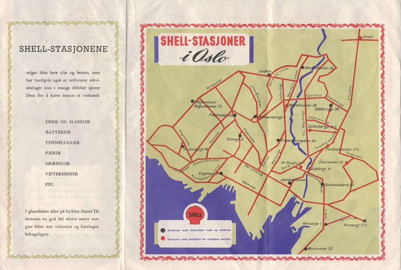
The Norwegian authorities made considerable efforts to attract tourists in the 1950s and 60s. The map shown here would once have been pasted into a 24 page Norwegian language booklet describing sights in each of Norway's counties. The booklet is lost, but the map survives, with half of one side explaining the services obtainable at Shell-stations and a basic map showing their locations in Oslo (the other half was blank, to be pasted into the booklet). The reverse was a similarly stylised map of the entire country showing principal locations where Shell fuels and other services could be found. No date or cartographer is provided, but it seems likely to be from around 1960. Note the unusual red coloured Shell pecten. |
 |

|
By 1963 Shell had moved to a dedicated paper map of Oslo, again using Emil Mostue for the cartography at a scale of 1:1,000,000 (above right). Shell's only know city map from Norway covers Oslo (left) and dates from 1961. Although the cover is not branded, it was jointly produced by the Oslo and District Tourist Information Service and Shell, and both marks and lists all Shell stations. Designed mainly for foreign tourists, a German language version explicitly says "FOR DISTRIBUTION ABROAD". |

|
Shell continued to work with the tourist authorities by sponsoring maps at least as late as 1970, when this camping map was produced. The cover showed no link to Shell at all. This side of the map was just printed in blue, to match the international road sign for camping places, and listed all main sites by the road number on which they were situated, with no more details than the village, camping name and official grading. The main map side, at a scale of 1,450,000 showed places with hotels and hostels as well as camping sites. Published by the National Team for Tourism in Norway (Landslaget for Reislivet i Norge) and prepared by Emil Moestue A.s, the only obvious link to Shell was a large logo in the bottom right corner. |
 |
 |
The Government intervenes
Initially the only change was that Fina started grading its fuels Eko-Super, after the Ekofisk oil field. But the Norwegian Government was concerned that the North Sea oil would not only benefit foreign companies. It soon established Statoil, as an equity partner in all upstream activities, and BP sold its 1,000 filling stations to a Statoil subsidiary creating the new Norol brand. Norsk Hydro, which had interests in electricity and aluminium, also moved into the oil business, although its first handful of service stations were soon sold to Norol in the mid-1970s. The third main Norwegian oil company established to take advantage of North Sea oil was Saga Petroleum, the only one wholly within the private sector. Although it publicly raised the prospect of buying service stations in the late 1980s, it never did, concentrating instead on more profitable upstream activities. Saga was eventually acquired by Norsk Hydro in 2000.

|

|
")
|

|

|
As with many other countries, maps from the 1970s and 1980s are less common than those from the preceding two decades. Shell's 1973 issue was essentially the same as its map from 10 years before, except that the cover image had been replaced by a photograph. Texaco used Fabricus for its 1983 map; the extract shows how its stations were located on the city inserts (such as Stavanger), although not on the main map. Norol's 1983 map of Southern Norway still uses the same basic cover design that was previously used by BP for a number of years. By 1985 Esso had moved to card covers enclosing a map at the widely used scale of 1:1,000,000 by JW Cappelans.
Norol image courtesy of Thomas Been
Norwegian companies expand in the 1990s
Statoil was legally obliged to operate solely in Norway until 1984, when a relaxation in the rules led to it soon acquiring interests internationally, including the former Esso chains in Sweden and Denmark. Hydro, not wanting to be left out, bought out Mobil in the same countries, and added the 200 Norwegian Mobil outlets in 1992 after the ending of a non-competition clause with Norol/Statoil. As it still lacked scale, it merged its downstream activities in Norway and Denmark with those of Texaco in 1995 to form HydroTexaco. Statoil eventually re-branded the Norol assets under its own name, to bring them into line with those in the rest of Scandinavia. |

|

|

|

|

|

|
Most of the main players in the Norwegian market have maintained maps in the last decade. The 1996 Hydro Texaco shows how both logos were used for a couple of years after the merger; the map uses the Folia/Legindkort system popular in Scandinavia dividing the country into strips. Esso's Gico map uses a similar system; it also dates from 1996 and Gico also produced a version for Fina with a small Fina logo where the Esso one is on the map illustrated. Gico also produced an Esso version of their Danish map; it is likely that a Sweden map would have completed the set.
By 1998 HydroTexaco had a new single logo, and saved money by producing a reversible map combining Norway with Denmark, their other marketing territory. Folia/Legindkort still prepared the maps, but using a more conventional system. Shell have issued several Norwegian maps in the past few years. The 1996 has a relatively non-standard cover design, but again uses Folia/Legindkort cartography, and marks Shell stations by both a logo on the map and address. Statoil's ca1996 issue completes the set of major branded maps, and it too opted for Folia/Legindkort cartography. |

|
|
|
Considerably fewer maps have been issued by petrol companies in recent years. Shell and Statoil both issued a Folia QuickMap system map of the country marking all their locations in 2004, and Statoil supports this with an updated version of the Nordic atlas, no longer spiral bound. However most outlets (including most Shell and Statoil stations) only sell commercial issues, generally by Folia or Cappelens. |


As well as the examples shown above, Jet regularly supplied maps of all of Scandinavia (including Norway) until the early 2000s. Fina and the OK cooperative are also known to have issued maps of Norway; Gulf may have done so, although it only had a relatively small chain. Please let me know if you have any maps from Norol, OK, Gulf or Fina available for sale or trade, or if you have ever seen a map from NOR Bensin.

Text and layout © Ian Byrne, 2003-20
All original copyrights in logos and map extracts and images are acknowledged and images are included on this site for identification purposes only.