DUCKHAM'S
Duckhams
Brief History
Alexander Duckham and Company was an East London (Millwall) based blender of oils that started in 1899 to import oil from Central Trinidad for lubricants and which later moved out to Kent. Duckham's was the second largest of the independent UK blenders after Castrol, and relied on technical innovation to ensure that it was stocked by independent service stations, as well as an arrangement whereby its Morrisol grades were recommended for use with Morris and Wolseley cars. By the mid 1930s it was sold in over thirty countries, mainly in Europe and British overseas territories, although no promotional maps are known from outside Britain. The apostrophe was dropped soon after the war so that Duckham's became Duckhams. In 1969 is was acquired by BP after a prolonged takeover battle, with the Monopolies and Mergers Commission requiring that it was kept at some distance from BP's main operations. The name remained in use by BP, although it suffered from the latter's merger with Mobil's European downstream operations (when BP stations switched to selling Mobil 1). After the ExxonMobil merger this was unwound, and some industrial lubricants passed to Esso; however BP soon after acquired Castrol in 2000 to serve as its main lubricant brand. The Duckhams name limped on, mainly in the market for oils for classic cars, until sold by BP to a start-up called Zain Holdings in 2016; it was relaunched by its new owners in 2017.
Maps
Two sets of maps on card, dating from before the first World World War, represent Duckham's earliest known maps.
|
|
|
|
|
|
The other set of card maps are slightly smaller in format (150x100mm against 200x125mm), and lack information on speed traps; it is likely that they date from around 1909. Their coverage of England and Wales is split across 20 cards at a much reduced scale; even so most of Cornwall, South Devon and Pembrokeshire are omitted from the set for a lack of space. The rear of each card is printed in red with information about Duckham's oils. |
|
|
|
|
|
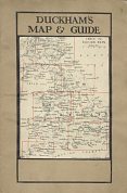
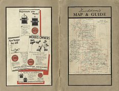
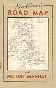
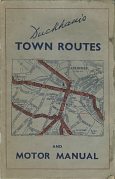
Duckham's later moved to a much cheaper format of booklet map, probably starting with a 1922 edition. Undated, each version consists of a 32 page guide to lubrication surrounding sectional Bartholomews maps at 16 miles to the inch. The earlier examples (above left) have 16 map pages and omit Northern Scotland and the Western Isles. The later ones have 20 pages of maps by George Philip & Son at 15 miles to the inch, but still exclude Orkney and Shetland. All were bound in a brown paper cover (with the earliest being sewn and the later ones stapled) with an index map pasted on the front. The Panel under the key map is sometimes overprinted with the name and address of a garage selling Duckham's oils. The middle of the three maps shown here (datable to 1931/2) alone has an advertising panel featuring Duckham's "Morrisol" blends, specially designed for use in Morris and Wolseley cars. The latest examples (above right) are from 1934/5; the "motor manual" is common to both, and effectively is just about lubrication. There are 29 Town Plans provided by Ed. J. Burrow & Co., including Aberdeen on the front cover and York on the rear - these are not repeated inside. It is perhaps also surprising that one has fawn covers, but the other blue-grey.
|
|
|
These sheet maps are undated but were probably issued soon after Duckham's launched Adcol in 1926, and before they moved out of their Broad Street Place HQ in 1931. Light card covers enclose a map of England and Southern Scotland at 1:1,000,000 by John Bartholomew, split across both sides of the paper. The inside of the covers include numerous testimonials for Adcol from both "owner-drivers" and the trade press, with an abridged chart of recommended grades on the rear; the later map (near left) refers to using Adcol N.P.2 oil in a 1926 Morris-Cowley, and was originally presented in an envelope with the same design. |
|
|
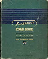
George Philip & Son produced this spiral bound atlas (left) in the late 1940s. Its 72 pages include unusual features such as a planning map of France showing areas with unfit roads; true compass routes across London and cross country timings in minutes between major cities. "Compiled for the business man" it also had a selected list of hotels. |
|
|
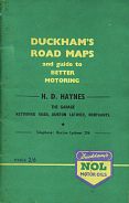
In 1953 Duckham's introduced a new small atlas, similar to the pre-war series, but including the cross-country timings (based on a motorist travelling at 30mph!). The example shown (above right) again used maps from George Philip & Son and the cover was overprinted in the name of H.D. Haynes, The Garage of Burton Latimer, Northants.
|
|
|
Historical Maps
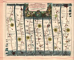
Duckham's has twice reprinted historical maps. In 1939, to celebrate its 40th birthday, it published a reduced facsimile edition of John Ogilby's Britannia in cloth covers. This comprised a set of 100 strip maps of the main roads in England and Wales, originally published in 1675 - plate 80 (Oxford-Cambridge) is shown here. Alexander Duckham wrote the foreword, pasted inside the front cover, noting that he had hunted "in later years" for a complete set of the maps. These maps were not, of course intended for use by motorists but "on this, our 40th birthday, I ask you to accept as a token of goodwill this copy of something prized by myself". |
|
|
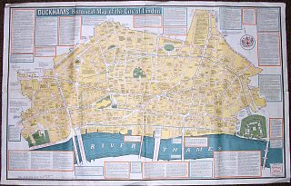
Many years later, Duckhams sponsored a reprint of the Historical Map of the City of London. Originally created by three City Police Constables (Campbell, Nibro & Macquillan) in the 1950s, the reprint was published sometime after Duckhams' HQ moved to West Wickham, Kent in 1966. It is thought that this map too was given to selected customers. |
Text and layout © Ian Byrne, 2000-18
All original copyrights in logos and map extracts and images are acknowledged and images are included on this site for identification purposes only.

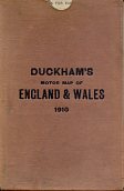
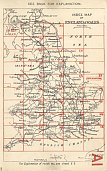
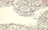 In 1910 Duckham's published a set of 35 maps of England & Wales printed on light card in black and red, collected into a stiff card case. At 8 miles to the inch each card covered an area of 64 miles by 40 miles, with no overlap between sections.
