Quiz 3 - Guess the Issuer and Cartographer
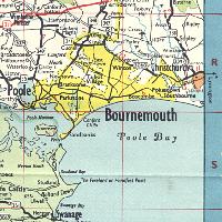
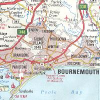
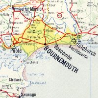
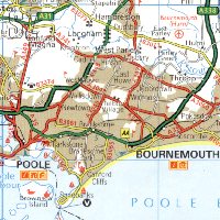
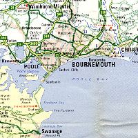
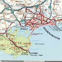
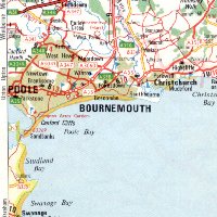
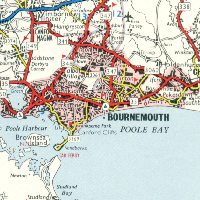
This quiz shows a number of maps of Bournemouth in Dorset and, next to them, a box. All the maps are taken from series issued by petrol companies between 1955 and 2000 at scales varying between 1:411,840 (6.5 miles to the inch) and 1:200,000 (approx. 3.2 miles to the inch), except for the final few maps which are from national issues at a smaller scale. All map scans are actual size when viewed at 72dpi. Clicking on the box to the right of the map should reveal the map's cover and a brief description listing:
- Issuing Brand
- Title of Map
- Year of Issue
- Cartographer
To cover up all the answers revealed, use your browser's Refresh button.
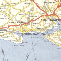
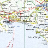
Hints: Not all the maps are from different brands. One cartographer also appears more than once! There are not many road changes, but look where the A338 runs on the East edge of each map. It's also worth remembering that Bournemouth was in Hampshire until 1972.
Have fun, and good luck!
|
|
 |
|
|
|
|
|
|
|
|
|
|
|
|
|
|
|
|
|
|
|
|
|
|
|
|
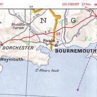
Hint: The village near the left border is erroneously called "Bere-Régis" with an acute accent. |
|
|
|
Hints:  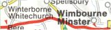
The Rownhams service area is indicated by the letters "T" in a circle and "R" in a pentagon, rather than "S" for services. And although Bere Regis is spelt right, both Winterborne Whitchurch and Wimborne Minster are incorrect, and Hampreston is given unusual prominence, suggesting a cartographer who is not familiar with Dorset! |
|
|
|
Hints: This map is clearly not primarily a road map, although it was co-produced with a petrol company and some roads (including all dual carriageways) and double track railway lines are shown in light grey. It was also published after I first put this page on the web! |
|
|
|
Hints: Another map where the cartographer was probably not too bothered about accuracy in the Bournemouth area: note how towns such as Swanage and Christchurch are missing. Also Bournemouth Airport should be about 5 miles East of where shown. The distance to Salisbury may also help. Stylistically, it was drawn by a cartographer noted for its conservatism. |
Final Observations
It's worth noting that if there are any grid lines shown, those from British maps are strictly horizontal and vertical, but those from the continent use latitude and longitude, which run at a slight angle. There's also a lack of consensus on which headland to name South of Swanage: some choose St Alban's Head and others Durlston Head. The larger scale maps near the top of the quiz (which don't show that part of the coast at all) tend to mark both and, correctly, to indicate the Western one as "St Aldhelm's or St Alban's Head". However, this information is of no practical use to the average motorist as there are no roads to them anyway!
It's probably not fair chastising the continental cartographers for getting some of the detail wrong as their maps are not designed to be used in the Bournemouth area. Indeed, this may even be a copyright trap where deliberate minor errors are introduced to an obscure part of the map as a check to see if any of their rivals are copying them.

Text and layout © Ian Byrne, 2000-13
All original copyrights in logos and map extracts and images are acknowledged and images are included on this site for identification purposes only.