 50 Road Maps of Europe
The European Union traces its origins back to the European Coal & Steel Community, which was created by the Treaty of Rome, signed on 25 March 1957. This page shows one map cover from a member state for each of the 50 years. Up to 1976, there were only six members: Belgium, France, Italy, Luxembourg, the Netherlands and West Germany. In 1973 the (then) European Economic Community was enlarged for the first time, expanding to include the UK, Ireland and Denmark. The maps below reflect only the membership in the year of the map, so most of the new member states (from 2004) are excluded. They are also restricted to maps from brands headquartered in the EU at the relevant time, so leading US brands (Esso, Caltex, Mobil, Gulf, etc.) are ineligible, as are Norway's Hydro and Statoil.
|
1957 |
1958 |
1959 |
1960 |
1961 |
|
|
|
|
|
|
|
1962 |
1963 |
1964 |
1965 |
1966 |
|
|
|
|
|
|

|
1967 |
1968 |
1969 |
1970 |
1971 |
|
|
|
|
|
|

|
1972 |
1973 |
1974 |
1975 |
1976 |
|
|
|
|
|
|
|
1977 |
1978 |
1979 |
1980 |
1981 |
|
|
|
|
|
|
|
1982 |
1983 |
1984 |
1985 |
1986 |
|
|
|
|
|
|


|
1987 |
1988 |
1989 |
1990 |
1991 |
|
|
|
|
|
|

|
1992 |
1993 |
1994 |
1995 |
1996 |
|
|
|
|
|
|
|
1997 |
1998 |
1999 |
2000 |
2001 |
|
|
|
|
|
|
|
2002 |
2003 |
2004 |
2005 |
2006 |
|
|
|
|
|
|
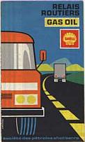
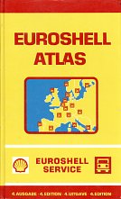
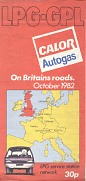
Most of the maps above are from petrol companies, but there are three LPG issues (1982 - Calor, 1984 - VIFF and 1994 - BK), two lubricant issues (1968 - Motul and 1989 - BP Visco) and two aimed at truckers (1971 French Gasoil and 1979 European atlas, both from Shell). Most are sheet maps, but there are some atlas or station location booklets with maps: 1963 Azur, 1968 Motul, 1979 Euroshell, 1987 Campsa Guide, 1989 BP, 1996 Preem and 2003 Metax). Two are joint issues with non-petrol companies: 1977 BP (with Trafalgar Tours) and 1986 MonteShell (with Hertz rentacar and Europ Assistance).
![]()

All original copyrights in logos and map extracts and images are acknowledged and images are included on this site for identification purposes only.