Road maps from Czechoslovakia and the Czech Republic |
Shortcuts to recent maps from the Czech Republic.
Prior to 1939
The regions of the Austro-Hungarian empire roughly corresponding to the Czech and Slovak Republics began to develop their industrial base in the late nineteenth century, creating a demand for oil products for lighting and transport fuels. In 1889, a Viennese shopkeeper named David Fanta built a kerosene plant at Pardubice in Bohemia and by 1918 the Fanto company had expanded its operations across much of central Europe (and as far West as Paris). In Bratislava, Slovakia, another refinery was built in 1895 under the name Apollo.
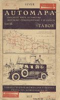
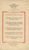
Czechoslovakia became an independent republic after the first World War in 1918, and there were a small number of other indigenous petrol companies operating in the inter-war years: including Naftaspol and BZ-Benzin, both based in Prague. Little is known about Naftaspol other than what can be gleaned from the map below and its involvement in a scandal that helped bring down the Government in the late 1920s. The images below are taken from a 1925 Czechoslovak Autoclub sectional map no.10. A good quality map at 1:200,000 marked road conditions and was prepared jointly with the National Defence Ministry and the Minister of Public Works.
|
|
|
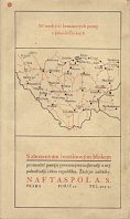
An unusual fold allowed 6 advertising panels on light card; four for the Laurin & Klement company (makers of Skoda cars and importers of Sentinel steam lorries) and two for Naftaspol. Panel 5 promoted their Caroil lubricants and stated their products, including TORPEDO petrol, were available from 180 blue pumps and 380 Caroil-autostations across the country. Panel 6 included a sketch map showing where these blue pumps could be found in Southern Bohemia (an area rather greater than the detailed map inside). The entire country was covered in 29 sheets including the Eastern region of Ruthenia ceded to the USSR after World War II. |
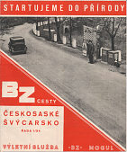 |
By the mid-1930s BZ-Benzin appears to have been the largest brand in the country and have been a successor to Naftaspol/Torpedo. Around 1935, BZ started issuing a series of maps of main the main tourist areas. Initially it was planned to produce 34, and the first batch contained 11 and most opened out to around 320x280mm, covering a small geographical area. Later the series expanded to 35 then 37 sheets, and the standard photograph of a BZ zapfstelle on the cover was replaced with a photograph of the area covered. All maps marked BZ-pumps in red and from 12 on, gave their addresses. All maps also carried a brief description of the main places of interest. |
|
In 1938 Hitler annexed the Sudetenland and in the following year, Germany completed the break-up of Czechoslovakia, annexing the Czech lands and establishing a puppet state in Slovakia. German petrol companies were strongly encouraged to reflect these changes in their domestic map series. |

|
Under Communism from 1948 to 1989
Following the defeat of Germany in 1945, Czechoslovakia regained its pre-war boundaries except for Ruthenia. A weakened state allowed the Soviet-backed Communists to take power in 1948. The war-damaged refineries were rebuilt, and the downstream industry was split between Benzina in the Czech Republic and Benzinol (based on the old Apollo assets) in Slovakia. The Pardubice refinery of Mineral Oils, which specialised in asphalt and later lubricants and heating oils, kept some independence and from 1960 started using an abbreviated name of PARAMO. However in appearance the service stations were similar, lacking strong branding and the sort of modern facilities being developed in Western Europe.
 Image courtesy Richard Horwitz |

|
These Benzina maps date from 1968 and 1978 respectively. Printed on relatively poor quality paper stock, the cartography was by Kartografie of Prague at 1:1,000,000. The later map, although lacking reference to Benzina on its front cover, carried extensive advertising for Benzina petrol, Mogul oils and its parent concern Chemopetrol inside and on the rear cover. |
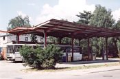
Typical Communist-era Czech Benzina station
|
The Velvet Revolution 1989-92
Despite having one of the most successful economies in the Eastern bloc, the Czechs also wanted freedom. When it became clear that the Soviets could no longer impose their will over Eastern Europe in the late 1980s, as they had done by invading Czechoslovakia in 1968, the Czechs moved peacefully to a democratic Government in the so-called "Velvet Revolution". But this allowed underlying tensions between Czechs and Slovaks to emerge, and was followed by an equally peaceful split into two independent Republics on 1 January 1993. No oil company road maps are known from this final short period of Czechoslovakia's history.
Czech Republic since 1993
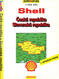
Most of the old Czech petroleum assets were placed into a holding company called Unipetrol, owning Chemopetrol, and majority stakes in Benzina and the Ceska Rafinerska. 49% of the refinery was sold to a consortium of three Western companies - Shell, Conoco (Jet) and Agip, all of which started to build service station networks in the country. In 1995 Shell added custom covers to a stock atlas by Kartografie Praha of the Czech & Slovak Republics (right). |
|
|
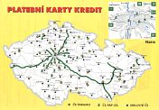
Paramo, in law the successor to pre-war Fanto, and its Pardubice refinery became an independent company from 1994-2000, when Unipetrol acquired a majority stake before buying the remainder of the company in 2009. Paramo started to build up its own chain of service stations and worked closely with Pap Oil, which also acquired the 25 stations branded S7. The map shown here is the reverse side on an A5 flyer advertising Paramo's credit card, and marks all locations (before the S7 purchase) for Paramo, Pap Oil and Smluvní service stations. |
The Czech Government made a couple of unsuccessful attempts to privatise Unipetrol, before agreeing to sell it to Poland's PKN Orlen in 2004.
Recent Czech maps
This section was first written in late 2004 and may not reflect current practice.
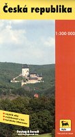
The most notable feature of relatively recent map issues has been the extensive range of city maps, road atlases and sheet maps of neighbouring countries issued by the larger Western entrants (Shell, Aral, OMV and JET).
|
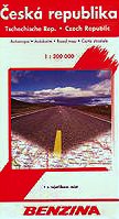
|
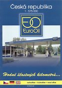
|
Three maps of the Czech Republic from less prolific issuers: |
Three city plans from brands with an extensive range: |

|
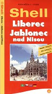
|
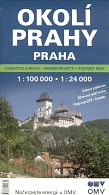
|
|
|
|
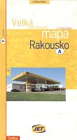
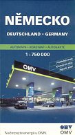
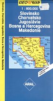
Three maps of nearby countries from prolific issuers: |
|
|
|
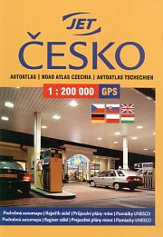
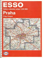
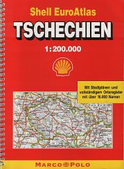
Four of the Czech petrol companies (Shell, Aral, Jet and OMV) have issued large numbers of atlases, generally at scales of 1:100,000, 1:150,000 or 1:200,000. Most are of a large format, with a spiral binding to allow them to open out flat and the scale determining the number of pages. Jet's example at 1:200,000 shown above is unusual in being a simple soft binding, with the atlas consisting of 48 pages of Shocart maps, preceded by 10 pages of useful information (including several on how to use GPS navigation) and followed by a 28 page index of place names. All the large scale atlases are produced to a very high standard of cartography and, inter alia, still mark every petrol filling station in the country irrespective of brand. Cartography tends to be either by Shocart or Geodesie CS, and may vary within brand; some atlases have additional maps of Europe or tourist features included to help differentiate them.
The Esso atlas of Prague dates from the late 1990s. Esso probably stopped selling branded maps before 2000, although this is a high quality (and highly priced) street atlas at 1:20,000 produced under the Falk imprint GeoAtlas; it sold its Czech service stations to ENI in 2007.
Not all oil company atlases of the Czech Republic are local editions, though. The third atlas was produced in Germany by Mairs under its Marco Polo/Shell EuroAtlas imprint. Mairs licenses the Shell name, and these products are commonly sold in bookshops as well as through Shell (and occasionally other) petrol stations in Germany. Like the local versions it is at a scale of 1:200,000; however it marks no petrol stations. The example above is undated but was sold around 1998.
|
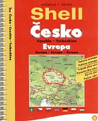
Smaller format atlases are also used, for example by Shell and OMV, either of just the Czech Republic or also including Slovakia. So the Shell atlas shown here still covers the Czech Republic at 1:200,000 using the same Shocart cartography as larger atlases, but runs to a total of 212 pages. Over half the pages are given over to town plans, miscellaneous information, Europe at 1:5 million and two place name indexes. |
Recent road maps from Slovakia are now shown on a separate page.
There are almost certainly more maps from Czechoslovakia or the Czech or Slovak Republics that I would have included on this page if I was aware of them; a few additional Benzina maps are shown elsewhere.
Please send me an e-mail if you can help me with any other pre-war petrol company maps of Czechoslovakia (especially from Fanto or Apollo), or with more recent oil company maps from Total, Tamoil, Benzina or Lukoil.
Text and layout © Ian Byrne, 2003-14
All original copyrights in logos and map extracts and images are acknowledged and images are included on this site for identification purposes only.
