Road maps from Slovakia (Slovensko) |
Introduction
The regions of the Austro-Hungarian empire corresponding to Slovakia began to industrialise in the late nineteenth century, and in Bratislava, Slovakia, an oil refinery was built in 1895 under the name Apollo. After the establishment of an independent Czechoslovakia the refinery prospered, and it served as the base for the state-owned Benzinol during the Socialist era. With the collapse of Communism in the late 1980s, Slovakia was keen to avoid being seen as a junior partner in the Czechoslovak Federation, so negotiated independence from 1993.
After the liberalisation of the markets, Slovakia attacted a fair number of international oil companies, as well as some local start-ups. Shell, ENI (formerly Agip, which also acquired Esso's operations), OMV (which acquired the Aral and Avanti operations) and Lukoil (which acquired ConocoPhillip's JET brand) can all be found in the country, although only OMV has more than 100 locations. The largest firm is still the successor to Benzinol, Slovnaft, and among the local names Jurki is largest, with around 60 outlets. Smaller local names, all of which are too small to have been likely to sell branded maps, include Spectrum, Oktan, and Sajgaoil.
Hayton-Jurki opened its first filling station in 1992 and currently operates 62 service stations in Slovakia, with its headquarters in Bratislava. Most of its locations are away from main roads, quite commonly on industrial estates, so it has not produced folding maps for sale to the public. However it does display a wall map of the country, marking Jurki branded locations, at each of its sites. |

|
Recent Slovak maps
This section was written in late 2006 and may not reflect current practice.
The most notable feature of relatively recent map issues has been the extensive range of city maps, road atlases and sheet maps of neighbouring countries issued by the larger Western entrants (Shell, Aral, OMV and JET) and the national brand, Slovnaft. Except for Slovnaft, the programmes are run in parallel with issues by their Czech affiliates, and most service stations stock both Czech and Slovak maps.
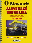
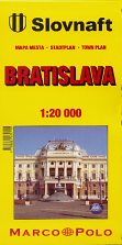
Slovnaft produces a range of maps of the country, generally with cartography by Marco Polo (Mairs, or Mapa Bratislava) or BB Kart. From L-R: |

|
|
|
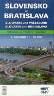
OMV publishes a wide range of maps, currently all from the Czech cartographer Shocart. |
|

|
|
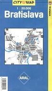
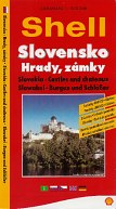
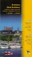
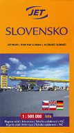
Shell, Agip and Jet also all sell a wide range of maps, with Shell's range extending to large cities in neighbouring countries. All maps shown have cartography by Shocart. |
|
|
|
The range of maps sold under petrol company covers is extensive and can include:
- maps of Slovakia at two different scales (1:300,000 and 1:500,000);
- a 1:500,000 map of Slovakia backed by a map of Bratislava;
- a city map of Bratislava, a second map with additional suburbs at 1:50,000 and small format city atlases, which may be spiral bound, as well;
- a combined map of Slovaia and the Czech Republic at 1:750,000;
- maps of the Czech Republic and city maps for Prague and Brno;
- maps of neighbouring countries (Germany, Poland, Austria, Italy, Hungary and Croatia/Slovenia);
- city maps of neighbouring capitals (Budapest, Vienna - Shell only);
- a map of Europe;
- a national map of Slovakia backed with a "transit" map of Central Europe;
- a camping map and a "castles & chateaux" map (Shell and Slovnaft only);
- mid-format spiral bound atlases inside a foldover card cover (OMV);
- large format spiral bound atlases of the Slovakia (and sometimes the Czech Republic) at varying scales between 1:100,000 and 1:200,000; and
- a hardback atlas of Europe and the Czech & Slovak Republics.
Please send me an e-mail if you can help me with any pre-war petrol company maps of Slovakia (especially from BZ, Fanto or Apollo), or with other recent oil company maps of Slovakia, such as Acord/Avanti, BP, Esso, Total or Tamoil.
Text and layout © Ian Byrne, 2006-14
All original copyrights in logos and map extracts and images are acknowledged and images are included on this site for identification purposes only.
