Petrol company road maps from Denmark |
Before the Second World War
Although it represented only a small part of Europe, the Danish petrol market was relatively open to competition and by the mid 1920s had already attracted international companies such as Shell, Standard (Esso), BP and Texaco.
|
|
|
|
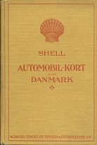
The oldest known oil company map comes from Shell's subsidiary A/S Dansk-Engelsk Benzin & Petroleums Co. using cartography by the Geodætisk Institut in Copenhagen. Issued in the format of a hardcover atlas (above left), it is dated 1933 and has 5 pages of fold out maps at 1:580,000. Beside (or on the back of) the main maps are simple black and white town plans, overprinted with the main through routes in red. There are also descriptions of 199 stately homes and castles that could be seen by motorists.
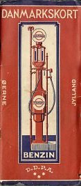
By 1935 or 6, Standard (DDPA) had started issuing an even more complex map book of Denmark. It consists of two booklets, each with a card cover, linked by a folding map from Möller og Landschultz at a scale of 1:500,000. The map is in colour and locates towns and villages with Standard stations by a red dot. The front booklet is 40 pages long and thumb-indexed, revealing sections showing details of Essolube, a mileage chart, a list of official Parking places, road signs, the complete traffic laws of 14 April 1932, a picture of a car chassis showing lubrication points and lubrication charts for cars, commercial vehicles and motor cycles. The section is completed by 92 town plans spotting Standard (DDPA) stations and a quadruple width pull-out map of Copenhagen. The rear booklet is printed on pink paper and lists Standard agents and around 3,800 dealers which sell DDPA (Standard) products.
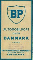
In contrast BP's late 1930s map is very straightforward, using typical local cartography at the commonly used Danish scale of 1:505,000 (~8miles to the inch).
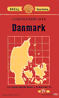
The 1938 Shell map of Denmark (right) uses the Foldex system, dividing the map into two sheets, pasted into a red card cover (and to each other). The main maps are again at 1:505,000, with a larger scale inset of the area around Copenhagen.
Why are many Danish maps at the scale of 1:505,000 or 510,000?
|
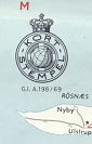 Most oil company maps of Denmark are at one of the unusual scales of 1:505,000 or 1:510,000. This choice was to avoid a topographic tax known as the "Kort Stempel" payable at the rate of 1/120 øre per square cm of map. From 20th February 1929 to 1st January 1992, most maps were required to have a tax stamp printed on them, including both foreign-made and locally produced maps which showed all or part of Denmark, whether the maps were for sale or to be given away. However maps at less than 1:500,000 or larger than 1:15,000 scale, maps made by or for the government, town plans and maps, charts and harbour plans, and sketches in daily papers, periodicals, and books which were not separate maps were exempt from this tax. Generally the only oil company maps subject to the tax were sectional maps. The example shown here, printed in navy blue rather than the more common dark green, comes from a 1969 Esso map of Sjælland and carries the code G.I. A.198/69, indicating that it is on a Geodætisk Institut base map.
 1950s maps
Denmark was occupied by Germany during the Second World War, so no oil company maps are known from this era, although production of Shell atlases did restart in the late 1940s. In the following decade, the distinctive pre-war map designs were generally replaced by simpler sheet maps adhering more closely to international map programmes from the large companies.
|
|
|
|
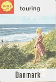
BP's mid-1950s map sports a typical international cover design and was prepared for them by I.S. Jensens at the traditional scale of 1:505,000, and included insets for major cities. Esso's 1957 map prepared using General Drafting Co's designs with Geodætisk Institut cartography was at the marginally smaller scale of 1:510,000. The Shell map is from around 1959 or 60, and is now credited to J.S. Jensens, at the slightly smaller scale again of 1:570,000.
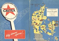
The Caltex map is not part of their international mapping programme, and may just be a commercial issue by S.v. Brockdorff (an uncommon cartographer) carrying a graphic Caltex advert on the rear cover; it is once again at 1:510,000, showing the Danish pattern of using unusual scales.
1960s/70s maps
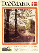
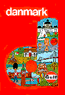
In the years leading up to the first oil price rises, Denmark was characterised by a relatively open market, largely split between Shell, Esso, Chevron, BP, Gulf, Texaco and Mobil. Just one national brand had any strength: UnO-X, which had been developed as a concept in 1956.
|
|
|
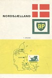
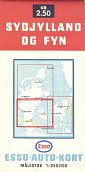
As in earlier decades Shell, Esso and BP maps are most commonly found, with larger scale sectional maps joining national titles. The three shown here date from 1963, 1966 and 1972. BP's, at 1:210,000, covers the smallest area - just the Northern half of Zealand backed with town plans (and it had a separate map for Copenhagen itself). More economically, Esso covered the country in 3 sections at 1:250,000 and Shell's sectional maps included one for Bornholm, which is very rarely seen. |
1980s maps
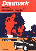
In the 1980s, Denmark started to appear a less attractive market to the large multinational companies, possibly as a result of increasing competition from UnO-X and the arrival of discount unmanned outlets from Conoco's Jet in 1985. Chevron sold out to Texaco in 1984 and Gulf to Q8 soon after, although both transactions were part of a wider divestment from Europe. In 1985 Norsk Hydro bought out Mobil in 1985 (having previously only operated a small chain under the Viking and Spar brands). And in the following year two further major changes occurred: Q8 picked up BP's outlets and Esso sold out the the Norwegian state company, Statoil. Although these mid-1980s changes affected more than half Denmark's service stations, none of the chains moved into Danish ownership.
|
|
|
|
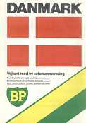
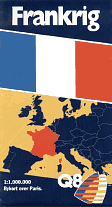
Although Danish maps are often undated, the five issues shown here roughly span the 1980s. Earliest is a UnO-X, followed by a Texaco from 1983, a Gulf from 1984 and a BP from around 1986 - the latter two designs possibly being their final issues for the country. The final map (left) is a late 1980s Statoil. All five are at the tax-efficient scale of 1:510,000 and the three that I have examined use cartography by Folia/Legindkort. |
|
1990s maps
The market was more stable in the 1990s, although there were two deals involving Norsk Hydro. First it acquired Uno-X, retaining the latter name only on unmanned discount outlets, then Hydro merged with Texaco, to form the inelegantly named HydroTexaco. DK grew rapidly through the decade making great play of its new position as the largest Danish-owned brand supplying service stations (as opposed to supermarkets).
|
|
|
|
|
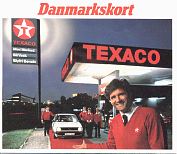
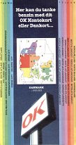
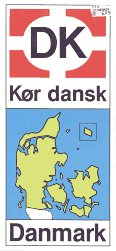
The major names continued to issue maps, generally locating their service stations. The Texaco example is almost certainly their last map of Denmark before the merger, dating from around 1996. Next to it is a similarly aged OK map and on the left is a DK map - the oldest known from the company. OK maps are less commonly seen than the small location booklets listing service stations and typically including good quality, but small-scale maps. |
Most recent maps
Several firms continue to sell branded maps in Denmark, although the more extensive map programmes of the 1990s have been curtailed. The major change to the brands available has been the replacement of HydroTexaco by the new Norwegian name YX Energi in 2007; the smaller firm Haahr (which may have issued a map at one time) was acquired by Statoil a couple of years earlier.
|
|
|
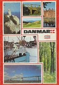
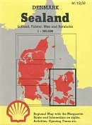
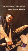
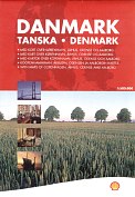
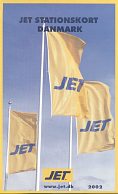
The commonest maps are those associated with location booklets; the one here is from HydroTexaco & Uno-X in 2000 and despite its small cover size manages to cover Denmark at 1:500,000 over 24 map pages. Shell continues to issue sheet maps at the same scale - the 2001 edition is shown. And even Jet, which solely supplies unmanned sites, has issued sheet maps marking its locations, as on the 2002 map shown. |
As well as the examples shown above, maps are understood to have been produced for Metax, an independent brand formerly owned by Shell.
There are around 15 other images of, or from, Danish maps on this website. They include more maps from DK, Esso (1950s scenics), HydroTexaco, Metax, OK, Q8, Statoil, and Shell, which has a whole page dedicated to from maps from the 1930s to the current date.
Please send me an e-mail if you can help me with more pre-war petrol company maps of Denmark, or with a map of the country from Haahr, KH, Viking, Spar, Netto (service stations, not supermarkets) or Bonus.

Text and layout © Ian Byrne, 2004-7
All original copyrights in logos and map extracts and images are acknowledged and images are included on this site for identification purposes only.