STATOIL
Norol
Brief History
After oil was discovered in the North Sea in the early 1970s, the Norwegian Government decided to ensure that its
population shared in the benefits, earning them the soubriquet "The Blond blue-eyed Arabs of the North". A key instrument was the
establishment in 1972 of Den Norsk Stats Oljeselskap A/S (Statoil) to share in production and develop a refinery. Downstream a Statoil affiliate - Norol - bought BP's chain of nearly 1,000 service stations and in January 1976 these were merged with the small Hydro and OK branded chains. Fifteen years later, the Norol name was replaced on service stations by Statoil.
Statoil's first international expansion downstream was buying Esso's Swedish chain in 1985, followed by its Danish outlets a year later.
The next major acquisition was of BP's Irish operation in 1991, added to by the bulk of Conoco's Jet chain there a
couple of years later, although this network was sold during 2006 to the local group Topaz. Statoil also bought Mobil's Northern Norwegian outlets in 1992 and BP's remaining Swedish marketing assets in 1993. Statoil bought the Danish and much of the Swedish Jet chains in 2009.
Statoil Fuel & Retail demerged from its parent in 2010 but just two years later was sold to the Canadian group Alimentation Couche-Tard Inc., which is best known for its Mac's and Circle K C-stores in North America. Statoil now supplies around 2,300 retail outlets across eight European countries and is especially strong in the Baltic region. In late 2015 Couche-Tard announced plans to rebrand its European network (including the recently acquired Topaz chain in Ireland) under the Circle K image.
Maps: Statoil
As with other recent arrivals in the Nordic region, there are a surprising number of Statoil maps to be found.
|
|
|
|
|
|
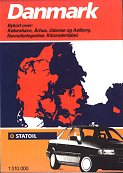
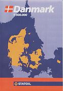
The maps shown above have come in the 1980s/90s from the Danish subsidiary of Statoil. From the left,
the first map is undated but probably from around 1990. Next are two later issues: - a small format booklet listing service stations with seven pages of maps at the back and the standard Denmark map on sale in Statoil stations which, like the booklet, shows their locations on the map. A second version of this map is known with the rear cover (carrying the barcode) advertising AVIS car rentals, and AVIS depots marked on the map as well as Statoil filling stations. All three maps were prepared by Folia/Legindkort, but the scale crept up from 1:510,000 at the start of the decade to 1:500,000 after the ending of the Kort Stempel tax on maps.
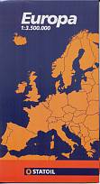
Statoil in Denmark has also produced a series of
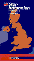
maps of Europe. The Europe and Great Britain maps both date from 1997 - there have never been Statoil filling stations in Britain.
The Europe map was a stock map from Freytag-Berndt of Austria with a card Statoil cover pasted on, but the map of Britain
was specially printed by the Budapest based firm, Cartographia.
Earliest Denmark image courtesy Richard Horwitz
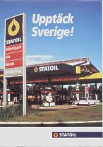
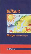
Although the Danish subsidiary also sells maps of Sweden and Norway, the Statoil maps shown below are from the local operating companies.
|
|
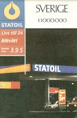
Left is a 1987 map of Sweden by Esselte Kartor. Both maps on the right are from around 1996 (the Norway one is undated) and were prepared by Maps International (although the Norwegian one also acknowledges Folia/Legindkort). All three maps are at 1:1 million and locate Statoil stations. A 2004 map of Norway is shown on the country page. |
 |
 |
|
|
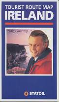
The only known map from Statoil's Irish subsidiary is dated 1996 (left); it is basically the standard Bartholomew Visitors' map of Ireland with a Statoil card cover added to it. |
|
|
|
|
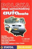
Statoil maps may also exist for other countries in which they market, although none are known.
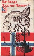
Maps: NorolNorol's 1983 map of Southern Norway was originally issued by Norsk Olje (Norol) in 1974 and still used the same basic cover design that was previously used by BP for a number of years. With details in Norwegian and English, and at a scale of 1:500,000 it was based on a map prepared by the Directorate of Military Survey in the UK in cooperation with Forsvarets karttjeneste in 1969, with roads updated at various times. |
|
Text and layout © Ian Byrne, 2000-16
All original copyrights in logos and map extracts and images are acknowledged and images are included on this site for identification purposes only.


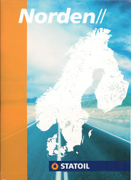
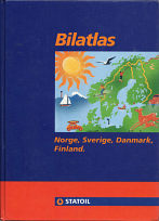 Statoil has also sold road atlases of the Nordic countries, including Finland where it has never retailed fuel. The 1992 example (near right) has a similar cover design to the Norway map shown above, and was a medium format hardback with almost 250 pages, including 170 of maps and town plans, mainly at 1:650,000. Cartography was quite simple but clear by GLA Kartor of Stockholm. The later larger format atlas (far right) is undated, but from around 2006. It has a wipe-clean flexible board cover, and runs to 384 pages with highly detailed maps by Folia, largely at 1:300,000 or 400,000. Both atlases mark towns with Statoil stations, although the latter marks more exact locations, including those of its unmanned 1-2-3 subsidiary brand. An earlier, spiral bound version of the Folia atlas is shown on the