ESSO
Road Maps from Italy
Esso has been active in the Italian retail petrol (gasoline) market since before the 1920s. However, it does not appear to have issued its own road maps before World War II, preferring instead to advertise on the maps issued by the RACI (Royal Italian Automobile Club), where the script Esso logo can often be found adjacent to that of Shell.
In the late 1940s Esso (Standard-Italo Americana Petroli) published a small format road atlas of Italy; a version in white covers is dated 1948 but the one in blue covers (below) is undated.
|
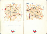
The atlas measured approx. 95x140mm with 30 double page spreads of sectional maps at 1:900,000, by Soc. Cartografica G. de Agostini/Italgeo. Each section was backed by a pair of city maps, such as Parma & Pavia, shown here. The city maps marked Esso stations classified as service stations, filling stations and [streetside] kiosks, which were most common. Any depots were listed underneath the plan. |

|
|
In the 1950s, all European Esso companies were expected to produce sheet maps conforming to a common style set by the Esso Touring Service in Paris (and using cartography to style initiated by the General Drafting Co.), and so Italian maps began to appear.
|
|
The two maps shown above right are both dated 1957, although the first one is the final (ninth) edition of the old design and is dated March. Its cover shows Paraggi (S. Margherita Ligure) and it used a more complex cartographic style with contour shading. The next map is the first edition of the next version: it probably comes from July or August 1957 and has Positano on the cover. |
|
|
|
|
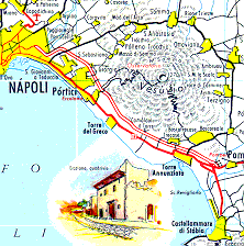
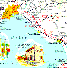
Extracts from these two maps are shown left with the earlier one above the later one; note how the graphic rendering of Vesuvius has disappeared, and smaller towns have been replaced by a population symbol, rather than showing their built up area. The same map was used when Esso moved to a photographic cover design - the examples on the lower row are from 1958 and 1959 respectively. |
|
|
Towards the end of the 1950s Esso started issuing a few Italian city maps for special events.
|
|
The map of Bari shown left is for the 1959 "Fiera del Levante", the annual fair and exhibition held each September. 200 km North up the Adriatic Coast lies Ancona, and the 1960 Esso map (right) was produced for its International Fishing Festival, held annually on 11-16 May. |
|
1960 - the Rome Olympic year |
|
|||
|
|
|
|
|
|
| A map issued by ENIT, the Italian tourist board also carried an Esso advertising panel, and this is shown on a separate adverts page. | ||||
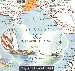
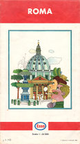
It is not surprising that Esso also chose to issue special maps for the Rome Olympics in 1960. Four new maps were produced: a version of the Western Europe map that had Northern Italy on the reverse and the first three illustrated above. Both the Roma (Rome) and Sardegna (Sardinia) maps were described as having been newly drawn for the year: it seems that the Italian authorities were trying to encourage tourism in the rest of Italy as well as in Rome. The Italian national map was described as being a "special Edition for the XVII Olympic Games" and included a large inset map of the Rome area at 1:150,000, marking the principal stadiums and camping sites. It also included the inset map of the Bay of Naples, showing how the Ercolano had been swept away by the 5.5 metre class yacht races.
By December 1960 Esso had reverted to a more typical scenic cover, showing the Ponte S. Angeo in Rome. The area occupied by the inset map of Rome now featured an enlarged scale map of the Italian Lakes.
Later Italian Maps
|
|
|
By 1967, Sardinia was available on a sectional map with Central Italy, using the standard Esso style. Each section was at 1:500,000 scale. Additionally, a city map of Rome was reintroduced; this is marked as being the 1st edition, July 1967 and used local cartography (IGDA) at 1:22,000 and was sold for a few years. |
|
|
 |
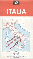
As Italian petrol retailing became increasingly unprofitable, several companies started co-producing maps with firms outside the sector. This June 1971 map was prepared jointly with Avis rentacar. However as late as 1980, Esso continued to produce the three sectional maps, as can be seen in this North example. The age of the base map is revealed in a 1968 copyright date. |
|
|
|
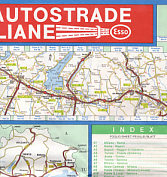
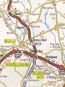
These 3 images are taken from the most recent known Esso map of Italy, of the motorway system (autostrade). Reasonably detailed linear maps of each autostrada were shown in bands around 56km wide, arranged around a basic planning map of the entire network. The reverse had more linear maps and plans of 10 main cities. Esso stations on the autostrade were shown by the logo, with a poorly registered red plate. |
The next page shows a few more Esso cruising guides.
Text and layout © Ian Byrne, 1999-2014
All original copyrights in logos and map extracts and images are acknowledged and images are included on this site for identification purposes only.

