 FINA
FINA
Maps from Great Britain
Brief History
Petrofina was established in 1920 in Belgium, but did not enter the UK petrol market until 1939 when it acquired Cities Service's Citex operation. The intervention of World War II and the pooling of all UK petrol distribution meant that the Fina name did not start appearing on service stations until the early 1950s. At this time Fina also signed up Preston-based Watsons Petroleum Company Ltd to carry its colours; before the War Watsons had distributed R.O.P.'s ZIP products. Due to the consolidated nature of the UK petrol market, by 1964 it was the fifth biggest group but its 1,600 sales outlets represented less than a tenth of the number of the market leader, Shellmex-BP. In the 1980s it transferred smaller outlets to its Arndale and Butler subsidiaries, so was overtaken in numbers by Burmah and Jet, and in the 1990s by its continental rivals Elf and Total. Fina was only the 11th largest chain when the parent company was acquired by Total in 1998.
Maps
This page concentrates on maps of Britain as there are additional pages for Fina maps from Belgium and the rest of Europe.
 |
 |
 |
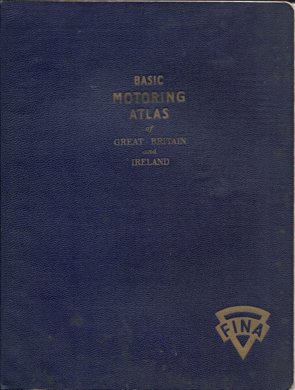
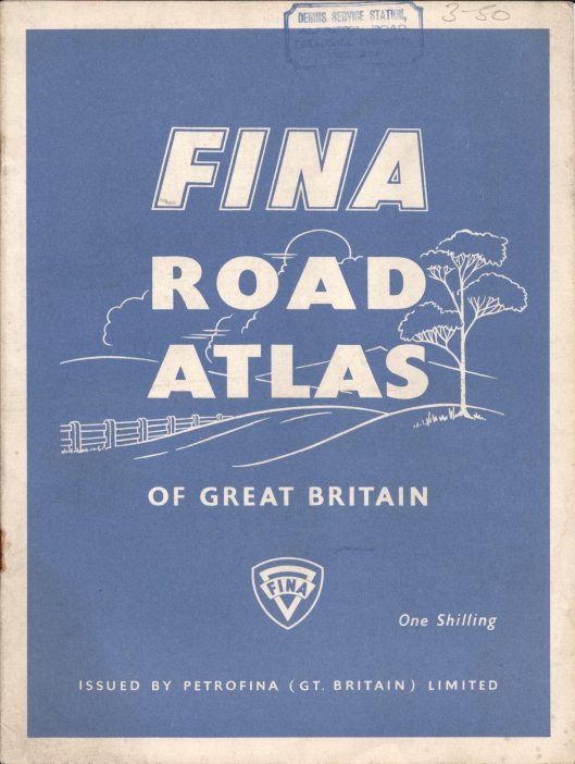
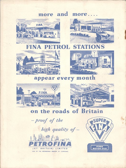
The first atlas (above left) is W & AK Johnston's Basic Motoring Atlas of Great Britain and Ireland, with blue textured covers embossed in gold. Internally it carries a price of 7/6d (37.5p). Two versionsare known: one that has a flysheet that says "With the Compliments of Watsons Petroleum Company Ltd sole distributors of FINA Petroleum Products in the Western half of England and Wales" suggesting it may not have been sold by them but given to loyal customers, and a second version with no reference to Watsons, presumably for sale by regular Fina stations. The atlas contains 48 pages of colour maps at 8 miles to the inch (but carrying a low level of detail, especially of minor roads) plus 32 pages of b/w town plansd and strip maps. Fina have four pages of advertising at the start and note that from 1951 they are distributing Vigzol lubricating oils. This section also shows the location of all Fina and Watsons depots. The other two images are taken from later 1950s atlas and has just 16 pages of sectional colour maps at 14 miles to the inch by W & AK Johnston & GW Bacon Ltd, Edinburgh & London. On the back it says "more and more Fina petrol stations appear every month on the roads of Britain". By keeping to simple paper covers, the price was reduced to just one shilling (5p), making it highly competitive with the sheet maps issued by Shell or Esso.
 |
 |
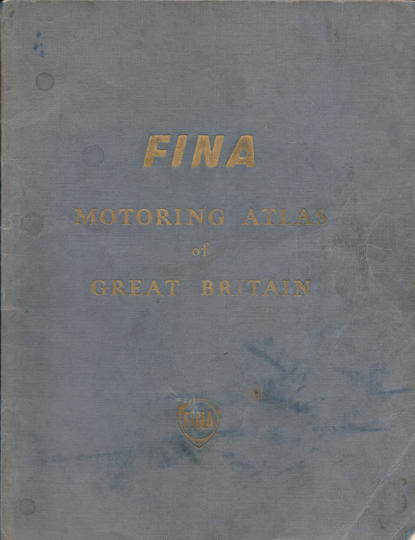
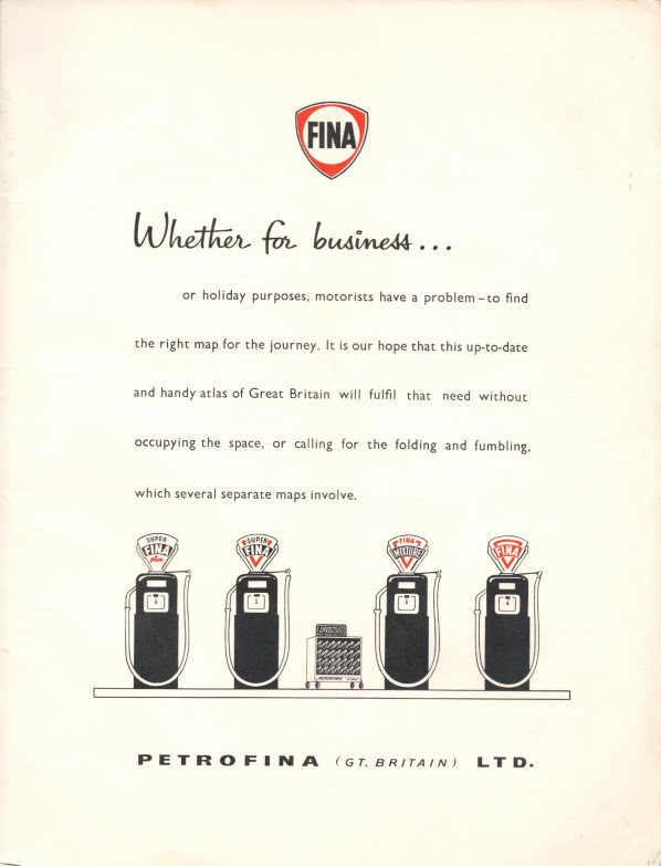
In August 1958 Petrofina commissioned George Philip & Son to print 14,000 copies of a Motoring Atlas of Great Britain in a blue/grey paperback cover. This contained 48 pages of full colour maps at 6 miles to the inch, omitting only the Western and Northern Isles of Scotland (and Northern Ireland). It sold for 5/-, the same as a set of Shell-BP maps using similar cartography, but omitted detailed maps of London. The frontispiece carried the new Fina logo, but showed a row of petrol pumps with the old logo on their globes. |
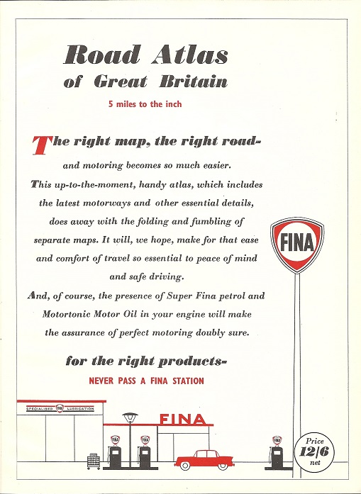
Fina's next known atlas is a slightly smaller format hardback dating from 1960. John Bartholomew & Son provided their usual high quality contoured cartography at 5 miles to the inch, but this came at a price - it now cost 12/6d, two and half times as much as the previous Philip's atlas. Six cities were covered at 1 inch to the mile. The frontispiece advert now referred to including the latest motorways, and advised you to "never pass a Fina station". |
 |
 |
|
|
|
|
|
|
|


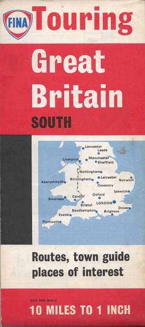
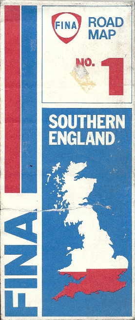
The oldest Fina sheet map of Britain shown below dates from 1960 and covers the whole country at 12 miles to the inch on a George Philip map. By the mid 1960s, Map Productions Ltd had taken over and split the country into two sections at 10 miles to the inch with a gazetteer listing points of interest. London came on a third sheet. The unnumbered red covered map appears to date from around 1970. A few years later the same company had increased the scale to 5 miles to the inch spread over 5 sections, including London. The final sectional maps were reduced to just three sections, omitted Northern Scotland and using cartography by Geographia identical to that used for Texaco, but still at 5 miles to the inch.
After sectional maps were discontinued, Geographia stayed as the cartographer on maps produced by Kirkgate Enterprises of Leeds (1983, far right, above). The single sheet (at 9 miles to the inch) omitted Northern Scotland, where there were no Fina stations.
 |
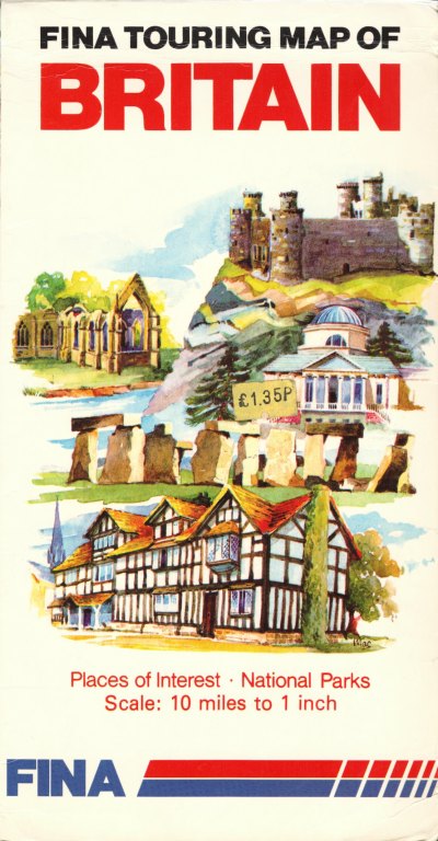
A similar cover to 1983 and the same production team of Kirkgate were used on the 1987 map which again covered all of Britain at 10 miles to the inch. This final sheet map used Bartholomew cartography (although the spine of the map erroneously still says Geographia, suggesting that it there may be an intermediate version too). |
 |
 |
In the mid 1990s Fina branded a version of the AA Big Road Atlas for customers who purchased a 5 litre can of oil at a Fina station (shown at 2/3rds size, left). |  |

Text and layout © Ian Byrne, 1999-2018
All original copyrights in logos and map extracts and images are acknowledged and images are included on this site for identification purposes only.