 FINA
FINA
Maps from Belgium
Brief History
Fina was established by Belgian banking interests to invest in the oil industry in 1920 as the Compagnie Financière Belge des Pétroles. Before long it had its name become shortened to Petrofina. Initially starting with oil production in the Balkans and Chechnya, it soon added marketing assets in Belgium and elsewhere. A joint marketing venture with the American Pure Oil only lasted until 1923 but the name (Purfina) remained in use until the late 1950s. In the 1960s and 70s it was generally around the fourth largest retailer, despite Belgium being its home market, so in the following decades it acquired interests in independent distributors, notably de Smet & van Diest and Elrop. Historically it had often worked closely with Total, so it was little surprise when the two companies merged in 1998 leading to the ending of the Fina brand a few years later.
Maps
This page concentrates on maps of Belgium as there are additional pages for Fina maps from Britain and the rest of Europe.

|

|
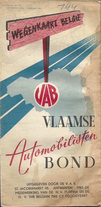
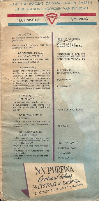
Initially, Purfina did not publish its own maps of Belgium, but co-sponsored maps with automobile clubs. This example, dated February 1954, was produced by VAB - the Vlaamse Automobilisten Bond - with the collaboration of Purfina and the Belgian Tire Cy (Goodyear). As such, it was entirely in Flemish. Purfina has a lubrication summary on the rear cover, as well as three further panels inside giving more detail, and a watercolour image of a Purfina station on the map. I.R.A. of Leuven produced the map which opened out to approx. 940x575mm; ten town plans were included and an unusually large distance chart listing 73 towns. |

|
The Belgian Purfina booklet map shown (left) dates from 1956 or 1957 and was produced in two versions (French and Dutch) under an identical cover. Nine pages of text described attractions in each province and each page was faced by two tone illustrations supporting the text. 16 pages of maps completed the booklet although they lacked any road numbering or distance indications. The covers were printed on light card and had photographs of Fina's laboratory and refinery on the inside. |
|
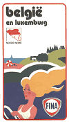
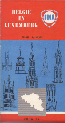
Although undated, the road pattern on this single sided sheet map almost certainly dates it to 1958, with the first stage of the Brussels Ring (R0) open. As such it would have been the final Purfina map before the company switched to the simpler Fina name. Cartography was by De Rouck at 1:350,000, based on its map 44, but PubliCAN is credited with the production. There are inset town plans for Brussels, Namur, Antwerp, Ghent, Charleroi, Kortrijk and Liege. |

|
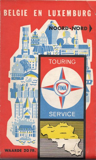
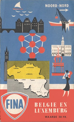
Fina's Belgian maps are often undated and almost all maps have reversible covers with one side in French and the reverse in Flemish. The three shown below come from approximately 1959, 1962 and 1963 based on the road construction shown.
 |
 |
 |
All three were created by Belgium's largest cartographer, de Rouck, at the scale of 1:350,000 but only the later two mark Fina locations. The later two included an index of place names on the reverse and include inset maps for scenic tours but - unlike the earlier map - no city plans. They also carry a nominal value of 20 BFr and 30 BFr respectively. |
 |
 |
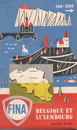
The map on the left comes from around 1970, and the extract map shows how its stations (shown by a blue shield) clustered along its Southern border with France: petrol cost 20% less in Belgium. Although the map did not name a cartographer, the next map, from around 1975, credits de Rouck and used the same cartography at 1:300,000 but no longer showed station locations. |
|
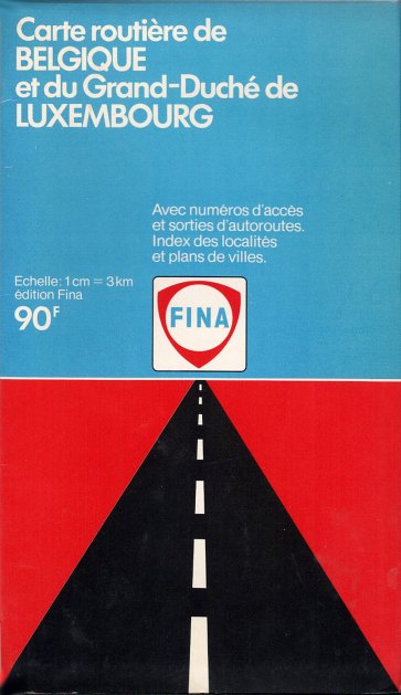
By the end of the 1980s, Fina had moved its maps to Giraud Gilbert, who took a stock issue (again at 1:300,000) - shown below left - and pasted it into a special Fina cover, for sale at 90 BFr.

|
|
 |
 |
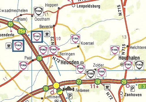
 The two maps (right) were both produced by CARTO of Brussels, and are dated 11/91 and 11/94 respectively. They are at a slightly smaller scale of 1:350,000 and list station locations under the Fina, Elrop and "de Smet & van Diest" brands: all are shown on the map as Fina, but the site at Koersel on the extract displayed the Elrop brand.
 The ca1978 issue (right) is almost certainly unique to the truck stop that sold it in the village of Eynatten on the German border near Aachen. A card cover in just French and German promoting the E5 service area has been attached to a stock Falk patent-fold map of Belgium & Luxembourg. |
|
|
 map of Belgium")

Fina continued to issue maps for their Belgian card holders, right up to an issue under the TotalFina identity and then as purely Total maps.

Text and layout © Ian Byrne, 1999-2018
All original copyrights in logos and map extracts and images are acknowledged and images are included on this site for identification purposes only.