Oil company road maps from Belgium |
Belgium has always had an above average number of filling stations and independent brands serving them. This has been reflected in the maps which come from a surprisingly large number of brands, and which (for major companies at least) are not too difficult to find. Most oil company maps include both Belgium and Luxembourg, and surprisingly many (compared to other countries) are undated, requiring a detailed study of the development of the motorway system.
1920 & 30s - The first maps
Despite major destruction in the First World War, Belgium soon re-built a large oil refining industry based round Antwerp. Three-quarters of the industry was controlled by American concerns (including Standard, Sinclair and Texaco) with the much of the rest divided between Shell and the German Olex, although a couple of French players were present too. In response, the Belgian firm Petrofina was formed in 1920 and before long started selling petrol in Belgium in a short-lived joint venture with another US company, Pure Oil. Over the next 20 years the industry developed rapidly; by 1939 there were nine refineries and numerous petrol distributors, although few branded road maps are known from this era.
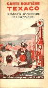 |
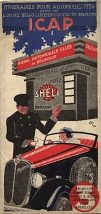
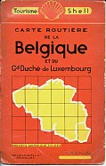
Pre-war maps are rare, with this early 1930s Texaco issue (left) one of the most commonly seen. It exists in at least two variants, suggesting the basic design was used for several years. The first known maps promoting Shell came from Editions I.C.A.P. Bruxelles for the Office Belgo-Luxembourgoise de Tourisme. An open Morris car is seen receiving a map in front of a service point for the Royal Belgium Auto Club selling Shell petrol and oils. The later 1930s Shell map (far right) is similar to a French issue, sharing cartography by Foldex. |
 |
 |
Although Standard maps are also known, no examples have been found from BP (which bought out Olex), Purfina or Sinclair.
1940s-50s - A growing sector
Antwerp was swiftly rebuilt as a major refining centre, and both major-branded and independent service stations spread rapidly along Belgium's dense road network.
 |
 |
 |
 |
 |
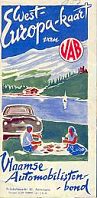 |
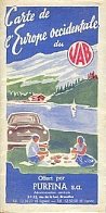
In August 1955, VAB (Vlaamse Automobilisten-bond - the Flemish Automobile Association) issued a map of Western Europe (left) as a supplement to their monthly magazine, 'De Toerist'. As a road map, it is of little use, as it only shows Europe in a pictorial way (a bit like Esso did). The map gives tourist information on most European countries and carries adverts from several companies. In the early to mid fifties, a number of VAB maps were issued with Purfina as the main advertiser, but always in Dutch. Uniquely this Europe map also appears in a French version sponsored by Purfina, apparently for use in the French-speaking parts of Belgium where the VAB version would not otherwise be distributed. |
 |
1960s
 |
 |
 |
 |
 |
1970s
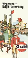
In the 1970s Belgium probably had more brands of petrol per square kilometre than any other country. There was little price competition other than from SECA, so stations took to issuing trading stamps such as Valois, Melior, Comidac and FORT, which are promoted on the Gulf map shown below. A few Total and Fina stations even gave away Green Shield Stamps to visiting British motorists, but the map of Belgium and Luxembourg offered by the Green Shield company was no more than a simple outline affair showing the towns with participating stations.
 |
 |
 |
 |
 |
1980s
Filling station numbers declined less rapidly in Belgium than in many other European countries, possibly because price competition from hypermarkets was blunted after the two largest chains (Delhaize and GB) sold their service station networks to Mobil and Shell respectively. However, as for other countries, branded petrol maps are uncommon from the decade.
|
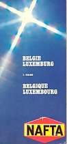
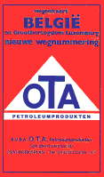
The map (left) from Russian-controlled Nafta actually dates from the late 1970s. Two Belgian independents also issued maps in the 1980s: Pollet's comes from 1981 and is similar in design to a map by BP, its main supplier, whereas the tiny OTA brand added its covers - in Dutch only - to a Claus-Geocart map in 1987. |
 |
 |
1990s
Where petrol companies issued maps in the 1990s, they were mainly to help motorists with payment cards locate the company's participating service stations. Numbers of sites operated by the largest names were falling, so a pocket map - often printed on quite cheap glossy paper - could be a useful gift to cardholders.
 |
 |
 |
All the maps are shown here at the same scale relative to the original maps! |
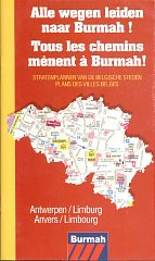 |
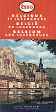
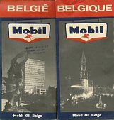
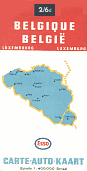
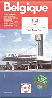
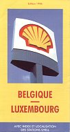
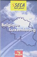
The Fina and Shell maps above are straightforward glossy paper issues, dating from 1991 and 1996. Both mark filling stations and were prepared by CARTO at 1:350,000. Seca's map was sold through its service stations and is on tougher paper. de Rouck prepared it for the company in the late 1990s. The tiny 1999 Q8 map unfolds from a credit card size to a give a very basic map of Belgium by Cartografie de Schutter locating Q8 service stations. (A larger image of this map is on the Q8 page.) At the opposite extreme were four highly detailed street atlases covering all Belgian towns produced by Geocart for Burmah in the late 1990s after it had bought BP's smaller outlets. These were Burmah's first ever maps of the country.
2000s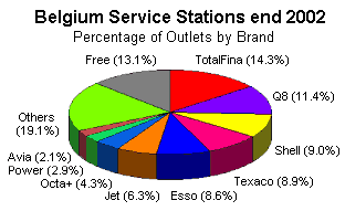 Source: Ministry of the Economy, SMEs and Energy |
As in most other European countries, the consolidation of the 1990s quickened at the turn of the new century. Q8's market leadership (after it bought out the remaining BP assets and Aral) was short-lived as Total, Fina and Elf merged to form TotalFina, although in 2003 their name reverted to Total. Burmah's stations went to Octa+, and after 40 years the Seca name was finally replaced by Jet, although a few years later they were sold to Lukoil. Independent brands and free (unbranded) stations remained common compared to the rest of Europe, although new environmental legislation meant that over 10% of all sites closed in 2002 alone, leaving just 3,875 active petrol stations. |
 Esso |
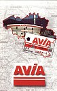 Avia |
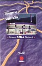 Octa+ |
 |
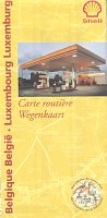 |
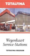
All the maps above are on relatively poor quality glossy paper. The three small format maps are by Geocart-Claus at 1:525,000/600,000. TotalFina's was much the same as the Fina one produced a decade earlier, except that Total stations were now shown as well as Fina, Elrop and de Smet & van Diest locations, and the cartographer credited had become Carpress/Scargraphic. Shell had moved to Uitgerverij Lanoo whose map was at the slightly smaller scale of 1:400,000. Octa+, which also had some outlets under AVIA name, had recently acquired the Burmah chain, and in 2001 re-issued the Burmah street atlases under their new identity; it has continued to issue location maps from time to time.
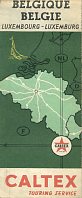
There are many other Belgian map images on this site. Several can be found on the pages for Fina in Belgium, Esso Benelux, Gulf, Trading, and the pages for the Belgian independents of ARA and RBP and Octa+, OTA, Pollet and Power. Additional images can be seen on the BP, Caltex, Nafta, Seca and the Shell 1958-72 and 1996-2000 pages.

Thanks to Michel Breugelmans for some of the images on the page.
All original copyrights in logos and map extracts and images are acknowledged and images are included on this site for identification purposes only.