 SHELL
SHELL
Road Maps from 1962 to 1972
The 1960s was the golden decade for oil company road maps in Western Europe, as rising prosperity allowed many people to explore neighbouring countries or seek the sun on self drive holidays. Most countries rapidly expanded their motorway systems, requiring frequent updates to maps, and motorists travelling in unfamiliar lands could be reassured by knowing that Shell products - including inexpensive road maps - were available at 40,000 service stations across all of western Europe except Spain.
 |
 |
 |
 |
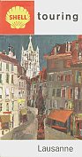 |
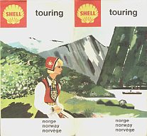
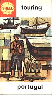
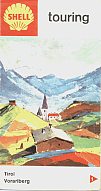
Around 1961-2, most Shell covers were replaced with designs incorporating a painting of part of the area covered, and the new red background pecten. From left to right above, the maps are:
- Norway, 1963, showing how the front and rear covers were continuous. (Emil Moestue A/S)
- Portugal, 1965. Illustrated by Câmara Leme, 40,000 copies were printed by Shell's Portuguese arm (in addition to the Touring Service Spain & Portugal map)
- Austria, 1965. This double map had section 2 (Salzburg & Oberösterreich West) on the reverse and was the only one shown to mark Shell locations (Freytag-Berndt u. Artaria)
- Switzerland, Cartoguide 4, 1961. The country was divided into 4 sections: this covered the South East quadrant (Hallwag)
- Switzerland, map 4, 1969. The country was now split into 6 sections, with the reverse of each having a plan of the main city in the area covered. This map was reversible as Lausanne (city plan) and section 2.
 |
 |
 |
 |
 |
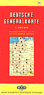
German Shell continued its collaboration with Mairs Geographische to produce a series of 26 Deutsche Generalkarte at the large scale of 1:200,000. The example above dates from 1962 and has very weak Shell branding: later in the decade the Shell logo was more prominently displayed.
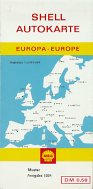
Mairs also produced four sectional maps of Germany at 1:550,000 for the exclusive use of Deutsche Shell (sold for 50pf); the first series (from ca1961 onwards) had large photographs on the covers but they soon replaced them with plainer covers. These were supported by a Europe map that was internally the same as the Taking the Car? map shown on the preceding page. Later sectional maps also have a larger Shell logo, located above the key map.
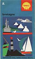
Shell also issued sectional maps in France and the UK. Its French maps were initially given away freely as individual sheets, but latterly sold in sets of 14 maps under name "Cartoguide", as the reverse was given over to tourist information about points of interest. Foldex France prepared the maps at a scale of 1:500,000. The example shown here is of Bretagne (Brittany) from 1969-70.
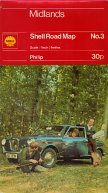
Britain was covered in 10 sections, mainly at 1:253,440 (4 miles to the inch), using cartography by George Philip & Son. Although most maps were issued in paper covers with a drawing of photos on the cover from 1971 onwards a few were repackaged into card covers with a standard design of a Wolseley 18/85 in a wood, possibly for sale through bookshops not service stations.
 |
 |
  |
 |
Shell was also responsible for less standard designs, particularly later in the 1960s.
|
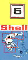
Five years later, Shell issued a uniform series of 5 maps, again by K Florias. Section 5 covered all of Greece on one side, with detailed maps of the islands of Crete, Corfu and Rhodes on the reverse, plus plans of the archaeological sites of Dilos and Knossos. |
||||
|
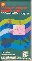
Shell, like Esso, also occasionally issued maps for ships and boats. The example shown here is the 1970/1 revised edition of the only known one to cover much of Europe. One side has a single big map at 1:1,000,000 covering is Belgium, Holland, Germany, Switzerland and
France to just south of Geneva. There are special inserts for Marseille, Le Havre and, in the east, Gdansk. On the reverse side are 4 identical maps at 1:2,000,000 for ship types 1 & 2 to 300 tons, 3 to 1,000 tons, 4 to 1,350 tons and 5 to 2,000 tons. No cartographer is mentioned. The map came in a weather proof plastic sleeve and was printed in Dutch (and carries a Dutch price). |
|
 |
 |
 |
 |
 |
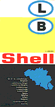
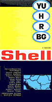
Shell's collaboration with Mairs has been mentioned above. From the mid 1960s, the scenic cover Touring Service maps were phased out in favour of uniform design Mairs issues. Two design series appear to have been used: one without card covers, and one with. The left hand maps lack card covers and carry the country name(s) in 8 languages. The Belgium/Luxembourg dates from 1967 and the Balkans from 1970. It's worth noting that at that time Shell had just one station, in Budapest, in the four countries on the latter map - these maps were designed for sale through retail outlets and elsewhere: my own copy came from the large bookseller chain of WH Smith.
 |
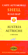
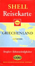
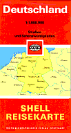
The alternative sequence of designs with card covers had German on one side and bilingual French/English on the reverse. These appear to have been used more in Germany and neighbouring states, where consumers preferred stronger covers on maps. Ironically, because of the way they were laminated, the card cover versions are often harder to find in good condition! The Austrian map dates from 1965 and has a most unusual Shell pecten; Greece from 1968 and the slightly smaller Germany map from 1971. |

Text and layout © Ian Byrne, 2000-6
All original copyrights in logos and map extracts and images are acknowledged and images are included on this site for identification purposes only.