BP
Pre-war and Maps of Europe
Brief History
BP's origins go back to May 1901, when William Knox D'Arcy acquired a concession to explore for oil in Persia. Incorporated as the Anglo-Persian Oil Company in 1909 it soon started looking for outlets for the vast quantities of oil it found. In 1917, the First World War allowed it to acquire the British arm of the German Europaische Union, formed in 1906, which used the trade name "British Petroleum". After the war ended the company, in which the British Government now had a 51% interest, moved to secure outlets in Europe (starting with L'Alliance in Belgium in 1919) and elsewhere. Norway (through MIL-BP) and Denmark came next; ironically it has now withdrawn from all three countries.
Marketing started in France and Germany in the 1920s and these major markets have proved more resilient, if not always profitable. BP was in Sweden by 1927 and Holland and Switzerland followed in 1931. In 1928 African and Middle East marketing was merged with that of Shell, and a precursor of a larger coupling 4 years later when Shell-Mex and BP Ltd was formed as a 60:40 joint venture in Britain. The corporate name switched to Anglo-Iranian Oil Company in 1935, but the brand name remained BP, in the shield first seen in 1930.
|
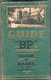
In the early 1920s BP set up the Société Générale des Huiles de Pétrole in France and soon acquired the long established firm of G.Lesieur, which marketed under the Energic and Energol names. The 1926 hardback guide to Paris possibly contains the oldest "BP" maps and street plans and is described in detail on its own page. A second volume covered the Alpes & Côte d'Azur. |
|
|
|
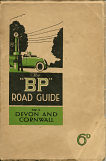
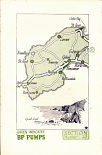
The oldest BP maps of Britain are to be found in the BP Road Guides. No. 2 covers Devon and Cornwall and is undated, but probably comes from the mid-1920s and was sold for 6d (2½p). A stiff paper cover encloses 96 pages, including 22 two colour maps locating towns or villages with BP pumps at the sacle of 4 inches to the mile. At the back of the volume these are listed by reference to the sectional map numbers. Most maps faced a page of adverts for local businesses. The guide was designed and printed by the British Publishing Co of Gloucester. |
|
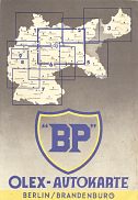
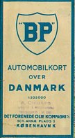
The most common pre-war BP maps are the 1930s sectional maps from Germany carrying both the BP shield and the name "OLEX". Olex was the former Oil Exporting organisation from Romania and was bought by BP from DEA in the 1920s. Far right is an undated 1930s BP map from Denmark, issued by Det Forenede Olie Kompagni A/S. As often in Denmark, it is to a scale of 1:505,000. Note how both maps use the old BP logo with inverted commas around the initials. Click here for a pre-BP Olex guide to Bavaria. |
|
|
The Second World War inevitably led to a pause in the expansion, but in the ten years after it ended BP added retail chains in Turkey, Greece, Malta and Portugal. Fill-in acquisitions included Runo-Everth in Germany, Fanto from Holland and the Swiss firm Noba, as well as Atlantic's European marketing. The final gaps in Western Europe were filled by a large acquisition in Italy in 1958 and by adding a small chain in Finland as late as 1965.
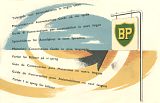 |
In the 1950s Shell, Esso and BP all developed touring services as tourism began to revive, initially driven by people wishing to visit war graves. As well as maps, phrase books were invaluable as many of these new motorists had not learned foreign languages at school: the one shown dates from around 1953. |
 |
 |
|
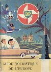
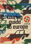
BP later started issuing thick pocket-sized touring guides to Europe, full of practical hints and colourful illustrations. Each country of Western Europe, ranging from Turkey to Finland, was covered by a single chapter. The examples shown come from France in 1959 (centre right) and Britain in 1964 (far right). Although printed locally - the British example by Geographers' A-Z Map Co - the content was essentially common in all versions. More examples of the contents of BP Touring Kits. |
|||
BP's downstream growth was fuelled by large quantities of crude oil; although it lost its Iranian interests in the early 1950s (and formally changed its name to British Petroleum in 1954) it was adept at finding replacement fields. However this growth was not always as successful at finding profitable outlets, and so with the onset of the oil crises of the 1970s, large swathes of European marketing were sold off or "rationalised". This started with the sale of Italy (to form Mach) and Norway (to form Norol) in the 1970s. During the 1980s the rest of Scandinavia was sold to Q8, Statoil and Union of Finland (now part of Neste). Ireland also went to Statoil in the mid-90s, and most recently Belgium was sold piecemeal to Burmah and Q8.
 |
 |
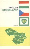 |
The BP Touring Service included maps from countries where BP petrol was not sold including (L- R) Spain (1960), Yugoslavia (1964) and, most unusually as few tourists were able to visit them by car, Hungary & Czechoslovakia (1965). |
 |
 |
 |
 |
 |
|
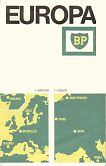
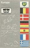
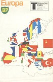
In common with other large oil companies it also issued maps of all Europe. The examples above come from (L-R) ca1958, ca1960, 1967, 1971 and 1977. Earlier maps were often by John Bartholomew -and the oldest is backed by a relief map of Europe showing no roads at all. Later examples were by George Philip & Son, although the Hungary country map was unattributed (but may have been created by Cartographia of Budapest). The 1970s maps were both jointly branded with Trafalgar Tours, a specialist in European coach travel that still sells up-market tours today. |
||||
In 1996 BP merged its downstream activities into a joint venture with Mobil, with BP as the senior partner which saw the end of the Mobil name on service stations. As both companies had spent much money on upgrading their retail outlets, the new group - whilst still in third place - was in its main markets a serious competitor for Shell, Esso and the new national champion brands. Following the Exxon-Mobil merger in 1999, BP acquired 100% of the petrol retailing business.
|
|
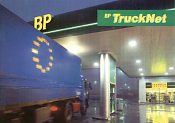
Although the days of Touring Service maps have long passed, this Truckers' guide from 1995 has rudimentary maps showing BP Truck Stops near main highways. It also has a small-scale fold out map of the whole of Europe pasted into the rear cover. It was produced in Belgium for the one group of customers felt still to have some brand loyalty.
|
At the end of the 1990s BP engaged in two large US acquisitions, bringing Amoco and Arco (the US successor to Atlantic, amongst other names) into the group. Even before these had been fully assimilated, it then added lubricant specialist Burmah Castrol in 2000 and, at the very start of 2002, the large German petrol retailer Aral. This transformed the company into the leading European petrol retailer, as well as a major force in lubricants world-wide. BP had previously worked closely with Aral through Routex, a pan-European payment card, and Aral stations had often sold Castrol oils.
Text and layout © Ian Byrne, 1999-2014
All original copyrights in logos and map extracts and images are acknowledged and images are included on this site for identification purposes only.

