ARAL
Brief History
|
Aral's origins go back over 100 years, to the formation of Westdeutsche Benzol-Verkaufs-Vereinigung GmbH in
November 1898 as a marketer of benzole, a by-product of coal. From this lengthy name, the abbreviation
BV was used as a trading name and the main motor spirit was Bevaulin. In 1924 a new name was added to certain blends:
ARAL, which came from the words "ARomaten" and "ALiphate" which were felt to be the new fuel's qualities.
Over the next 50 years ARAL became the main brand, although the BV was not removed from the logo until 1974.
|
|
|
|
Aral acquired Gasolin in the 1950s but did not change the branding until August 1971. Gasolin was the successor
to Leuna, the retail petrol arm of the pre-war industrial conglomerate IG-Farben. |
Maps: BV, BV-Aral, Aral (Germany)

|

|

|
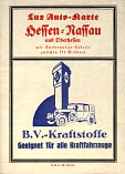
In 1936 BV introduced a second series which increased the scale of its maps to 1:500,000, requiring 13 sections, including one centred on Berlin. Cartography was probably by Witzel, and marked towns with Aral stations by shading them blue. Coloured flags were used to indicate locations that sold Derop (1936) or had Bevaulin or diesel pumps (from 1937). From left, this 1936 map was centred on Berlin and promotes Deropol oil and Derop Benzin, but by 1937 the cover promotes Bevaulin. |
The 1939 map (above right) shows how Germany had annexed not only Austria, but SW Poland (Silesia-Pomerania) and Bohemia. Inside it is dated 1.4.1939, although some maps with the same internal date do not show Bohemia (Czechoslovakia) as part of Germany on the cover. The physical size of the sheets varied considerably, depending on the area covered by the map. | |||
|
|
|
|
|
|
|
|
After the war, a third series covered West Germany was in 13 sections. The 1951 map (which, unusually, is dated) still had an old-fashioned zapfstelle shown; by 1954 (edition III/5) it had been replaced by a more modern petrol pump and oil cabinet. |
From around 1955, Aral increased the sheet size to enable West Germany to be covered by 7 sectional maps in dark blue covers. The Aral section 2 is from a series issued around 1959, and the bolder section 3 from 1972/3. These are all marked as the 4th series, but now attributed to Busche of Dortmund. |
In 1974 a simplified Aral logo and lighter blue was introduced, and for much of the 1980s floated on a variable cloud pattern. By 1991 the clouds had gone, and Germany was finally re-unified, needing 2 extra sections. |
|||
Dating Aral maps is difficult, although most carry an edition (Ausgabe) code.
 |
 |
 |
For a long period in the 1950s and 60s, the 7 map sectional series (including the planning maps, Für den Fernverkehr, shown here) carried a code of IV/n, where n ran from 1 to around 14. A rule of thumb suggested that the year could be found by adding 1955 to n, to get the year. Thus the first map shown here, coded IV/3, would be 1958. However two slightly different versions of this map are known; the actual map appears identical, but the legend varies. One has a list of border crossings below the legend; the other a panel promoting Aral in German, English and French. |
Around 1962 (IV/7) a cover price of 50pf was added, as shown on above centre on a map coded IV/13, with non-German titles costing DM1. However the map dated 1972 on its cover is coded V/5, which would suggest that the revised series was introduced in 1968 (V/1 ?) and that maps coded IV/13 and IV/14 should not exist. | |||
|
As a broad generalisation maps from before World War II give more prominence to BV and after the war to Aral. The main sectional maps (8 to 1935, 12 from 1935-8, 13 after Austria was annexed, 13 just covering West Germany in the early 1950s, 7 during the partition of Germany and 9 since reunification) have always had relatively plain covers, usually in blue with an outline map of the area covered. Inside they have been produced by Busche Verlag of Dortmund and consistently marked towns and villages with Aral stations, allowing a fascinating picture of the changes in the number of service stations over a 70 year period. (Only Conoco in the US offers a similar historical record.) They have always been available as sets in a leatherette or plastic wallet, and the 1930s sets included an extra map covering 100km around Berlin and a sheet showing road signs and a summary of the motoring laws. |
|
|
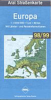
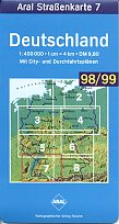
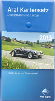
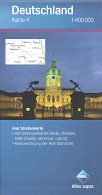
Since the mid-1990s, maps have come in card covers if sold singly (above right), or with paper covers of the same design when sold at a special price in a vinyl wallet. The 2013 set (on sale from mid 2012) contains 14 maps and a register of towns. Eight of the maps are sections covering Germany at the scale of 1:400,000 and locating Aral stations; each is backed by larger scale maps of urban areas (at 1:100,000) or tourist districts (at 1:150,000). The set additionally contains maps of Germany (at 1:1 million), Europe, Benelux, France, Italy and Austria/Switzerland. The 2013 set mainly had photographs of landmarks at twilight on the covers, although the box cover (a loose card held in place by a press stud) showed a Morgan motor car, an image also used on the 2013 softback atlas. As paper map sales fell with growing competition from in-car satnavs and Google maps online, annual sets were discontinued. It appears that the only set since 2013 was published in 2016, but the box no longer carries a cover date. |
|
|
|
|
Aral occasionally issued maps outside the sectional series. BV maps of cities are uncommon; Hannover dates from the mid-50s and may have been issued for visitors to one of the trade fairs held there. A map also exists for Berlin from the same period. Most cities were covered by relatively simple maps drawn on the reverse of the sectional maps, as shown on the Freiburg im Breisgau page. The diesel map at 1:1,000,000 was printed around 1953, and lists all BV stations selling diesel - note that Aral was only used for petrol (gasoline) grades. |
|
|
|
|
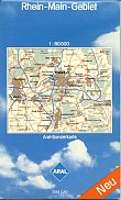
Aral has also produced other maps for many years. The enlarged map of the Ruhr (far left) dates from the late 1950s and highlights Aral-Methan stations. In the mid-1980s they added an enlarged map of Rhein-Main-Gebiet with card covers; this map was later (1997) repackaged for the coal producer Steag. Neither map is dated, but both were by Busche. The Ruhr map was produced in Aral covers until around 2011, after which it was only sold as a Busche map. |
Busche's web site (http://www.busche.de/) showed that most of their cartographic products were branded by Aral until the mid-2000s, but maps from outside Aral's traditional marketing territory are now sold under their own name.
Collectors may occasionally see BV-Tourenblätter advertised, often as large scale walking maps of Germany or Austria. These are unconnected with BV-Aral, but are published by BergVerlag Rudolf Rother of Munich.
Text and layout © Ian Byrne, 1999-2018
All original copyrights in logos and map extracts and images are acknowledged and images are included on this site for identification purposes only.


