 ARAL
ARAL
Scenic and unusual maps
Touring and Freizeitkarten
In the 1950s BV started an exceptional series of undated tourist area maps with scenic art covers. These were later rebranded as Aral maps, and were the predecessors of today's Freizeitkarten ("free time maps").
|
|
|
|
|
|
|


The oldest map is a BV of Schwarzwald Nord; relatively few areas appear to have been covered in this series and the cover drawings were different from later maps. By the early 1960s the series had been extended, as shown on a BV Eifel und Ahr and a mid-1960s Aral Oberbayern. Late 1960s maps (not shown here) lowered the Aral logo into the blue band and removed the word "BV" from in front of the word "TOURENKARTE". The cover took on a completely different and less attractive design around 1971/2 as seen on a slightly later (ca1972/3) map of Eifel und Ahr. The two final maps are from ca1974-5 and ca1975-6 and cover Oberbayern West and East sheets - Munich is in the top corner of both. No attempt was made at national coverage, although sections were also produced for the Austrian Tyrol. Sold for many years at a Deutschemark or less, the price rose sharply in the 1970s, from DM1,50 in 1972, through DM1,85 (1973-4), DM2,50 (1974-5) to DM3,50 just four or so years later. Maps from the three later series on only rarely seen, probably reflecting the rapid inflation in their cost. Note how the final map has changed from the old dark blue of BV-Aral to the turquoise blue introduced around 1974 and a new image although the rest of the design is fundamentally unchanged, other than for fewer words in the yellow sun splash.
The cartography on all the maps above was by Witzel at a scale of 1:150,000, with a light grey background. Hills were shaded darker, and wooded areas marked in green, with built up areas in pink. The unusual colour scheme continued to white roads, except for three circular tours on each section (labelled A-C) red, blue and yellow. The reverse described the sights found on each of the three tours (again colour coded by printing the details on pink, light blue or yellow backgrounds) and was illustrated by watercolours of some of the main tourist attractions, in a style similar to the older covers. These attractions were numbered, as can be seen on the extract from the Oberbayern map around the village of Prien, where routes B (blue) and C almost meet. |
|
 from 1975-6 Aral Touring Map of Overbayern")
|
|
|
|
|
|


")
 from 2001")
|
After unification the maps were renamed Freizeitkarten and extended to 28 sections with photographic card covers, with the cartography now credited to Busche. Section 20 covers the Northern part of the Black Forest and sections 26 to 28 overlap other sheets: no. 27 is centred on the Ruhr, described as Sauerland, Bergisches Land, Siegerland, Arnsberger Wald. All these maps have points of interest described on the reverse of the map, illustrated by numerous small colour photographs. |
|


In 1951 BV-Aral issued a series of 5 large format booklets, entitled Links und Rechts der Autobahn; these were available in a presentation box. Each booklet consisted of between 7 and 12 pages of attractive strip maps to a scale of 1:175,000, with numerous scenic illustrations. The series initially covered Gottingen-Bruchsal, Hof-München, Karlsruhe-Salzburg, Herford-Frankfurt/Main and a combined Lübeck-Bremen & Helmstedt-Herford issue. The cover designs varied, but all included rather unrealistic sweeping motorways across a typical landscape. Witzel was credited with the design, but they were printed by Busche.
A year or so later they were reprinted and two volumes extended to include additional sections of motorway that had been opened (or were under construction). The two revised titles were Herford-Frankfurt which added the Aachen-Düren autobahn, and a doubly extended title covering Northeim-Bruchsal & Mannheim-Kaiserslautern (shown above). All the newer editions also included, for the first time, an index plan showing how the autobahn was split between the pages, and marked towns with BV filling stations by underlining them. Small editorial changes were also made to the maps themselves; for example the location of the Gottingen film studio was moved and the old building was removed from the map.
From Hamburg to Jutland: E3 and the Green Coast Maps
|
|
|
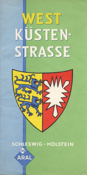
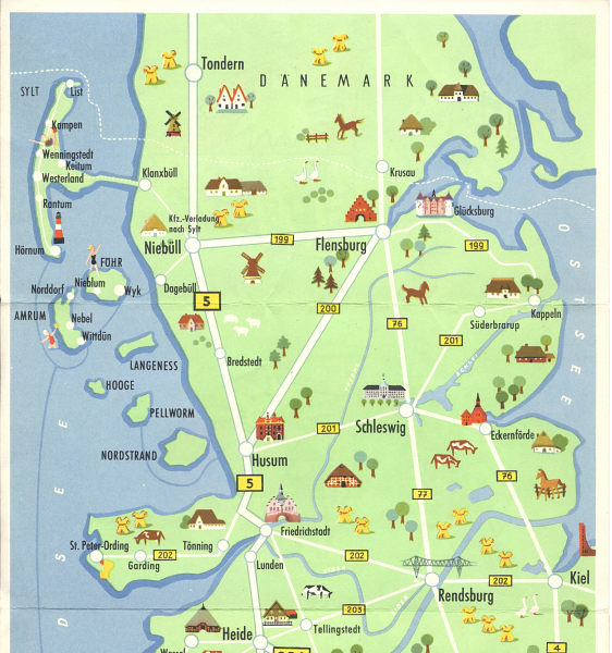
In April 1957 Aral produced this West Coast map, sub-titled Schleswig-Holstein, that covered an area from Hamburg to just North of the border with Denmark. 100,000 copies were printed, including 65,000 in German (with the other languages not known, but possibly English and Danish). The design was by Bruno Karberg, and the reverse included two panels of descriptive text. Unlike the other maps in this section, the rear cover was almost identical to the front, save that it replaced the subtitle with "Immer gute Fahrt mit Aral bleifrei". |


|
|
|
Just three months later, in July 1957 Aral sponsored this pictorial strip map of the new European route E3 from Frederikshavn (Denmark) to Hamburg. 200,000 copies were printed including 85,000 in German (with editions in English and Danish also known), giving descriptions of the sights in the main cities of Jutland and North Germany (and of Aral's fuels). Principal BV-Aral locations were marked on the German stretch of the route. This appears to be a one-off map designed by Ulrik Schramm. Its format is slightly larger, and it covered all of Jutland. |


|
|
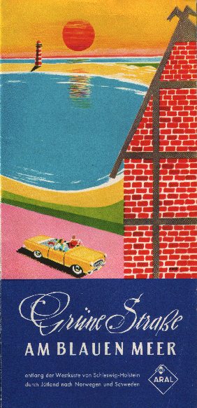
117,000 copies of a rather similar map were printed in 1961 under the colourful title of the Green Road to the Blue Sea (Die Grüne Straße am Blauen Meer. This showed a route from the Kattegat at the Northern tip of Denmark to Hamburg. The reverse side was given over to short descriptions in German (and a thumbnail drawing of each) of 34 places of interest that were along the road. The map was credited to "H.M.D." (see also below) and also included a small map of the Southern North Sea. |


|

|
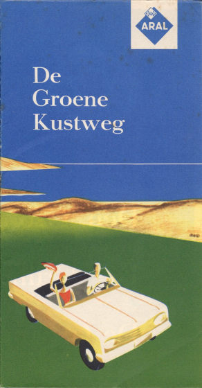
Only 100,000 copies of the next version were printed in 1963. Die Grüne Küstenstraße (The Green Coast-Road) now showed the route from the Kattegat at the Northern tip of Denmark to the Rhine delta in the Netherlands. The reverse side was expanded to include descriptions in German (and a thumbnail drawing of each) of 67 places of interest. H Müller-Dennhof was credited as the map designer; it now bore no Aral product promotion. |
 |
50,000 copies were printed of a Dutch version "De Groene Kustweg" (shown on the New 2014 page) and it highly likely that a Danish version will also have been printed even though, as with England, there have never been any Aral service stations in Denmark.
Next Aral Page (atlases)

Text and layout © Ian Byrne, 1999-2014
All original copyrights in logos and map extracts and images are acknowledged and images are included on this site for identification purposes only.