Oil company road maps from Germany |
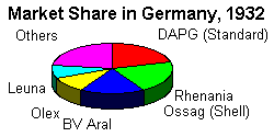
Germany made a rapid push towards re-industrialisation after the end of the First World War. The energy industries were a key component, and were soon dominated by 5 groups: BV-Aral, Rhenania Ossag (Shell), Deutsche Amerikanische Petroleum (Standard, later Esso), Olex (bought by BP at the end of the 1920s) and Leuna, part of the IG-Farben industrial grouping.
|
Amazingly descendants of these 5 groups still form the top four petrol brands in Germany: BP-Aral, Shell-DEA, Esso, and Total (which through Elf acquired the Leuna refinery in 1992 after re-unification). Despite a slump caused by hyperinflation, the first roadside filling stations were opened in the 1920s; many were of a simple design incorporating all facilities in a single large pump, known as a Zapfstelle. |
|
1920s - The first filling stations - and maps
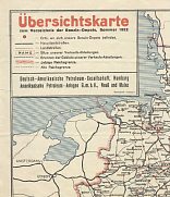 |
1920s maps are, not unsurprisingly, very rare. The one shown left is a summer 1922 Deutsche-Amerikanische Petroleum map showing towns with petrol-depots: at that stage roadside filling stations were still a novelty and motorists had to go to depots. Inset maps showed the industrial areas of Saxony and city plans of Berlin and Munich. |
 |
|
|
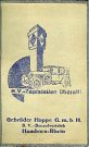
An alternative approach was used by Gebrüder Hoppe G.m.b.H. which distributed BV-Aral products to 41 zapfstellen (small filling stations) in the Western Ruhr from its base at Hamborn-Rhein. Hoppe took a standard Ravenstein sectional map (sheet 70) which was dissected into 8 panels and mounted on cloth. The reverse side was then devoted to 8 panels about the company, including a list of all its locations and information about other products - principally building materials - that they also sold. The cover picture shows a car in front of an oversized zapfstelle and carries the date 1927; it was used by another BV distributor on a Lux map, shown on the Aral page. |
1930s - Large map programmes from large companies
Around 1934 all the major petrol companies started to issue series of sheet maps, possibly as a result of Government encouragement. Some carry a "Deutschland ist schöne" logo, and there seems to be a positive encouragement of motoring as a leisure activity, despite Germany still having many fewer cars per capita than Britain, France or the USA.
 |
 |
 |
 |
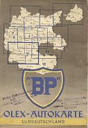 |
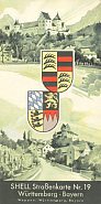
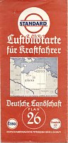
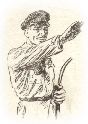
| The maps from the five major brands above can be dated as 1936 Shell, ca1936 Standard, 1937 BV-Aral, 1938 Leuna and 1939 BP-Olex, showing the expansion of Germany to include Austria after the Anschluß. Standard took most sections to cover the country (30), Shell took 21 and the others 9 or 10. However this does not mean that Standard's were at a significantly larger scale; their maps were distinguished by being hatched relief maps called Luftbildkarten (aerial picture maps) on semi-gloss paper covering a fairly small area. All 5 firms identified towns with their filling stations present. The political influences of the time can be seen in the straight armed salute from a Standard attendant (right).
|
 |
 |
 |
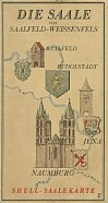 |
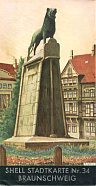
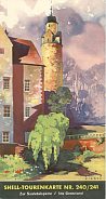
Shell also ran a series of almost 90 town plans - no. 34 was Braunschweig. These reveal how quickly major streets and squares were adorned with the names of Nazi leaders. The touring maps were designed to encourage motoring for pleasure: after an initial run of almost 200 titles was produced, probably in 1934-5, a second series of double-tours followed. No. 240/1 from this latter series was based on Chemnitz and called Zur Saaletalsperre / Ins Grenzland. A third unnumbered series of maps covered river valleys and tourist areas, such as the Saale (left). |
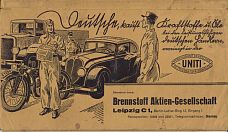
| As well as the majors, independent firms also issued road maps. The most common were paper bound atlases produced to a common basic design for members of Uniti, the trade association of mid-sized oil companies. While larger Uniti members customised the atlas, smaller ones, such as Brennstoff AG of Leipzig - shown here, kept to the basic format. These atlases had 13 fold-out pages of maps, backed by plans of major cities. |
 |
1940s - War and Division
Due to the war and subsequent reconstruction, there are no maps of Germany known from the 1940s.
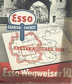
| However it appears that pre-war Esso maps, showing the old borders, were recycled with the post-war borders overprinted on the cover with the explanation "Kartenausgabe 1938" (1938 map edition). The bottom half of the section 10 map (shown right at 50% greater than normal scale) shows how this was done; this copy appears to have suffered some smoke damage, maybe from storage in a wartime warehouse. The map by Bruckmann appears not to have been edited following the war, but the gazetteer on the reverse includes several areas that have been overprinted by adverts for Esso motor oil, obliterating the original text, although it's not obvious why - they do not appear to have political or anti-Semitic links. Both the gazetteer and the outline map on the cover suggest that the map was printed well into 1939, and not in 1938 as stated on the overprint. |
|
1950s - West Germany rebuilds
Both major and independent petrol companies in the West restarted operations in earnest in the 1950s. Indeed some, such as A May, were forced to relocate their Head Office from the East (Erfurt) to the West (Schweinfurt). New, larger tankstellen were built beside main roads, to replace the older on-street zapfstellen of the 1930s.
 |
 |
 |
 |
 |
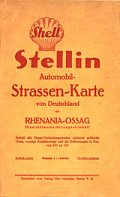
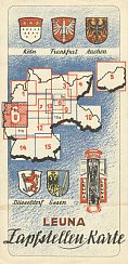
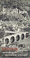
The Western rump of Leuna was in something of a mess but introduced the Gasolin name on its filling stations. Gasolin and Nitag, which had been Wintershall's downstream chain before the war, were acquired by Aral, but not before this Nitag map (ca1952) was produced. Gasolin remained in use as a secondary brand by Aral and, as well as sectional and city maps, issued an interesting series of panorama maps in 1956, such as the Neckarland one above.
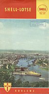
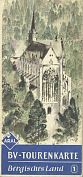
Shell regained its pre-war position and issued a range of sectional maps (Wegweiser), detailed maps known as the Deutsche General Karte (see also 1980s, below) and 46 town plans, including Koblenz.
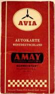
Many independents were looking for a stronger national branding, so signed up with AVIA from 1953 onwards, when the Swiss based cooperative brand became available in Germany. Uniti member A May was one such, and had its old name overprinted on this mid 1950s AVIA map.
1960s - Rapid growth in numbers: Garages, Brands and Maps
The 1960s were the heyday for the petrol industry in much of Western Europe, and West Germany led the way. There were many new international entrants into the market: Total, OXY (buying Varol and Kirol), Amoco (through Adler), Gulf (buying Frisia), Chevron (splitting out from Caltex), Pam, Marathon, Elf and Conoco/Jet (buying Sopi and, in 1970, VK Georg von Opel). Many bought shares in oil refineries based on a flow of cheap oil from the Middle East and North Africa. Competition was keen for the best sites to build new service stations, although those on the autobahns were strictly regulated to ensure that independent German distributors could get a presence, too. The number of sites rose back to its pre-war total of over 46,500 outlets, although by the end of the decade some of the smaller names were already looking to withdraw.
 |
 |
 |
 |
 |
 |
 |
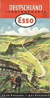
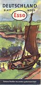
Esso's sectional maps started the decade with scenic covers, as in the 1960 example shown, but soon moved to a standard design with just an outline map of the country.
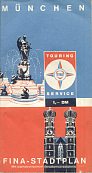
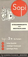
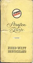
Amongst the newer entrants, Fina - which had bought its first German chain in 1955 - was one of the few to issue city plans, such as the München one here. Sopi was a South German and Austrian chain bought by Conoco in the mid-1960s. The Conoco name proved unpopular, so it was soon replaced by the simpler Jet brand. Finally Fanal was a domestic chain associated with the Hugo Stinnes group. The map shown dates from the very early 1960s: unlike all the others shown on this page so far it was merely a stock cartographer's issue (Falk-plan in this instance) with branded card covers pasted on. Fanal bought Gulf's operation in the 1970s, but was sold to BP a few years later. |
1970s - Crisis and Consolidation
In 1972 the first oil price and supply crisis hit West Germany badly. The country lacked domestic oil supplies, yet was increasingly dependent on cars (and the motor industry). The oil industry reacted with a wave of consolidation, with many of the new players from the 1960s seeking buyers. Service station numbers fell from 45,850 to 27,000 over the decade - a 41% fall.
 |
 |
 |
 |
 |
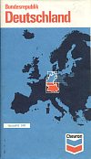
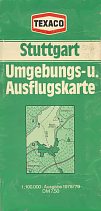
The main successor to Caltex, which had been relatively weak in Germany, was Chevron, represented here by this early 1970s issue. Texaco gained a stronger position by acquiring DEA, which had grown since the War to be the fifth largest petrol retailer. The map here is of the Stuttgart area and dates from 1978.
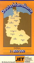
Smaller companies only rarely issued maps in the 1970s. This 1979 Jet is therefore something of an exception, especially as Jet was a pioneer in cut-price self-service stations.
1980s - An uneasy decade
The 1980s were still not an easy decade for West German petrol retailers. Although fuel supplies (and prices) steadied, the decline in filling station numbers continued - dropping a further 8,750 to under 18,300, as new uses were found to be more profitable than selling fuel.
 |
 |
 |
 |
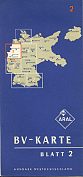
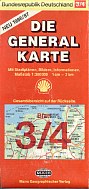
In a similar manner, Shell also persevered as co-sponsors of the long running detailed Die General Karte maps; these were now issued in double sections.
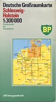
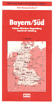
BP and AVIA were two companies whose programmes were slowly running down. The BP of Schleswig-Holstein shown is about as late as German BP maps go, as is the AVIA section 7. BP's map was based on a JRO- issue (just as Esso was now using Hallwag). The AVIA map was in fact a stock Kümmerley + Frey issue, with AVIA covers pasted on, rather like Fanal did in the 1960s.
1990s - Return to the East and Reunification
With the rapid fall of the Communist regimes in Eastern Europe at the end of the 1980s, West German petrol firms soon saw opportunities in the former DDR. For a couple of years it was only possible to do business there in joint ventures with Minol. Then in a surprise move, the old Leuna refinery and Minol distribution assets were sold to the French company Elf. Aral and the other majors were forced to build their own Eastern networks, competing with new entrants such as the Norwegian Statoil (who sold out to Shell in 1997). Back in the West, numbers continued to drift downwards, with most chains becoming 100% self service.
 |
 |
 |
 |
 |
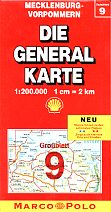
Shell and DEA (and for that matter, Esso and Aral) continued to issue sectional maps inside card covers, as in the latter half of the 1980s. The Shell map shown comes from 1998 and the DEA 1999. Shell's were now co-branded with Marco Polo, a proprietary name of Mairs, their long-term cartographers, and larger sheets required many fewer sections than before unification.
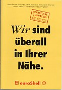
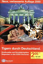
In parallel with the maps, some companies issued maps for payment card holders; these showed branded filling stations and were often A5 format paper-covered atlases. Agip's dates from 1998 and also marks Westfalen, Elf and selected Minol stations. The EuroShell atlas is a year younger and extends to cover all Shell sites in Austria and Switzerland as well as Germany.
2000s - Fewer Sheet Maps but some Atlases
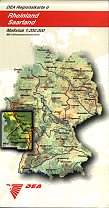
Consolidation remained the order of the day with BP acquiring market leader Aral (but keeping the local name on service stations) and Shell buying the DEA chain from RWE. With a resurgence of unbranded stations, the smaller majors focused on cutting costs - and any remaining map programmes had to go.
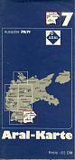
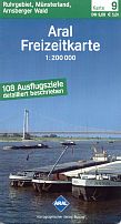 Section 9 covers the Ruhr & Münsterland. |
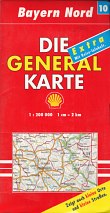 Section 10 shows Bayern Nord. |
 |
 |
In the 2000s German motorists, like their peers elsewhere, increasingly turned to other sources for routes, including online maps and satnavs. Although Shell and Aral continued to sell sheet maps for most of the decade, Shell's were mainly sold through bookshops, with Mairs regarding the Shell pecten as a sign of quality. |
|
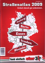
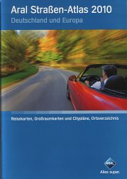
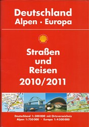
2010s - The trend continues
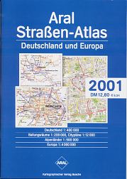
So far, I have only found Shell and Aral maps or atlases carrying a 2010 or 2011 date - both these examples were on sale in late summer 2009 (although a 2011 Aral atlas is shown on the introduction page). The two medium format atlases sold here represent good value, with each costing only a little more than a single sheet map, and are likely to be continued even if sheet maps are discontinued. As always, Shell's version was produced by Mairs and Aral's by Busche. |
|
|
There are over 200 German maps or images from German maps on this site. The largest selection are on the pages devoted to Aral, BP, DEA, Deltin, German Esso maps, the Esso Touring Service, Gasolin, Leuna & Nitag, and 1930s Shell maps of Germany. There is a page devoted to AVIA's predecessor brands - Boie, A May, Minera and Östol (Oest).
Other brands with German maps included on this site, but not shown on this page, include Adler, Autol, Caltex, Rheinpreussen, Divinol, Esslin Tank, GD, Freie T, Haltermann, Hettöl, Hinrich Stöhr, Homberg, Kraftin, Kraftstoff, Lotherol, Milag, Migrol, Montan Union, Strato, Tramin, TS, Turbotank, Westfalen/Rückwarth, Varol, VK, Wiol and the Uniti members - Euco, Arenol, Paul Donath (Donizin), Alfrid Espig (Espolin), Hudolin, Olus, Oelvertrieb Nordhausen and VCG, as well as a postwar generic Uniti design.
A full list of independent distributors and associated brands known to have issed maps is maintained on the Freie Tankstellen page.
There are also pages showing maps promoting 3 lubricant brands: Fuchs, Pintsch Oel & Viscobil, the lubricant specialists (but occasional operators of service stations) Optimol & Veedol, and adverts on commercial road maps.
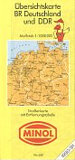
East German maps from Minol, Intertank and Petrolchemisches Kombinat Schwedt are shown on a separate page devoted to maps from the former German Democratic Republic.

Thanks to Dave Leach, Jon Roma & Richard Horwitz for some of the images on the page.
All original copyrights in logos and map extracts and images are acknowledged and images are included on this site for identification purposes only.