East German Maps
Minol, Intertank, Petrolchemisches Kombinat Schwedt
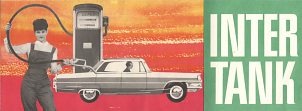
Brief HistoryMinol was established as the East German retail petrol monopoly in the late 1940s, based at the old Leuna refinery. Western brands of petrol were eliminated and the number of filling stations severely reduced, allowing Minol to make relatively little investment in its network. A few sites on autobahns, main roads and in big cities carried the Intertank name, able to sell fuel for hard currency. |
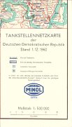
Early Minol maps, like this 1960 issue, lacked any attempt at a cover, instead being folded so that the Minol name appeared in the legend on the outer face.
|
Maps
|
|
|
|
|
|
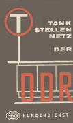
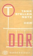
The 1963 and 1966 maps of East Germany (the DDR) give little importance to the name Minol, and more to the generic T in a circle used for Tankstellen.
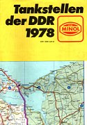
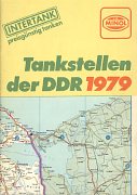
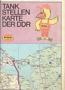
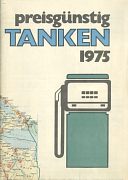
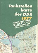
By the 1970s Minol's standard issue map was folded into an A5 format, but lacked a proper cover, instead bleeding the map onto the space below the title. The three examples above date from 1978, 1979 and 1987; the 1979 one also refers to Intertank. The most recent design introduced a bird (vaguely reminiscent of Esso's "Happy") to try and give Minol stations a more friendly image; the character also appears in a number of poses on the reverse of the map. This map cost Östmark 5,50 including a donation of 0,30M to the 1988 East German Olympics team. All five maps shared cartography by VEB Hermann Haack of Gotha at the scale of 1:500,000 (1963/6) or 1:600,000 (later issues) and all marked towns and villages with Minol/Intertank filling stations.

|
In October 1986 Minol published this small station locator map of East Berlin, which opens out to A4 size. The map is very basic marking only main roads in a hard to read yellow on a white background, plus Minol locations, the Berlin radio tower, zoo, Intercamping and Schönefeld airport. The 20 category I or II filling stations are listed on the back but the 14 category III or IV stations are not. |
|
|
|
|
|
 |
 |
 |
In 1990 Minol produced what was probably its final map, covering both West (BRD) and East (DDR) Germany as Eastern citizens were, for the first time since the War, able to travel freely to the West. The old Eastern cartographer, VEB lacked an up to date map of West Germany, so Minol was forced to buy a design from Busche of Dortmund. Beneath the covers, the map is in fact identical to the Aral/Busche Übersichtskarte, even down to locating Aral stations (not Minol!) on the autobahns. |
|
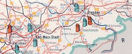
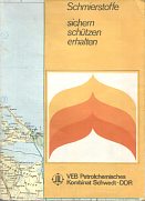
Petrolchemisches Kombinat Schwedt (PKS) was the main holding company for the lubricant blending plants in East Germany. Perhaps surprisingly, a version of the VEB Hermann Haack map was prepared for them in 1964, and occasionally updated, as in the 1974 issue shown here. It was overprinted with the location of PKS's plants in red as well as Intertank (but not Minol) petrol stations. The reverse was given over to detailed lubrication recommendations for all cars, trucks and motorbikes available in East Germany. The two stroke Wartburg and Trabant cars were expected to use Hyzet, but other eastern bloc cars (such as Skoda, Moskwitch, Dacia and the Fiat 125) had Addinol grades. Addinol oils are still sold in Germany, but under new ownership. |
 |
Cross border issues from West Germany
|
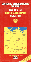
Here are two interlopers from a West German map programme. As travel restrictions began to ease slightly in the late 1980s it made sense for Mairs to include a map of the German Democratic Republic (East Germany) in their Shell map series, using their own cartography at 1:750,000. The left example was dated for sale in 1989-91, and for 1990-2 they introduced sectional maps in the Die Generale Karte series at 1:200,000, which distinguish between normal (Minol) and Intertank filling stations. The reverse was devoted to large maps of Rostock and Stralsund. Of course by the end of the planned sales periods the GDR had been abolished and reunited with the West, rendering the maps obsolete. |

|
|
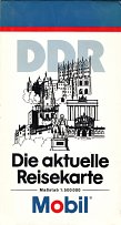
This Mobil map of the DDR is another, more surprising, West German issue. Mobil had no filling stations in West Germany as it was a minority shareholder in Aral, the largest domestic brand. In exchange, most Aral stations sold Mobil oils, as well as their own Aral Super Elastic product. One Mobil promotional atlas is known from the 1980s, but this is the only known West German Mobil sheet map. It dates from 1990 and was a card cover placed onto a stock ADAC/Mairs map of East Germany at the scale of 1:500,000. The rear cover of the map shown here carries a sticker for Franz Drexler, a Mobil lubricant distributor in Pfarrkirchen, Bavaria. |
|
Thanks to Alexander Drews, Bill Phillips and Jon Roma for their help with some of the images on this page.
Text and layout © Ian Byrne, 2001-11
All original copyrights in logos and map extracts and images are acknowledged and images are included on this site for identification purposes only.

