German independents from the 1950s & 60s: H
Haltermann | Hettöl | Hinrich Stöhr | Homberg
HALTERMANN
Brief History
Established in 1893, Haltermann was a small Hamburg-based company that started life as a tar distillery. It moved into the local petrol market in the 1920s and remained active until 1970. They supplied 80 service stations in 1957 but only 45 by 1970, their last year as an independent brand. The company continues to trade in speciality chemicals from its Hamburg base and in 1998 was bought by the UK chemical company Ascot plc. In 2001 Ascot was in turn bought by the large US chemical company, Dow, who continue to use the Haltermann name on speciality hydrocarbon-based chemicals and solvents.
Maps
|
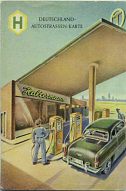
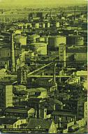
This early or mid-1950s map of Germany was prepared by Falk-Plan at 1:1,500,000. It is folded in the same manner as DEA atlases were, by enclosing the map in a folded card cover that makes a small booklet (approximately 4.5" x 6.5"). The rear cover shows the Haltermann plant in Wilhelmsburg, an industrial suburb of Hamburg. Images courtesy of William Phillips. |
|
|
Prior to this sheet map, they had in 1950 overprinted "HALTERMANN HAMBURG" in gold onto a plain covered road atlas produced by JRO-Verlag. This atlas had 117 sides of maps, mainly of Germany (including the Eastern sector), Switzerland and Western Austria at 1:400,000, but also including a planning map of Europe and an 88 page index and town plans section.
HETTÖL
|
|
|
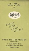
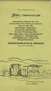
Hettöl is another tiny firm that added its own card covers to a JRO stock map - this example is JRO's 1:300,000 section entitled "Ruhrgebiet-Mittelrhein". As always with JRO the map is undated, but from the autobahn construction seems to be from around 1965. Hettöl was the brand name of Fritz Hettesheimer Mineralöle, based in Lüdenscheid, South of Dortmund. It owned a small tank farm at Oberbrügge and supplied 15 filling stations which are listed on the rear cover of the map. |
HINRICH STÖHR
One feature of the German market over the past 50 years has been the large number of totally unbranded or "white" stations. Although some joined the Bundesverband Freien Tankstellen, allowing them to use the Freie T identity, others remained with no visible brand.
|
|
|
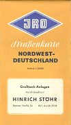
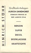
It is likely that this map from Hinrich Stöhr of Sandhorst in the far NW corner of the country was issued by just such a white station. Calling itself a Großtank-Anlagen, it could also have served as wholesaler for other similar stations in the district. The rear cover shows that its products included petrol and diesel and were described as being "first-class fuels". Hinrich Stöhr is no longer in business. The map was a standard JRO sectional issue of NW Germany at 1:500,000. It is undated, but was printed around 1963 and uses a stock cover design also bought by Veedol among others. |
HOMBURG
Brief History
J & A Homburg was another Uniti member based in Wuppertal, but also with branches in Solingen and Siegen. The company is believed to have existed into the 1990s, possibly as a fuel oil distributor. All the Homberg maps shown here are undated (and in three different collections) so it is hard to create a chronology.
Images below left courtesy of Jon Roma; below right courtesy of Bill Phillips
Maps
|
|
|
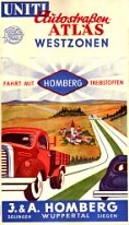
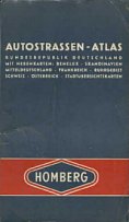
This mid-1950s map of Germany was possibly a standard Uniti design, although no similar Uniti maps are known. Internally it was again based on a Falk-plan issue with a patent fold as used on the Bolco and GD maps above. The map locates 25 Homburg stations (grosßtankstellen), broadly located in a triangle with Aachen, Lippscheid and Neuwied at the corners. On the right is an atlas which as well as West Germany included pages for Benelux, Scandinavia, France, the Ruhr, Austria, Switzerland and leading towns. |
|
|
|
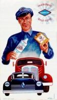
These two examples (right) are probably slightly later than the atlases above. Both are smaller maps just covering the Ruhr and the area to its Southeast, as schematically shown on the cover of the left image. It lists the addresses of 37 Homberg stations, and shows a slightly later design of oil can from Homberg's Aufix Selekta brand. It appears to have been prepared by NSU-Werke of Neckarsalm. |
|
Text and layout © Ian Byrne, 2000-13
All original copyrights in logos and map extracts and images are acknowledged and images are included on this site for identification purposes only.

