 GASOLIN
Brief History
Gasolin was formed after the Second World War to take over the West German retail operations formerly supplied by Leuna, a part of the IG-Farben conglomerate that was broken up by the allies. Around 1954 Gasolin acquired Nitag (Deutsche Treibstoffe AG) to form Deutsche Gasolin-Nitag AG, but the NITAG brand name was soon discontinued. Apparently acquired by Aral soon afterwards, the Gasolin name continued in use until August 1971. NITAG had been part of the Wintershall group, and as a result Wintershall remained a minority partner in Aral until the 1990s, when BASF - its parent - sold its stake to Veba. The Gasolin name was reintroduced on a couple of filling stations in Eastern Germany in the mid-2000s, apparently to protect the trademark.
Maps
Gasolin issued maps for much of its period as an independent company. These were not generally given away and the cover price rose from 25pf in 1957 to 50pf in 1963 and 1DM in 1968. Up until the mid 1960s they were produced by K.G. Lohse of Frankfurt and located Gasolin filling stations; the later maps came from Dr te Neues.
|
|
|
|
|
|


The first map is the Southern section cover of West Germany from a 1952 map. This map, at a scale of 1:1,000,000 could be refolded to have a Northern section cover .
Two years later, Gasolin covered West Germany in 3 sections labelled A to C (running North to South); all three sections shared a common cover design. The maps were produced by Georg Westermann at 1:600,000 and marked Gasolin locations with a T; on the reverse there was a planning map of Germany which also located Gasolin sites selling diesel by the letter D. By 1956 the covers had been redesigned to show attractive ladies in a number of poses: on section A she is in a swimsuit. Berlin was covered by a fourth section, numbered D. The cartography was now credited to KG Lohse. In 1957-8 there were 8 sections - the rear cover advertised the 30th anniversary of Motanol, and the scale had been enlarged to 1:500,000. In the early 1960s only 6 sections were used although the same scale was able to be retained partly by dropping the section linking Western Germany with Berlin. Section 5, from 1961, covers Baden-Wurttemburg & the Black Forest.

|

|

|
In the 1960s, Gasolin moved to photographic covers. Section 3 (from ca1963) shows the view from Bacharach above the Rhine; the arrangement of sheets was the same as for 1961. However by 1968 West Germany was again covered in just two sections by expanding the sheet size and using both sides of the paper for the main map. |
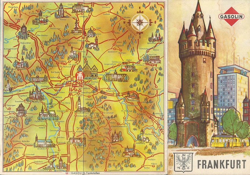
Left Gasolin issued this specially prepared 64 page softback road atlas of Germany and Europe in 1967. | |||

|
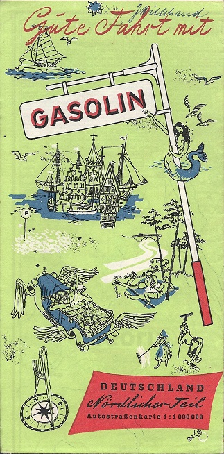
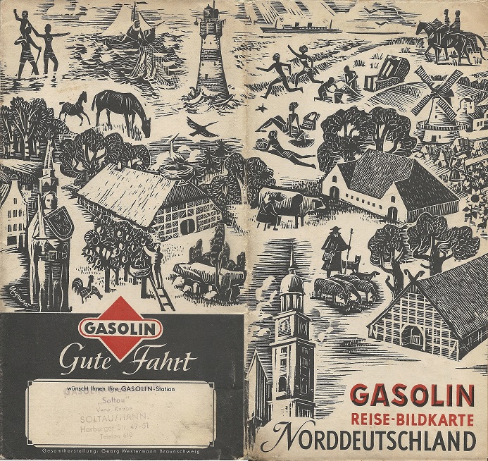
Gasolin's first pictorial maps were described as "Bildkarten" and carried colourful maps by Georg Westermann at 1:400,000. Gasolin stations were marked with a small T symbol, but these maps were not really practical for motoring use. The extract shown here from the 1954 map of Northern Germany covers the area just South of the Danish border on the North Sea coast. The reverse of the map carried conventional street plans of major towns. |

|
 |
 |
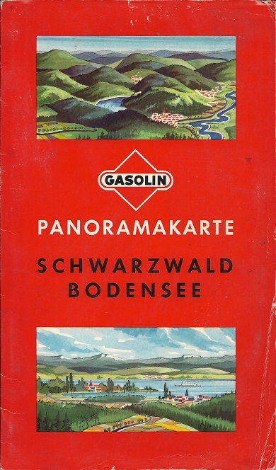
Gasolin later moved to series of 10 Panorama maps, covering about two-thirds of West Germany. The far left example is section 6 - Neckarland, Odenwalt & Spessart from 1956. The cover shows Heidelberg, which is in the area covered. Near left is a 1961 map covering just the Black Forest (Schwarzwald) and area round Lake Constance (Bodensee); this was pasted into card covers, unlike any of the other sheet maps shown on this page . |
 |
|
|
The 1956 Panorama map 1 "Nord- und Ostseebäder - Ostfriesland - Schleswig-Holstein" (thumbnail left) is shown below in a fully zoomable and pannable format. |

City Plans
|
|
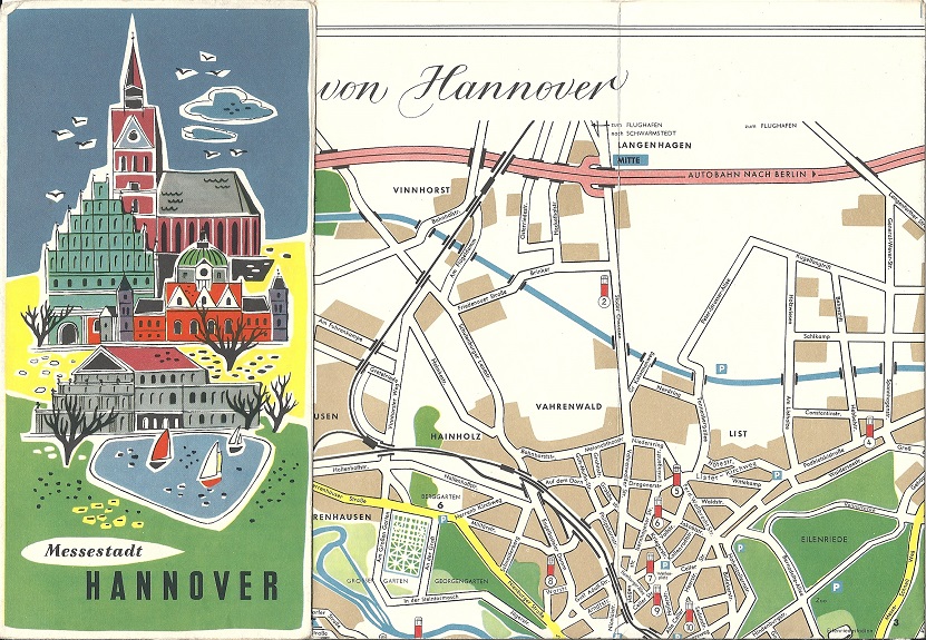
Gasolin also issued a few small city maps with attractive covers, most commonly of its home city of Hanover, as shown in the 1956 example (left ). |
|


|
This Gasolin map of Hannover (pictured rear and front covers) may be a little earlier, as inside, on a very basic map of the city, the company marks its 23 locations with a symbol based on Leuna's pre-war design of zapfstelle. Meisterstudio of Hannover prepared the design locally, which also had ink drawings of local landmarks, including the Gasolin Haus (head office) and a list of hotels and restaurants. |
|

 |
 |
 |
Gasolin also issued a booklet of "Tips" each year; the content varied and did not always include any maps. However the two examples shown above, believed to date from 1961 and 1962 respectively each contained maps drawn by K.G. Lohse of Frankfurt. The left example provided plans for 45 German cities (Aaachen to Würzburg), and the centre one contained 52 single sheet sectional maps. Both faced the maps with a list of the main attractions in the town or map area, interspersed with brightly coloured cartoons and occasional full page adverts for Gasolin products. The maps covered only around 95% of West Germany, with small gaps between them if there were no points of interest. This significantly reduces the usefulness of the booklet as a road atlas. The page shown is map 1, of the coast near Sylt and Heide. The sectional maps, but not the street plans, located Gasolin stations.
Austria
Gasolin (as the successor to Leuna) and Nitag also operated in Austria. In 1955 the Allied powers signed a treaty under which all formerly German oil assets (which included the BV-Aral chain, as well as smaller firms such as Donau-Oel and WIFO) passed to the Russians in an organisation called MARTHA. However when the Russians withdrew, the Austrian state took over these operations which had been consolidated under the Aral brand name. As a result Aral was the largest petrol company in the country until the 1990s, when the Martha elements were transferred to OMV.
 |
 |
 |
Lists like these can be used to trace the history of European service stations. For example, of the eight outlets in Graz listed in this booklet, five had been included in the 1939 Leuna Zapfstellen-atlas of Germany. However according to a 1960 map only four were still selling Aral, which had by then replaced Gasolin in Austria. Surprisingly, 20 years later three stations remained in Aral colours. But by 1997, only one of the ex-Gasolin sites was still selling petrol; it had switched to the independent co-operative brand Genol. This station too has now closed: indeed no more than two or three of the early 1950s Gasolin locations listed in Styria are thought to be still selling petrol.
The 1954 Gasolin map indicates the primary function of most of the locations where Gasolin fuels could be bought. These are analysed on the page devoted to an overview of Austrian maps.
Thanks to Richard Horwitz and Jon Roma for help with some of the images on this page.
Please follow this link to a page of Leuna and Nitag maps.

Text and layout © Ian Byrne, 1999-2020
All original copyrights in logos and map extracts and images are acknowledged and images are included on this site for identification purposes only.