 LEUNA and NITAG
Precursors of Gasolin
Brief History
Leuna was the retail petrol arm of the pre-war industrial conglomerate IG-Farben: petrol was first sold under the Leuna name in 1927, and the company entered into some sort of alliance with Standard Oil in 1929.
Broken up by the allies after the war, Leuna's refinery was in East Germany and used to supply the Minol
monopoly service stations. The Western chain was renamed Gasolin after the War and was apparently acquired by Aral in the 1950s.
Around 1954 Gasolin acquired Nitag (Deutsche Treibstoffe AG) to form Deutsche Gasolin-Nitag AG, but the NITAG brand name was soon discontinued. NITAG had been part of the Wintershall group, and as a result Wintershall remained a minority partner in Aral until relatively recently, when BASF - its parent - sold its stake to Veba.
Maps: Leuna
 |
 |
 |
 |
Leuna was a prolific map issuer in the 1930s with a combination of sheet maps, city maps and "Zapfstellen" atlases.
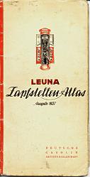
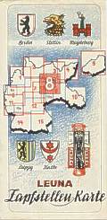
Next is a typical Zapfstellen atlas; each of the 15 pages unfolded into an approximately square map at 1:925,000, drawn by Ravenstein. Towns and villages with Leuna zapfstellen (a type of large roadside gasoline pump) were marked with a small red blob, and the full address of each facility was listed on the reverse. This atlas comes from 1937, but there is a similar one with street plans of metropolitan Berlin dated 1935. By 1939 the number of pages had risen to 18 to include Austria and Bohemia. Up to 1936 Leuna appears also to have given away coverless individual sheet maps, identical to the folded out pages of the atlas except for a slightly broader margin.
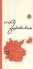
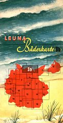
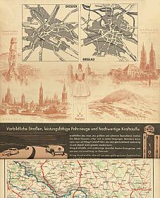
From 1937 Leuna added more colourful covers to these sheet maps. The 1937-8 design is shown first, and then one of the larger scale (1:500,000) maps from the 1939 series which had been extended to 19 sections to cover recently annexed Austria and Czechoslovakia. An extra section numbered 3b covered the Baltic Sea Coast of Germany and was marketed as a Bäderkarte with a distinctive cover.
|
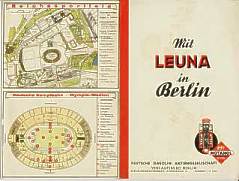
The oldest map shown here is however a city plan of Berlin: this appears to have been used for the 1936 Olympic games as a plan of the stadium is pasted over the previous rear cover (shown opened out right). Leuna issued similar maps for a small number of other major cities, as well as a Zapfstellen atlas of Berlin in the same format as the road atlas shown above. |
|

|

|
Although most Leuna City Plans have relatively plain covers, there are a number of smaller cities that were provided with graphic covers, similar to those on Shell city plans. The town of Görlitz, near the Czech border, is shown here; inside the map locates all Leuna zapfstellen. |
|
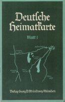
In the 1930s, much was made of the concept of a "homeland", and in particular the area of Munich and Upper Bavaria (Oberbayern) - the Heimat. In 1938 Verlag Georg D.W. Callwey published a pair of Heimatkarten at 1:100,000 covering the areas to the SE and SW of Munich. Each consisted of a 28 page booklet describing, towns, scenic routes and Nazi party sites in the area and included a sketch plan inside the back cover locating Leuna filling stations. The booklets were sponsored jointly by Leuna, Agfa and Ford, as can be seen from the graphic rear cover. Two more sections were planned, but it is not certain if they were ever printed. |
|
|
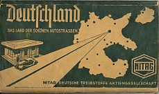
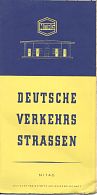
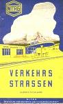
Maps: Nitag
|
|
|
|
A 9 page station listing was included at the front of the atlas, including around 433 sites supplied by the recently acquired Pennsylvania GmbH of Mannheim. Euco stations were not highlighted as they were already in Nitag colours. Germany is described on the cover as being the "land of beautiful motor roads". |
 |
 |
Thanks to Wilhelm Feuer and Jon Roma for help with some of the images on this page.
Please follow this link to return to the Gasolin page.

Text and layout © Ian Byrne, 1999-2006
All original copyrights in logos and map extracts and images are acknowledged and images are included on this site for identification purposes only.