Oil company road maps from Austria |
After the first World War, Austria had to find a new position in Europe, and saw itself as a possible rival to neighbouring Switzerland for attracting wealthy tourists to its ski-slopes and mountain resorts. Despite this, few tourists made their way there by car between the wars, so Austrian road maps from this era are quite uncommon.

|
 |
  |
 |
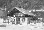
In 1938 Hitler annexed Austria and the German Shell map programme was extended to cover the new territories. Map 91 (above right) covers the city of Linz and dates from ca1939.
Post war issues - 1945-59
After the Second World War, Austria was partitioned by the Allies until 1955, and branded petrol was unavailable in the Russian sector. Consequently, petrol companies were slower to reintroduce map programmes promoting their chains, although examples are known from Mobilgas and Gasolin. Under the 1955 treaty all the former German oil assets (which included the BV-Aral, Gasolin and Nitag chains, as well as smaller firms such as Donau-Oel and WIFO) passed to the Russians in an organisation called MARTHA, in exchange for their relinquishing the monopoly in the East of the country. However when the Russians withdrew, the Austrian state took over these operations which were consolidated under the Aral brand name. As a result Aral was the largest petrol company in the country until the early 1990s, when the Martha elements were transferred to OMV.
 |
1954 Austrian Gasolin outlets by primary function |

This 1954 Gasolin map booklet has 11 double pages of maps by Freytag-Berndt, allowing the cartographer's standard scale of 1:600,000 to be used. A station listing is annexed at the rear, and usefully indicates the primary function of most of the locations where Gasolin fuels could be bought. Of the 182 outlets - which were still restricted to the Western sectors of the country - only 40 were primarily listed as being filling stations (Tankstelle or Großtankstelle). The largest category were 60 Kaufhaus, most probably pumps outside a village general store, and the third category were Guesthouses and hotels - with 26 sales locations. Relatively few were attached to garages or car or truck repair workshops, although many of the 28 undefined sites may have fallen into this category. Seven were at agricultural engineers (Landmaschinenhaus) and one - which was the Graz location later branded Genol - was attached to an agricultural co-op. Among the others were Gasolin pumps at a car park, a chemists, a tyre depot, a driving school and a textile works.

|

|
Most companies eventually produced maps in the 1950s, with the Mobil map dating from before 1955 when Mobilgas was not on sale in the Russian sector. BP started a sequence of maps from Platzer (later absorbed by Freytag-Berndt) with a relatively large format in the early 1950s: the example is from around 1955. |
|
|


Aral was the largest brand after it acquired Gasolin in the late 1950s, as it was also the brand used on the Austrian state's Martha stations. Although it's not clear on the scan, this ca1959 Aral map has a Martha dealer stamp from a garage in Bludenz. At the end of the decade Shell again started to issue city maps, this time for all eight of the provincial capitals, including Eisenstadt which had a population of under 10,000 and so is possibly the smallest town in Europe to have been given the honour of its own petrol company map. All four maps above locate service stations for their respective issuers.
Growth in the 1960s
As in many European countries, during the 1960s the older streetside pumps were replaced by newly built service stations, using common designs for each main company. This expansion, and a desire to create a strong brand image, resulted in a golden era for maps issued by petrol companies.

|

|
")
|
 |

|
As well as a national map sheet, Shell covered Austria with six sectional maps at 1:500,000, again by Freytag-Berndt. In the mid-1960s they were issued back to back (section 2, above, covered Salzburg province and part of Oberösterreich and was backed by the Tirol and Vorarlberg). By 1969 Shell had dispensed with a cover, and released the maps as single A3 sheets marking their service stations, but backed with brief touring information, summarising attractions in the main tourist towns with boxes for castles, spas and motor-boating.
In the late 1960s the state's OROP outlets were merged with the Dutch-owned PAM chain to form Elan and this map is one of the last produced by PAM before the merger. Mobil issued a typically tall map at the end of the decade; Rudolf Hautzinger prepared the maps inside.
Fewer maps in the 1970s/80s
As elsewhere, the first oil price crisis led to the start of widespread closures of marginal service stations. Fewer maps appear to have been produced in Austria in this period, and they were no longer available for just a few groschen, as can be seen from the BP map below which cost 6 schillings.

|

|
 Texaco map of Austria") |
  Elan and BP continued to use large format maps from Freytag-Berndt/ Platzer - these come from 1973 and ca1976/7. Elan and BP continued to use large format maps from Freytag-Berndt/ Platzer - these come from 1973 and ca1976/7.They were joined by Texaco which had acquired DEA, and used a similar style of map. Image courtesy Walt Wimer Jr, |
In contrast Agip had Hallwag prepare its 1978 map, featuring the Brenner motorway on the cover. Aral's maps followed its international style, being prepared in Germany by Busche - this one dates from 1980.
The 1990s return to plenty...
Austria is unusual in that all major companies continued to issue branded maps right into the 1990s, long after programmes had been curtailed in most other lands. The maps shown here are only a small selection of the range of issues that have been issued in the decade. However there appears to have been a distinct curtailing of map programmes at the end of the 90s into the new century.

|

|

|

|
 |
...but few maps again in the 2000s
Despite the significant number of maps on offer at the very start of the decade, few new titles appear have been produced since 2000. Most service stations just sell Freytag-Berndt maps, with a few stocking other cartographers' issues including Marco Polo (Mairs) or Falk.

|
Both maps shown here are atlases produced by Freytag-Berndt in 2007. OMV's is a stock spiral bound atlas of Austria at the scale of 1:150,000, with a small European section at 1:3.5mn. Doppler, which supplies almost 200 stations under the BP, Turmöl, Shell and Arriva brands, sells a bespoke atlas at 1:500,000, marking all its stations with a blue blob. Both have street plans of the provincial capitals, adding all European capitals (including Chisinau and San Marino!) in OMV's case, and the Austrian city of Wels for Doppler. OMV's atlas cost €16,95; Doppler's around half the price. |

|
|
This map is something of a curiosity, as it is a ski-map (not a road map) of Kärnten (Carinthia), produced jointly by Agip and the local tourist board for the 2007-8 season, and given away at Agip service stations. As well as a relief orientation map of the province, it includes ski-maps for 13 resorts, plus information on holiday packages and a competition. The maps were based on designs drawn as far back as 1976 by Kartographie Moser. It is unlikely that any other provinces were covered by similar maps. |

|
Other Austrian Petrol Maps
There are a number of other Austrian maps shown on this site, including relatively recent examples from the independent brands A1 and Genol. Older maps are shown shown from Aquila, Montan Union and OROP, and there are several more maps shown on pages for BP, Agip, Avanti, Esso, Mobil and Shell (in the 1960s and 1990s sections). An AVIA map is also known to exist, but it may have come from the Swiss chain rather than the small Austrian one. TOTAL maps can be found from both Total Austria and Tank Rumwolf, a large distributor based at Klagenfurt in Kärnten.
Other brands that may have issued maps, but for which none are known to me, include API, Jet and Sopi. Smaller independents that may have issued maps include Disk and Stroh, which is now owned by OMV. As always, if you can help me out with any of these gaps, please send me an e-mail!

Text and layout © Ian Byrne, 2000-15
All original copyrights in logos and map extracts and images are acknowledged and images are included on this site for identification purposes only.