SHELL
Recent Maps: 1995 to date
As the retailer with the largest number of filling stations in Europe, Shell has also kept the most extensive map programmes. These do not appear to be centrally co-ordinated, although there are a number of regional groupings. Shell has however started selling underperforming chains, including its subsidiaries in Spain, Portugal, Romania and Ireland, which has reduced the number of available Shell maps.
Scandinavia
 |
 |
 |
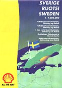
 Luleå from the 1997 booklet map of Sweden. A Polar site is marked near the left and there is one Tankomat among the 5 sites in Luleå itself. |
 |
Shell is the last petrol company to have branded service stations in all four Nordic Countries (although in Sweden and Finland the name is used by St1 under franchise) and it has produced some sort of map for each country during the 1990s. The first two examples above are traditional folding maps from Norway (1996) and Sweden (1997) by Folia/Legindkort at 1:1,000,000. The Norway map lists all Shell stations on the reverse and both locate sites on the map itself: both were for sale, not free issue.
Different cartography was used, at a slightly reduced scale, in a free issue 1997 Summer Guide of Sweden with savings coupons. The maps were spread across 21 sides of the 72 page booklet: facing each map was as short touring guide and the central pages of the booklet were devoted to savings coupons for a variety of tourist attractions and other businesses. Both Shell maps also marked stations selling Shell's regional Bilisten (B) and Polar (P) brands, as well as unmanned Tankomat (T) Shell stations.
Shell does not appear to have issued a sheet map in Finland in recent years, but it has issued a small format booklet with 10 pages of Karttakeskus maps at 1:2,000,000. These again mark Shell locations, with separate lists for Shell's Simpukka restaurants, diesel sites and boat filling stations. Later versions of this booklet expand the maps section to include 12 sides of city plans; to help accommodate them the booklet has been increased to an A5 format.
Denmark has had an extensive map programme including many non-Nordic countries: these are shown on the Shell Denmark page, although by 2007 only a single QuickMap sheet of the country itself remained on sale.
Netherlands
 |
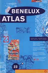
Shell produces a series of four tall maps with cartography by Falkplan (or affiliates) for sale in its Dutch outlets. As well as the obvious Netherlands and Belgium sheets, the series contains Germany and France, the latter at the generous scale of 1:800,000 for a map on a single side (making it physically one of the largest sheets ever sold, measuring 108cm by 127cm), although recently the map sizes have shrunk. These are occasionally backed up by softback Mairs atlases of Benelux or Europe (although neither appeared to be on sale in 2008/9). The Benelux atlas shown here dates from around 1994 and is marked as the first edition; its maps are at the scale of 1:200,000. |
|
|
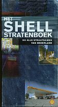
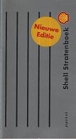
Shell's leading Dutch map product is however a 4cm thick Netherlands street atlas (stratenboek). It used to list every street in the country and ran to 100 pages of road maps, no less than 635 town plans and a 588 page street index. It sold for a bargain NFl 29,95 (approximately $15) and by April 2000 had reached its 44th edition (left), with special millennium covers. The current version (right) has flimsier soft card covers in a plainer grey with silver stripes, and is printed on cheaper paper which has kept the cost down. The index to plans and national map pages (at 1:100,000) are now omitted. It seems that most Dutch motorists have a copy of at least one edition of this atlas! |
|
Germany and Austria
 |
 |
 |
 |
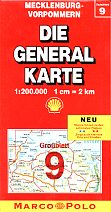
Deutsche Shell continues to work closely with Mairs Geographische of Stuttgart to produce the Die General Karte series of maps, that have been sold for around 50 years at 1:200,000 scale. Since unification Germany has needed 12 sheets (section 9 for Mecklenburg-Vorpommern in the former East Germany is shown above), and the series extends to cover Benelux (in 3 sheets), the Czech and Slovak Republics (2 sheets) and Austria (3 sheets). Mairs (which also uses the Marco Polo trade name) sometimes extends the co-branding with Shell onto more distant maps, including one of Nepal!
As well as the Austrian General Karte maps, Austrian Shell stations sell a softback atlas of the country (with Europe) and a hardback "Grosse Shell Atlas" that includes 109 Austrian town plans. These are augmented by sheet maps of major cities: the Wien (Vienna) Superplan at 1:20,000 is dated 1998 and the town plan of Graz at the same scale is the 2000 edition. This series is known to include Innsbruck; it is likely that Salzburg and Linz were also covered. Shell's Austrian operation uses the old British slogan "Go Well Go Shell" on its own maps.
Despite the range of maps on sale at Austrian Shell stations around 2000, within a few years they had all disappeared to be replaced by generic issues, usually from Freytag-Berndt. Some Shell branded maps do however remain on sale in Germany, where the Shell brand is seen as having value to Mairs, its principal licensee on maps.
...and elsewhere
 |
Shell has generally stopped selling branded maps in most countries. However, some Irish brands do have maps, and the example (left) was "commissioned by Irish Shell" from the Ordnance Survey. At a scale of 1:600,000, it has through route plans for Dublin, Cork, Limerick, Galway and Waterford. Although covering all of Ireland, it only appears to have been sold in Shell stations South of the border. This 1995 map of France (right) clearly shows the new RVI (Retail Visual Identity) introduced that year across Europe. Sites are located by a numbered list; the map was created by CDP & Géo Signal. |
 |
 |
 |
 |
 |
 |
Shell has however continued to issue maps with the main purpose of locating their stations for holders of EuroShell cards. These have been produced intermittently by local Shell companies and so reflect a wide range of styles. (Indeed some countries, such as Britain, have not published maps but relied on producing printed lists of stations instead.) From left to right the maps above are:
Spain - 1999, cartography by Rugoma at 1:2 million, station list on reverse;
Hungary - 1998, cartography by GS-Hister (Top Gráf), large plan of Budapest & station list on reverse;
Italy - 1999, cartography by IGDA, Novara at a large scale on both sides of map;
Switzerland - 1997, cartography by Hallwag at 1:303,000 with no station list at all;
Belgium - 2000, cartography by at 1:400,000 by Tele Atlas & Aquaterra, full station listing, with index on reverse.
The latter three maps all have very high quality cartography, unlike the French CDP map which is basic outline map mainly useful for locating the Shell stations.
I am grateful to Shell GeoStar and Svenska Shell for providing me with a set of late 1990s Shell maps which I have used in preparing the above comments.
 This Shell map of Portugal is undated, but as it marks locations expected to sell Shell branded LPG in '97 or '98, and from the road construction in the area of Lisbon's Expo 98, it almost certainly dates from 1997. All stations are marked with large Shell logos on a good quality map at 1:600,000; the reverse includes larger scale maps of the Algarve and Lisbon. The focus on tourist areas was possibly due to it being a co-production for Shell and Auto Jardim rent-a-car (which had the other cover). Two insurance companies and Zoomarine had smaller adverts inside; the entire map was produced by Guia Turistico do Norte, Lda.
 |
Shell has re-entered most of the formerly communist countries of Eastern Europe, and high quality Shell maps are sold in several of them. Both examples shown here have card covers enclosing what are essentially stock maps. The Shell map of the Czech Republic was prepared by Shocart in 2003 at 1:250,000 and includes a 48 page place name index stapled inside the cover. In Poland it sells an extensive series of city plans, including this 2003-4 map of Lodz at a scale of 1:21,000. Both these maps mark all service stations, irrespective of branding. |
 |

|

|
In recent years, oil company branding has become less valuable on maps. This 2004 map of France is, in fact, a special edition produced by Blay-Foldex for Shell, but the front cover is completely generic on first inspection. In fact, the typography uses a special Shell font, and the rear cover refers to the benefits of having a Carte Fidelité Shell; in very small print it confirms that the map was Fabriqué pour Shell, and was described on the service station price tag as a Shell map. Unlike its 1990s predecessors, no Shell locations are marked on the map. And within a few years Shell was reduced to a rump of around 100 stations in France, mainly on motorways, with most of its other stations switched to AVIA branding. |
Other recent Shell maps are shown on the Shell Denmark page (2002 and 2005) and the country pages for Austria (Vienna, 1997), Romania (1999), Sweden (2001), Slovakia (2003), Poland (2004 atlas) and the Czech Republic (two examples from 2004). A 2006 Shell map of Warsaw is included on the page celebrating 50 years of the EU.
