 1930s/40s German road maps (zapfstellenkarten):
Non-Uniti companies
Brief History
Although most road maps from independent German petrol companies in the 1930s are associated with Uniti, a few appear either not to have been members of the grouping or to have made their own arrangements for the production of road maps. Neither of the names shown here survived the Second World War, so it is difficult to be certain about their exact status.
This page also includes a wartime map from Generatorkraft.
Maps: Milag
|
|
|
|
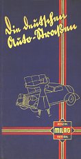
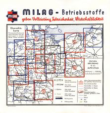
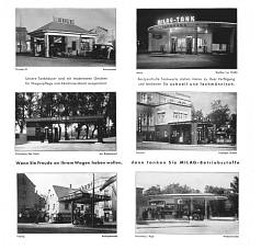
Milag was established by a consortium of French companies under the leadership of Desmarais Frères (Azur) around the time of the first World War to distribute surplus oil from its Galician concessions into Germany and Poland. It had clearly grown to a sizeable company by the time it was sold in 1934, just before this combined map and calendar was issued in 1935. As no later Milag maps are known, it is likely that the name was replaced by one of the major brands, but it is not known which. The service stations illustrated spanned most of Germany, with a bias to the North and East, as seen by examples shown from Berlin, Leipzig and Dresden among others. The atlas lists 13 main "Tankhäuser" but there were probably many hundred more retail locations.
Images and information courtesy Jon Roma
Maps: Wiol
|
|
|
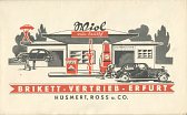
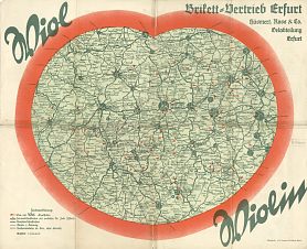
Wiol were based at Erfurt (like Uniti member A. May) and the company name was Hüsmert, Ross u.Co. The map also prominently displays the "Wiolin" grade of petrol and the name "Brikett-Vertrieb-Erfurt" suggesting an involvement with smokeless solid fuel. Wiol list 70 zapfstellen addresses on the reverse of the map, and mark each location with an arrow on the map itself. A full list of lubricants is included, including their proprietary B.V.E.-Spezial motor oil, as well as branded oils from Gargoyle (Mobiloil), Valvoline, Veedol and Viwobil. The map is from the mid-1930s and is centred just West of Erfurt; it was drawn at a scale of 1:500,000 by the local printing firm of J.G. Cramer's Druckerei.
A 1941 map from Generatorkraft
Germany lacked oil supplies in the War, so invested heavily in synthetic fuels production, with much effort focused on creating oil from coal. However as Germany had considerable supplies of wood, some steam lorries were converted to run on pellets and conventional trucks fitted with so-called Generator Gas production units. Solid fuel, which was generally wood, was first converted into a mixture of combustible gases by burning in a generator, usually mounted at the rear of the vehicle. The gases were then extracted from the generator by engine suction through a pipe beneath the vehicle, and then burned in a modified petrol or Diesel engine located at the front of the vehicle. In Germany these vehicles were often called Generatorgaswagen, or when using wood as the fuel source Holzgaswagen. In England, these were known as "producer gas vehicles." By the end of the war there were as many as 500,000 producer gas vehicles in Germany.
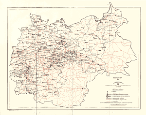
A network of wood pellet filling stations appears to have been set up, although whether one existed before the war is unknown. The map shown below comes from "Generatorkraft" - Aktiengesellschaft für Tankholz und andere Generatorkraftstoff. Little is known about this company, except that it was controlled by the Ministry of Armaments and War Production and appears to have been the principal supplier of wood pellets for vehicles.
|
This is a simple two-colour map, only marking towns or villages with Generatorkraft filling stations. Towns with wholesalers for the fuel are underlined, and distribution boundaries are marked in black. Roads are coloured red. Its main interest is as a map of greater Germany, with much of Poland, Luxembourg and Alsace-Lorraine within the Reich. The map, dated September 1941, was created by Werner Ruks and has a similarly simple map of Berlin on the reverse. There is no cover; when unfolded it measures just 45x36cm. |
|

Text and layout © Ian Byrne, 2000-7
All original copyrights in logos and map extracts and images are acknowledged and images are included on this site for identification purposes only.