Introduction to European Petrol (Gasoline) and Oil Road Maps |
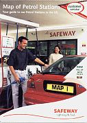
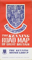
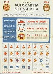
This website is designed to give a brief history of Road Maps issued by, or in association with, petrol and oil companies in Europe. Most maps were sold through petrol stations, although a few were issued directly by Oil Company Touring Services. Unlike in North America, where road maps were widely given away free in gas stations, in Europe most were sold for a nominal charge. This means that fewer maps were printed of each title than was common in the US and - inevitably - fewer have survived. There are also only a handful of European collectors of Petrol Company Road Maps who are preserving them from destruction.
What is a Petrol Map?
|
|
|
|
|
|
|
|
Not all petrol company map issues carry the company branding on the front cover. This French cartoguide from 1975 covering Bourgogne Rhone-Alpes only had a small Shell logo on the reverse, even though it was prepared uniquely for the company. However most cartoguides were sold in sets of 15 maps in a plastic wallet that did carry the Shell pecten. |
|
|
|
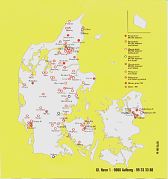
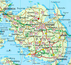
A proper petrol map must show roads and towns, including ones in parts of a country where it has no service stations. The 1999 Metax location map of Denmark (left) fails the test of being a road map, but the extract from a DK brand booklet of the previous year (right) passes, as it is a usable road map. |
|
|
|
|
|
|
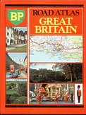
Maps can exist in the form of hardback atlases (BP, 1982 Britain, far left), location booklets (Statoil, 1997 Denmark), and Cruising Guides for boats (Esso, ca1956 Norfolk Broads). It's doubtful that a map of the moon could qualify! (National Benzole, 1981) |
When were maps issued?
|
|
|
Which companies issued maps?
|
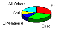
The pie chart above gives a very approximate indication of the relative frequency of branded maps in Europe. |
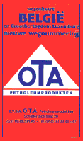
Unlike in the USA, where there over a dozen very common brands, in Europe Shell and Esso dominated the market for maps, even though they each only had about 15% of the petrol stations. Over 200 brands are known to have issued maps, including ones as small as the five-outlet Belgian brand, OTA which published this Belgian map in 1987. All known names are listed with links to pages describing them on the BrandsList page. |
|
For which places can Petrol Maps be found?
|
|
|
|
|
|
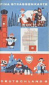
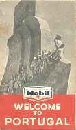
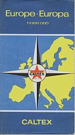
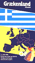
| Petrol maps can be found for areas ranging from a single road to the entire continent as can be seen from left to right above. First is a 1963 Total map of the A1 autoroute running just 44km South of Paris. (Total were later regular issuers of strip maps for the French autoroutes.) Next is a typical mid-1950s city map of Frankfurt, issued by Gasolin and marking its service station locations. Centre is a sectional map of West Germany from Fina, which used 8 sheets to cover the country. To its right is a Mobil map of Portugal from 1960: unlike the others shown it was mainly for the foreign tourist market and printed in English and French: only 20,000 copies were produced. Finally, another tourist map, but covering the whole of Europe in 1958 by Caltex. Much more modern is the early 1990s map (right) of Greece produced for Q8 in Denmark; Q8 has never itself sold petrol in Greece. |
|
|||
More about this website
Thank you for visiting this site. If you want to see as many map images as possible, I suggest going to the brands list and working through it in order! At the foot of each brand, a link will take you top of the next page in the sequence. In total, there are around 2,500 images from 237 brands on these pages.
If you are not sure which brand to look at, this link will take you to a for a brand which has issued maps in the UK.
If you have been here before, then you may like to look at what is listed on the New Page.
Or, you could look at summaries by country or, if you are looking for something in particular, I suggest using the Search Facility:
I hope you enjoy your visit! There is even a quiz page if you wish to test your knowledge of maps, and the page also has a jigsaw, wordsearches and matching games.
Please send me an e-mail if you have any comments or suggestions.
Return to the Home Page
Text and layout © Ian Byrne, 2000-14
All original copyrights in logos and map extracts and images are acknowledged and images are included on this site for identification purposes only.





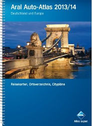
 Apart from some isolated atlases issued by Pratt's Perfection Motor Spirit as long ago as 1904-5, the first branded maps in Europe date from around 1930, as in the Belgian Texaco map shown left. Except in Germany, relatively few maps were issued before the War. The peak period for maps was roughly from 1952 (when the Esso Touring Service started) to 1972 (the first oil crisis). Most companies continued to issue maps through the 1970s and 80s, but the cover price rose sharply so fewer copies were printed and sold. A few companies, mainly in Scandinavia, Benelux, Germany, the Czech Republic and Poland still sell branded maps, as shown by this 2013-4 Aral atlas (which was on sale in service stations in summer 2012), alongside a range of sectional sheet maps, a boxed set of maps and two other Aral branded atlases.