Oil company road maps from the United Kingdom |
1904-1929 - An early start
Prior to the First World War, oil product distribution in the UK was dominated by the Anglo-American Oil Company (part of Standard Oil which used a number of trading names, including Royal Daylight for paraffin and Pratt's for motor spirit) and a German-owned company called the British Petroleum Company ("BP") which had the sole rights to distribute Shell's fuels. Minor players included Russian interests, and an English wholesaler named Carless, Capel and Leonard that alone used the name "Petrol" for its motor spirit. In 1914 the British Government bought a half share of the Anglo-Persian Oil Company to safeguard the navy's need to control fuel oil supplies, and in 1917 Anglo-Persian bought BP. Shell needed to find other outlets for its products, so soon after the war bought into Bowring Petroleum, which controlled the Mex trade name. Petrol was sold in two-gallon cans and there were no petrol filling stations in Britain until 1919 when the Automobile Association opened its first as a service to members near Aldermaston. Over the next decade petrol pumps soon sprung up outside nearly every garage in the country, with most selling a range of competing fuels.
 |
|
 |
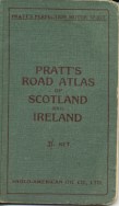
Anglo-American soon saw the advantages of using road atlases to promote its Pratt's Perfection Motor Spirit. The first were issued in 1904 with red covers, encompassing most of England. |
 |
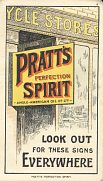
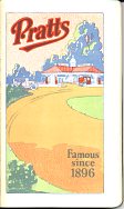
The following year, a pair of green covered atlases spanned England & Wales and Scotland & Ireland. The two images on the left are from 1905 atlases: note that the frontispiece advert shows Pratt's being sold by Cycle Stores, not garages. By 1929 (above, centre) the Pratts atlas showed a very American looking service station.
The only other map known from the early decades was issued by Bowring (Mex) during the Great War and showed roads and points of interest beside the River Thames.
1930s - A few maps
In the 1930s garages still sold multiple brands of petrol (a practice that did not totally die out until the late 1960s). Competition was also limited by pooling of interests between Shellmex, BP and Eagle in 1932, an arrangement that lasted until 1976. These factors inhibited the growth of incentives for customers, such as the free road maps commonly produced in the USA. There was limited price competition between brands, with Dominion and the Russian-controlled ZIP a penny or so a gallon cheaper. It is perhaps surprising then that the first petrol company sheet maps were issued in 1936 by ZIP.
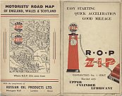 |
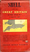
Russian Oil Products (ZIP) issued maps from 1936-8; the middle year's issue included a cover showing the Caspian "where R.O.P. oils come from". Shell had an international agreement to sell maps using the Foldex patent. Only a few of these were made before the Second World War for Britain including this Southern section - sheet 1 map of around 1938. These maps were overpriced compared to competing commercial issues such as Bartholomews. |
 |
1950s - Branded Petrol returns - with maps!
During the Second World War and the period of austerity following, all petrol distribution was pooled into a single operation known, logically enough, as "POOL". Branded motor spirit did not return until February 1953, although all the major players had been advertising extensively in the preceding years in order to rebuild brand loyalty. Two large pre-war names had gone for good: with the Cold War ZIP no longer had access to Russian fuel supplies, so was bought by Regent, and even before the war, the American Cities Service company had sold its chain to Petrofina, although the Fina name did not appear at filling stations until 1953. National Benzole, which had been set up in the 1920s to distribute benzole, a by-product of producing coking coal, also soon succumbed to Shellmex-BP, although the brand survived until 1990 (and has been revived in recent years for use by BP distributors). However Mobilgas, which before the war had restricted itself to selling lubricating oils, entered the UK market.
 |
 |
 |
 |
 |
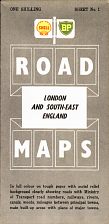
The Shell-BP map is one of a series that was produced in three versions: Shell, BP and Shell-BP, for use dependent on whether the garages were solus or multi-branded. It is known that this design was in use as late as 1959, but it originated in the mid 50s. Shell probably also continued to sell its Foldex sections as a more expensive alternative. National Benzole probably designed its map before being bought out by Shellmex-BP, although they share a common cartographer (George Philip & Sons) but not style of map. From 1960 onwards, Shell and BP maps used the same style of mapping as these National maps.
Mobilgas had relatively few filling stations as a new entrant in the 1950s, so its maps are correspondingly rare. This series had unusual cartography with white roads on a navy blue background; later issues were more conventional.
Finally, Regent issued very few sheet maps in the 1950s: instead it sold a single small scale atlas with a spiral binding. Several designs exist from the 1950s, but the one shown is thought to be the earliest.
1960s - Many new arrivals
During the 1960s, Britain was seen as being a key European market for any oil company wishing to have an international marketing operation and especially those which had found new reserves in North Africa. New arrivals included Total from France, Agip from Italy, Nafta from the Soviet Union and the American companies Amoco, Atlantic, Conoco (which bought Jet, the leading discounter), Gulf, Murco, Signal (which bought VIP, selling it to another US firm - Occidental - in 1968), Sinclair, which bought the small Abco and Gainsborough chains, and Tenneco which bought the Globe and Golden outlets. Not all these names appear to have issued maps; none of Britain are known from Agip, Nafta, Atlantic, VIP, Abco/Gainsborough or Globe/Golden. Like Signal, Agip did not last the decade, selling its small chain to Esso in 1966. Today, only Total, Jet (Conoco) and Murco remain in the UK. Regent's ownership was also rationalised, with Texaco buying out the minority interests and spinning off a small Chevron chain.
At the end of decade self-service began to revolutionise petrol retailing, along with a seemingly insatiable desire for Green Shield (and other) trading stamps, but of these two developments, only self-service was to survive the 1970s.
 |
 |
 |
 |
 |
Shell and BP (and also National) issued sectional maps by George Philip & Sons, initially at 5 miles to the inch but later at the larger scale of 4 miles to the inch. The examples above are from 1963 and 1969.
The Regent Texaco transitional issue will date from 1968 although its cartographer, Geographia, did not date it. Like the Cleveland map next to it, Texaco kept to the smaller scale of 5 miles to the inch. Cleveland was Esso's secondary brand, famous for marketing a petrol-alcohol blend called Discol. Although it had been owned by Esso since the 1930s, it only started issuing maps around 1963 and from 1967 onwards, used a similar map style by Edward Stanford Ltd to that of Esso. Soon after 1972 the brand was eliminated and alcohol blended fuel disappeared from the UK market.
Fina issued maps for much of its 50 year life in the UK, starting and ending with atlases in the 1950s and 1990s. In the 1960s its map offering was a series of 3 sheets covering Great Britain North, South and London prepared by Map Productions Ltd.
1970s - oil crises and price inflation
The steadily rising petrol sales that had followed the end of rationing in 1954 came to an abrupt halt in 1972 with the first oil crisis. This set off a bout of inflation and recession, leading to the issuing of books for petrol rationing (never actually used) and the rescue of Burmah Oil (which was admittedly only a minor player in downstream market) in 1974. But Britain was also able to benefit from its own North Sea oil resource, which started to come onstream in June 1975. The major companies took the opportunity to rationalise their networks and to increase the proportion of company-owned petrol sites. This led to a 15 year flowering of independent brands which, at their peak, controlled 20% of the service stations, although a considerably lower market share. Independents also gained sites after the Shellmex-BP joint venture was dissolved in 1976, with National passing to BP, despite it being the smaller partner.
The smaller American chains also started to withdraw, selling to European companies - so Arco (formerly Atlantic and Abco/Gainsborough) sold out to Total and Occidental's VIP chain went to another French company, Elf.
 |
 |
 |
 |
 |
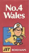
Gulf issued a number of maps in its 35 years in the British market, including a final atlas jointly with its credit card partner, Fina. Like Jet and Total, though, it did not continually have branded maps on sale. In fact, the Jet map shown is from the only series of sheet maps it ever sold, dating from 1971. Total's tall format map comes from 1973. All three were prepared by George Philip & Sons but at the differing scales of 6½ (Gulf), 5 (Jet) and 5½ (Total) miles to the inch.
Esso's cartographer of Stanford had been bought out by Philip's, but to distinguish it from the Shell and BP group maps, was credited to George Philip Printers. Its maps remained at 5 miles to the inch until a final series produced by the AA in 1990. The example above comes from 1977.
Amoco's most extensive map series dated from 1974-5 and utilised mapping by Bartholomew at 4 miles to the inch.
1980s - independent brands do well
Although independent names started the 1980s on a high, even the largest names such as UK and Anglo did not issue maps and generally supplied smaller or badly sited garages. Unleaded fuel began to appear on forecourts - by the end of the decade over 90% of outlets sold it and ten years on leaded super ("four star") was prohibited completely. Supermarkets began to open filling stations, initially quite tentatively, with only Sainsbury's using its own name on fuel. To fight back, the larger oil companies stared to develop their own convenience stores attached to the petrol forecourt; the traditional repair garage with petrol pumps became increasingly rare. More Americans pulled out, with Chevron selling to Texaco and Tenneco's chains went to Jet and Fina. But the Spanish company Repsol moved in the opposite direction, buying Anglo, and Kuwait's Q8 bought several smaller chains including Pace, Sadler and Nafta.
 |
 |
 |
 |
 |
Mobil issued maps more or less continuously from the early 1960s until 1984. Its final design was introduced in the late 1970s and was drawn by Wm. Collins, but based on earlier maps prepared by AW Gatrell.
Also from 1984, the BP National map was the only to carry both brand names, and the last prepared for BP by George Philip. Shell stayed with the format (which had moved to a metric scale of 1:200,000 in the mid 1970s) for its 1987 series, which featured pastel drawings, such as Ironbridge on its Midlands section.
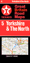
Texaco's final sheet map series dates from 1987 and, although by George Philip & Son again, uses quite different cartography.
1990s - supermarkets and price wars
The fortunes of the smaller brands reversed in the 1990s. Supermarkets became major competitors, with Tesco, Asda and Safeway developing significant chains to rival Sainsbury's. Collectively their market share rose above 25%, forcing the majors into a prolonged price war, led by Esso with its successful Price Watch campaign. Many companies issued electronic loyalty cards in an attempt to keep customers, but with the main supermarkets following suit, it proved to be of limited benefit.
Smaller filling stations closed in ever increasing numbers, and several suppliers were also forced to pull out or close. Amoco and Heron sold out to Elf, and Gulf to Shell, with BP and Mobil pooling their interests across Europe. Texaco was forced to rescue some of its wholesale customers, such as the Beca and Proteus chains. And where did all this leave maps? - nowhere, really, as all companies focused on selling only profitable goods through their service station shops. Own brand maps had been a loss leader and were quietly jettisoned, except by Murco, a relatively small US-owned chain, which steadfastly issued a road atlas each year throughout the decade. However supermarkets occasionally produced simple maps numbering all their growing locations.
 |
 |
 (2/3rd relative scale) |
 |
 |
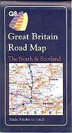
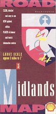
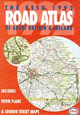
Q8 did not issue any maps until 1990, when it covered the country in three sections by George Philip. Meanwhile Shell had abandoned Philip's for the cartography department of the Automobile Association (AA) for its final sectional maps, produced in the same year. Esso (and BP) used the same cartography for their sheet maps of 1990-2, and Esso repackaged them at a slightly reduced scale for the 1992 softback atlas shown here.
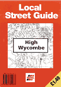
In contrast Total issued a number of non-standard issues, including an extensive series of black and white street plans around 1995 in a card cover. They proved of limited popularity with the public and were not repeated.
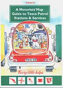
Finally an example of a supermarket sheet map of Britain. This comes from Tesco in 1995, and is the earliest known example, using a map from Cook, Hammond & Kells. Sainsbury's and Safeway gave away similar maps to their customers, although by the end of the decade they were more likely to be in the form of a booklet.
2000s - the story continues
The brands available on the UK market reflected mergers internationally. Total had merged with Fina in 1999 and acquired Elf in 2001, leading to the loss of the Fina and Elf names in 2001-2, and Exxon took over Mobil, leading to BP gaining total control over the former Mobil sites. The ChevronTexaco merger in late 2001 had little effect in Britain, as Texaco remained the brand in use. Among the medium sized players, Save went into bankruptcy, unable to compete in the continuing price wars and Repsol sold its chain to local interests, which soon also became insolvent. Q8 sold its operations in 2004 to the newly reformed Pace Petroleum (reviving one of the 1970s successes) and the Gulf name reappeared, initially mainly on stations formerly branded Thrust or Save, but expanding widely under its Irish owners, Certas Energy.
|
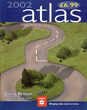
Murco started issuing large format atlases in 1991 after a few years with a single sheet map of Britain. Although not very competitively priced, they obviously proved moderately successful as a new design appeared each year up to 2008. Murco's atlases have been produced by a mix of Wm Collins, Bartholomew and the AA. The 2002 example is shown at 2/3rds the relative scale of the sheet maps on this page. After its sale by its American parent, the Murco name was restricted to smaller dealer-operated stations, with the company sites switched to major brands. Texaco also experimented with a large format atlas in 2000, and back in the 1990s occasional ones came from Fina and Mobil. Branded maps did however peter out. At the time of writing (2018) I know of only one from the past decade - a 2011 Morrisons supermarkets large format atlas. Petrol companies very occasionally still advertised on third party maps, with the two most recent examples being from Total (Isle of Man - 2011) and Rubis (Jersey - 2016) — significantly neither from the UK mainland. |
There are over 200 images from British maps on the web site. Among the companies not shown on this page are maps from the petrol brands Bell, EP and Heron. There are also examples from:
• the lubricating oil brands of Castrol, Duckhams, Millers Pistoneeze and Thelson Oils
• filling stations at Tesco, J. Sainsbury, Morrisons and Safeway superstores
• the garage chains of Caffyns, Kenning, Stewart & Arden and Swanmore Garage and
• adverts on commercial road maps.
All the major brands also show maps from the UK. Of particular interest may be the pages devoted to British maps, including those from Amoco, BP, Burmah, Cleveland, Esso (and especially scenic maps from the 1950s) and Esso Road Atlases, Fina, Mobil, Murco, National, Pratt's, Regent/ZIP, Shell and Total.
Finally there is also a page devoted to the famous Shilling Guides issued by Shell-BP in the 1960s.
All original copyrights in logos and map extracts and images are acknowledged and images are included on this site for identification purposes only.
