NATIONAL
National Benzole
Brief History
The National Benzole Company was formed in England in 1919 to market motor benzole, a by-product of coal carbonisation. For normal motor car engines it was blended with petrol as National Benzole mixture; by the 1950s there were over 250 benzole plants associated with gas works or the steel industry. With the decline of coking coal as a fuel, benzole production fell and in 1957 National Benzole was acquired by Shell-Mex & BP Ltd.
National was retained as an independent brand and merged with Power Petroleum, which had been bought in 1934. The "Benzole" was downplayed in the late 1960s as natural gas replaced town gas and National products sold by over 4,650 garages became simply petrol. When Shell and BP divorced in the 1970s, about 40% of the National stations switched to Shell, but the brand was kept by BP in England only. Between 1981 and 1988 the name was slowly replaced by BP. However in 1992 the Scottish independent NEF reintroduced the brand under licence from BP and in the following decade it was used at over 100 small filling stations across the UK supplied by BP authorised distributors (jobbers). When BP decided to sell its wholesale activities, some of the National stations ended up under Texaco's control, but these supply contracts were later sold to Ireland's DCC and by 2010 the name was only used at service stations on the Scottish Islands, where it has a near monopoly.
Maps
|
|
|
|
|
The first three maps shown above represent designs produced in the 1950s for National before it was bought by Shell-Mex & BP. Britain (no Ireland) was covered at 5 miles to the inch on George Philip & Sons maps, with covers showing two scenes from the area covered; these maps are described as being distributed by R. Sculthorp & Co., Ltd. In 1959 the colour was lightened significantly and a planning map produced of the whole country at 18 inches to the mile; this map (and section 3) had a larger Mercury logo. Around 1960 a new simplified blue, yellow and white logo was introduced; confusingly the maps are still copyrighted 1959 until about the 1964 edition, although a variable number of small stars (*****) on the rear cover helps to place editions in date order.
|
In 1960-1 National decided to introduce a broader range of maps and added 6 touring sections at 2.5 miles to the inch. These highlighted four tours with descriptions of the tour and attractive watercolour drawings on the reverse. The sections were: |
|
|
|
|
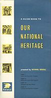
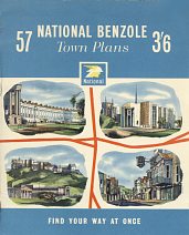
An undated softback atlas of 57 town plans (above left) was also produced, but by Geographia. A brochure, above right, described all the maps and a 44 page guide book (top right) to Our National Heritage completed the year's offerings.
|
|
|
|
|
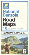
In 1965 National changed the scale on its maps to 4 miles to the inch and increased the number of sections to 9. Section 6 covering Southern Scotland and the Isle of Man is shown above left. George Philip & Sons were kept as the cartographers, but the style was brought into line with Shell and BP maps. The new cover design lasted for just two years, and was replaced by a new series of images. Still with nine sections, the Scottish ones were reorganised so that section 8 covered just the Western Isles and so is relatively hard to find. Northern Scotland was renumbered 7 (above). The cartography was also updated, with trunk routes drawn thicker and in red rather than blue, which was reserved for motorways.
Two sections of town plans North and South (shown centre) were included in 1968-9; unusually there were no equivalent Shell or BP versions of these maps. London was covered on section 9 at 0.75 inches to the miles (suburbs) and 5 inches to the mile (central). The name Benzole was dropped from the covers by 1969, although the 1968 map of Scotland still uses the old name whereas the 1967 London one does not.
For 1971-2 new covers were used carrying a large decimal price (12p). No maps appear to have been printed in the following year immediately after the oil crisis.
|
|
|
|
|
In 1974 George Philip produced a new set of maps at the metric scale of 1:200,000. Britain was now covered in 8 slightly larger sections and except for the removal of the price after 1975, this design stayed current until 1979. (Note that the design is the same as the 1971-2 series, although the width of the folded map was slightly less and the areas covered were different.) London was still numbered 9 and in 1975 (only) a motorway strip booklet numbered 8 was produced to replace the Western Isles map, now incorporated into the two main Scottish sections. The motorway map design is similar to that printed for BP, with curving motorways rather than the straight line representation used for Shell. During the life of this series the logo was slightly modernised, gaining rounded corners from 1976. After a gap in 1980, a new cover design ran in 1981 with a photograph of a location in the area covered behind a signpost indicating the map area. This was the first series to include Ireland in the set, as by then National had assumed responsibility for Munster Simms in Northern Ireland. The final series, still using the same cartography, was a joint BP-National set from 1984 with an extract from the map on the front cover and a small photo on the rear.
Also shown above is a map of the moon produced by Philip's as an extra to the 1981 series. The cover features a Smurf in a space helmet to tie in with the very successful promotion of these small plastic toys.
Atlases
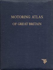
The oldest known National Benzole map is a road atlas, bound in blue leatherette and dating from around 1953 (below left). Printed by W. & A.K. Johnston & G.W. Bacon Ltd, the cover simply carries the title "MOTORING ATLAS OF GREAT BRITAIN" with a small Mercury logo in the bottom right corner, all embossed in gilt. Inside, the company name is not used at all, although the cryptic message "Mr Mercury wishes you - Happy Motoring and more miles per Gallon" printed on the flyleaf confirms the link to National Benzole.
|
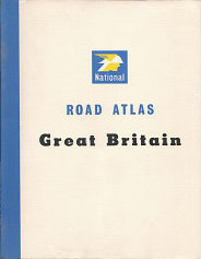
The Johnston & Bacon atlas has 48 pages of colour maps at 8 miles to the inch, plus 32 b/w pages of town plans and main route strip maps. |
|
|
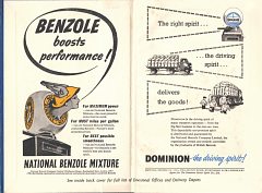
Another Johnston & Bacon atlas, probably from the mid-1950s, had a plain mid blue cover embossed in gold with the legend "3 MILES to 1 INCH ROAD ATLAS Issued by the NATIONAL BENZOLE COMPANY LTD". Unusually this was of standard book format, measuring just 214x145mm. This required 324 map pages, each covering an area of around 15 by 24 miles. The map covered Britain including the Isle of Man but excluding the Scottish Northern & Western Isles. Only the inside front and rear covers carried National advertising - the front promoting National Benzole for maximum power and Dominion as the right spirit to deliver the goods as a non-premium spirit. The rear listed divisional offices and delivery depots. |
|
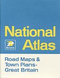
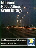
National later published hardback atlases without dust covers, using the same George Philip cartography as the sheet maps, but at a slightly reduced scale of 5 miles to the inch, even after the sheet maps had moved to a metric scale. On the left is a relatively early example, dated 1968-9. The final National-only cover came on this 1982 road atlas (right), which included over 80 large scale maps of city centres. |
|
Our National Heritage
|
|
|
|
In 1953 branded petrol returned to the UK after the war and the country celebrated the Coronation. National Benzole marked both with a 28 page booklet listing key events in the summer of the Coronation Year as "This is the year you can travel so many more miles to the gallon". Printed on glossy paper with numerous black and white photos, it can be seen a precursor to the larger books described below.
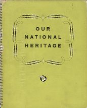
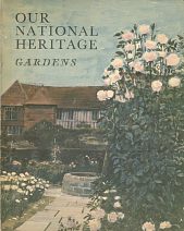
National Benzole then ran a series of books from 1954 to 1962 entitled "Our National Heritage". From 1955-60 they were numbered II to 7; although of identical spiral bound format, the cover colour changed. Each year, the book focused on a particular aspect of heritage, so that in 1954 and 1955 it was Beauty Spots, 1956 Sports and Pastimes to 1960, National Trust properties. Each was well illustrated with black and white photographs, with each location identified by a small inset map. In 1961 a map-sized format was produced (see top row), but - in what appears to have been the final edition - for 1962 National reverted to a larger format with a book on gardens, featuring an introduction by Vita Sackville-West. Volumes 1 to 4 were reissued in an omnibus edition in 1958, with hard (board) covers at a special price of 10/6d, although the text was reset and there were some omissions. For example, several of the original sports and pastimes were deleted, including such dubious activities as Otter Hunting.
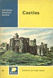
National's use of a well known name continued in 1964-5 when it published a series of eight small paperbacks edited by Sir Hugh Casson. These carried superb illustrations by Paul Sharp and covered Castles, Bridges, Monuments, Follies, Museums and three volumes of Sailing Guides (which are much harder to find).
Finally, a word of warning - not all British maps carrying the name National were issued by this company. Bartholomew's issued a series of National GT maps which were simply commercial issues, unrelated to the petrol brand.
Text and layout © Ian Byrne, 1999-2013
All original copyrights in logos and map extracts and images are acknowledged and images are included on this site for identification purposes only.


