Irish independent petrol brands selling maps
Campus Oil | Mex & Maxol | MS (Munster Simms)
 MAXOL
MAXOL
Mex
In 1916 the McMullan Brothers started trading kerosene in Belfast. Two years later, seeking secure supplies, they obtained the sole agency for Mex petroleum products in Ireland. The Mex name had been introduced by Anglo-Mexican Petroleum before the First World War in Britain: a 1910s Mex map of the River Thames is shown elsewhere on this website. When Shell took full control of the company in 1921, McMullans retained the rights to the name in Ireland.
The Maxol name was introduced in 1964, gradually replacing Mex over the following 20 years. Maxol has become the largest brand in the North in terms of station numbers in recent years, and has expanded in the South by acquiring Ola and surplus Jet stations following the latter's takeover by Statoil. It also acquired the Estuary branded chain in SW Ireland, and that name remains in use of a small number of low volume filling stations.

|

|
The first road maps were issued by Mex in 1950-1, but few survive. In 1963 George Philip & Son produced the map (left) in England showing all Ireland at 8 miles to the inch. It carries the slogan "S-T-R-E-T-C-H your mileage with MEX". By 1967, the cover carried both Mex and Maxol brand names; the switch was made gradually over a period of many years. Despite their small size when folded, these maps are at a larger scale than the most recent Maxol issue. |

|
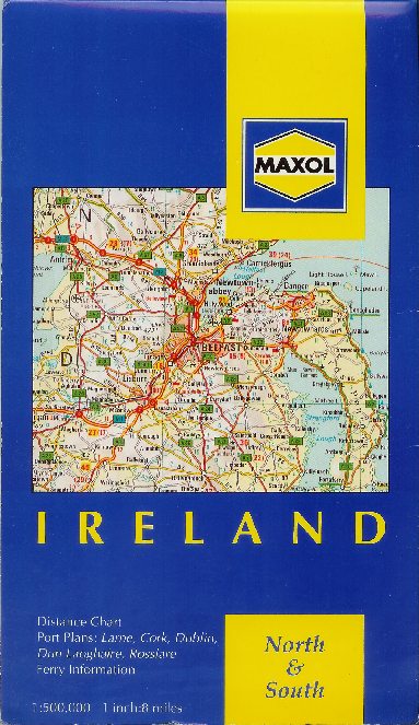
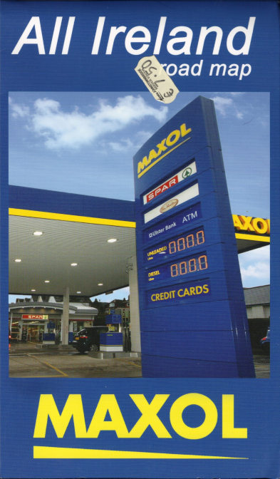
Although no Maxol maps are known from the 1970s or 80s, it is likely that some were produced. Relatively recent Maxol maps are essentially stock maps of Ireland pasted into Maxol branded card covers. The first one (left) was printed in Switzerland around 1992 by Recta Foldex of France; it uses typical Recta cartography at 1:500,000. The next comes from 1997 and was produced in England by the Automobile Association at the scale of 1:350,000; its cover shows a Maxol station and the slogan "Stick with Maxol The Irish Company". |

|

|
The Maxol map shown here dates from 2000 and was again produced in England, but by yet another cartographer - Collins Bartholomew. This map is at 9 miles to the inch (ca1:570,000) and carries the updated brand identity. |

|

|
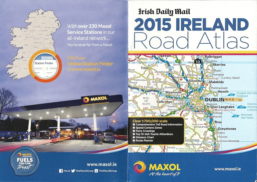
In 2015 Maxol produced a 32 page A5 format road atlas of all Ireland on high gloss paper, in association with the Irish Daily Mail. As well as the AA's regular cartography at 1:700,000, it featured an index, distance chart, details of Irish Toll Roads, four pages of small scale maps showing safety camera locations in the Republic, the Top 10 Irish tourist attractions (again only in the South) and a list of Maxol service stations on both sides of the border. Surprisingly this was given away free to anyone buying a car wash at a Maxol station. |
 MS
MS
Munster Simms & Company was a Belfast based independent operating mainly in Northern Ireland, but also in the Republic. It was possibly best known for its Staminol lubricants, although its premium grade petrol with Veloxine was also popular with Irish motorists. In the 1960s it was bought by National Benzole, the semi-autonomous subsidiary of Shell-Mex & BP, and operated independently for a few more years. With National's absorption into BP, the MS stations were gradually rebranded, too, and by the mid 1980s had finally disappeared.
|
|
The first three maps shown here were produced by Geographia Ltd, probably in the late 1950s, and cover Northern Ireland at approx 1:300,000 with a small scale map of the entire island. City plans are included for Belfast, Londonderry, Dublin and Cork, a feature not normally found on oil company maps of Ireland. The top left map is undated and the top right one comes from 1962. |
|
|


CAMPUS
Campus Oil was established in Wexford in 1978, and rapidly grew to become one of Ireland's leading independent brands, although it remains strongest in the South-East of the country.

|
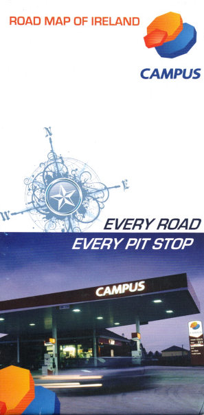
The earliest known map from Campus Oil dates from 2002, and was prepared for them by the (British) Automobile Association at the unusually specific scale of 1:689,655 (which fits neither metric nor Imperial measurements). Using a format similar to the QuickMap system (and also used on an Esso map of Ireland), the country is divided into four horizontal bands. Two bands are included on each side the map, which unfolds into a strip 1350mm wide but just 240mm high, and is printed on water-resistant gloss paper. This format also allows for town plans of Dublin and Cork to be included, as well as a double advertising panel about the company. The whole map fits into a clear plastic envelope and was sold for €6.80. |

|
Campus's next map shows their updated image, and consists of card covers pasted onto a stock Ordnance Survey map of Ireland at the equally unlikely sounding scale of "7.1 miles (approx. 11.5km) to the inch". In fact, this turns out to be the metric scale of 1:450,000 expressed in Imperial units. The map itself is something of an enigma as it shows very few of the new motorways as being open - in fact less than on the 2002 Campus map (and the same as on Maxol's 2000 map). This rather outdated map was on sale in a rural Campus station for €3.99 as late as April 2012.
