Road maps from Ireland |
Before Partition
Ireland was wholly within the United Kingdom until 1923, when the Southern 26 counties split to form the Irish Free State.
|
|
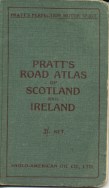
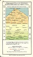
As in the rest of the UK, very few maps associated with oil companies were issued in this early period, with the only known example the Pratt's Perfection Motor Spirit atlas of Scotland and Ireland, first issued in 1905 (left), and possibly also sold in separate volumes for the two countries. There were 40 pages of sectional maps of the country at 6 inches to the mile drawn by George Philip & Son, as well at town plans of Dublin, Belfast, Cork, Waterford, Kingstown [Dun Laoghaire] and Wexford. The atlas also included road profiles and a diagrammatic key showing the height above sea level of selected towns and physical features. |
Irish Free State
The Texaco atlas shown below is the only known petrol company map of Ireland between partition and the creation of the Irish Republic in 1948.
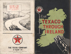 |
In common with some other countries, such as Sweden, Texaco published an undated small format atlas of Ireland with a metal spiral binding, folded into two. The atlas marked all places where Texaco products were available by a red star, and was produced by George Philip & Son of London at 8 miles to the inch, with 10 pages of maps facing gazetteer entries. The inside rear cover advertises Insulated Texaco Motor Oil, understood to have been introduced in 1938, suggesting a date between then and 1947 when Caltex replaced Texaco in Europe. No Texaco stations are shown in Northern Ireland, so it may have been post-war when the UK had a single unbranded "Pool" spirit on sale. The sign board on the rear cover is printed in red with "DUBLIN Brooks Bros. Garage Rere 7 Upr Gardiner St." |
From 1948 to 1984
Despite not having been in the Second World War, the Irish Republic was still largely an agrarian economy with low levels of car ownership in the 1950s compared to much of Europe. This is reflected in a limited supply of maps from petrol companies, with the main firms (Esso and Irish Shell & BP Ltd) participating in the map programmes of the UK. |
|

|

|

|
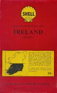
These three maps all come from UK/Irish combined map programmes. The early 1950s Esso map, at 8 miles to the inch, was produced by Edward Stanford Ltd, with a cover drawn by Blofeld and carries the UK sectional number 8. |

|

|
|
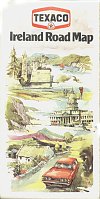
Texaco operated in the UK through Regent; elsewhere in Europe - including Ireland - it had a joint venture with Chevron under the Caltex brand. The first map here dates from 1958 and the next, published in association with the Irish Tourist Board for distribution in the UK, from three years later. Both were created by the Swiss firm of Orell Füssli. After the Chevron-Texaco divide in 1967, Texaco picked up the Irish operations, and used maps with the design shown for several years - this one dates from 1982. Uniquely within Europe, Irish Texaco used the star in hexagon logo, identical to that used in the Americas. |
There were two firms indigenous to Ireland, with operations both North and South of the border. Munster Simms & Co were stronger in Ulster, but issued a variant of their map created by Geographia for use in the Republic (below). It probably dates from the late 1950s and includes a larger scale map of Northern Ireland on its reverse side. MS were bought by BP in the 1960s.
Mex has been the leading independent in Ireland since the 1920s and for many years used both Mex and Maxol as brands names. This George Philip & Son map is dated 1967 at 8 miles to the inch, like the Shell/BP ones above, but folds to give a smaller cover size. |

|

|

|
|

|
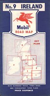
UK firms often included Ireland in their map programme, even if they had no operations in the Republic. This late 1950s Mobil map (far left) was shown as section 9, and is the only series that devoted a map to Ireland; later series combined it with Scotland even though Mobil sold petrol there but not in Ireland. This example was sold by a garage in Hampshire. |
More recent maps
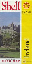
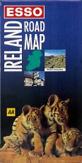
In the early 1990s the UK's Automobile Association (AA) made a concerted effort to sign up the main petrol companies for its new mapping. Shell and Esso both briefly sold maps from the AA, and their Irish affiliates followed suit, but with noticeably different designs. Shell's map, believed to date from 1990, was specially prepared for them, and included short summaries in the margins highlighting the main tourist attractions by county, as well as photographs of landmarks taken from the Shell Guide to Ireland and a full set of traffic signs (as Ireland uses a different style to the rest of Europe). In contrast Esso simply paid to have a bespoke card cover added to a stock AA map of Ireland in 1993; the Shell and Esso cartography at 1:350,000 was identical. |
|
|
|
|

|
|
|
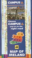
Petrol companies have continued to produce, at least occasional, branded maps of Ireland right up to the present day. Most appear to have been sold only in the Republic; in the North - as in the rest of the UK - branded maps have been withdrawn. The first of the five examples above, from the independent distributor Campus Oil, is the youngest, dated 2002. Printed on a wipe-clean light card, it uses AA cartography in a patent folding system, rather like the Scandinavian QuickMap system. A similar arrangement was also used in the mid-1990s by Esso, but with Bartholomews cartography.
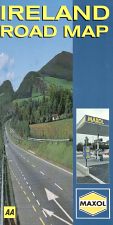
The Maxol map, dated 1997, also used AA cartography (but on a folding map essentially identical to the 1993 Esso version above); more recent Maxol maps have switched to Collins Bartholomew but both use stock maps inside custom card covers.
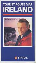
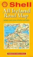
Shell's 1997 map was specially printed for them and uses a map from the Irish Ordnance Survey. Statoil entered the Irish market by buying BP, and their 1996 map is another Bartholomew stock edition pasted into custom card covers. Both Shell and Statoil sold their chains to the local concern Topaz in the mid-2000s, and in 2008 the Topaz name started appearing on service stations.
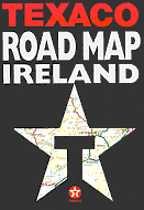
Texaco's 1997 map (above right) was again a special production for them using cartography by the AA; like Maxol, they switched to use Bartholomew mapping for their 2002 maps, although they looked very similar externally.
|
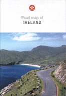
Texaco remained with Collins Bartholomew throughout the 2000s, although it is not known how many map editions were produced. The cover design shown here (left) was used for both 2006 and 2009. Unlike the 1960s, when the Irish road network was static, an influx of EU money enabled major additions to the motorway network over this short period, so that the updated map was necessary. The later version also included changes to ferry and airport information, as well as an expanded list of radio stations. |
|
Among other brands, Jet (which sold out to Statoil and Maxol) issued a Handy Map of Ireland in 1986, but I have never seen a copy. It is thought that maps may have been produced in the colours of Lobitos or Shamrock (both of which were acquired by Burmah), but none are known to collectors. Among more recent brands, Emo (successor to the Burmah chain) and Top (Tedcastles Oil) may have also published branded maps. Topaz - the current market leader - is not known to have issued branded maps, but AppleGreen (Petrogas) is reported to have produced a map. No maps are known from other more recent brands such as Great Gas (which is owned by Emo) or Tesco's Irish operation. Although Chevron sold its Irish Texaco operation to fellow US company Valero in 2011, it is continuing to use the Texaco brand.
Please send me an e-mail if you can help me with these, or with any other brands of petrol shown on Irish road maps.
There is a page dedicated to maps from Irish brands, which includes additional examples from Campus, Mex, Maxol and MS. There are also other examples shown from Esso (including a Guide to Irish Airports), Caltex and Shell (including a dealer advertising issue of Dun Laoghaire) on this website.
Text and layout © Ian Byrne, 2004-14
All original copyrights in logos and map extracts and images are acknowledged and images are included on this site for identification purposes only.
