ESSO
Road Maps since 1975
Anything goes!
In contrast to the strict uniformity of the preceding 25 years, the final quarter century has seen a large variety of Esso maps and, to a lesser extent, atlases. Many of these maps are shown on the pages for Britain and Germany, so this overview page will concentrate on other countries.
1970s/80s street atlases
There are relatively few maps from the late 1970s to be found, as it took some years for oil companies to regain the confidence to produce maps after the embargoes and price hikes earlier in the decade.
 |
 |
 |
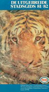
Esso issued a number of versions of a paperback atlas of Dutch town plans in the 1970s; early ones were prepared by Kart. Inst. van Klink of 's-Hertogenbosch with 50 plans. By 1979 (far left) it covered 52 cities from Alkmaar to Zutphen and used a typical European design in full colour at varying scales. Cartography was by Cito-plan, and the volume was issued in association with ANWB. Two years later (centre) it had grown to 75 maps - the Esso tiger is superimposed on an aerial view of part of Amsterdam. |
1981 and 1983 images courtesy of Stan DeOrsey |
|||
1980s maps
 |
 |
 |
 |
 |
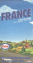
This 1983 map of France was produced by the Institut Geographique Nationale, rather than Esso's traditional partner. Note the very small Exxon logo in the bottom RH corner.
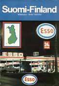
Dating from the same year, a map of Finland carries a night scene. The map was prepared by Maanmittaushallitus at 1:800,000.
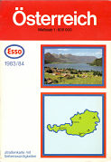
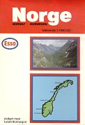
The next two cover designs show a degree of similarity to older ones, although - like the Finnish map - both have card covers pasted onto a stock map and larger in format than those inspired by General Drafting Co. The 1983/4 Austria issue uses a Hallwag map at 1:600,000 that extends as far South as Modena in Northern Italy; it matches German maps of the same period so would likely have been sold in all German-speaking countries. The 1985 map of Norway is based on 1972 cartography by JW Cappelans and its 1:1,000,000 scale is larger than on older maps.
Although it may look somewhat different, the 1988 Netherlands map is very similar inside to all Dutch Esso maps since the early 1960s. All were drawn by Topografische Dienst Delft.
1990s maps
|
|
|
|
|
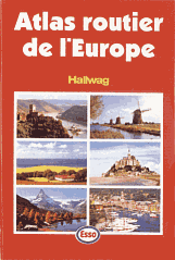
Few Esso maps were produced in the 1990s, and those that were often had to meet more than one purpose. The atlas of Europe by Hallwag was specially prepared for the Esso Collection, a loyalty scheme in France. Motorists had to gain 20 points and additionally pay 27Fr to obtain this hardback atlas of 340 pages. One point was earned by buying 10 litres of petrol; a paper voucher for 2 points is shown next to the atlas.
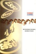
Beneath the voucher is a late 90s Esso Card International Directory. This lists the addresses of several thousand Esso stations across Europe, and marks them on around 100 pages of Geocart maps interspersed with the listings.
Two contrasting maps from Esso Nederland BV date from 1996. On the left is a commercial map of Great Britain, fitted with an Esso card cover for sale in its Dutch service stations. This is later than any true British Esso maps.
Next to it is a small map, sometimes given away free and mainly useful for locating towns with Esso stations which are marked with red or blue blobs on the map, and listed on the reverse. Both were produced for Esso by Geocart, although the Britain map is based on a German Ravenstein map and the small map uses common cartography with the International Directory. Beneath it is the 2000 Belgian equivalent map using a very similar design by Geocart-Claus.
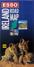
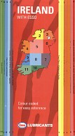
In Ireland Esso used common maps with those from Britain until 1990, but when the British stations stopped selling maps simply kept the same cartography by Britain's Automobile Association (AA) adding a bespoke Irish Esso cover. This cover was used on (at least) editions from 1993 and 1995, before being replaced by a novel folding design shown below. Note how the normal oval logo has been dropped in favour of the white on red ESSO style commonly used on other station identification at the time. |
|
|
|
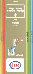
In the mid 1990s the QuickMap system was heavily marketed to those oil companies still selling maps. QuickMaps break a country into small sections, rather than being a continuous map sheet, and have colour coded side indices to help locate the correct section. Esso used it in two countries in 1996. In Norway (left) it sold a Gico commercial map with a simple Esso logo overprinted in the white box (a Fina version can also be found). |
|
Most recent maps
|
|
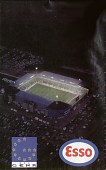
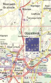
It is unusual for groups of dealers to club together to issue maps, but this 2002 map was paid for by 20 Esso dealers in North-East Belgium. Co-sponsored with the football club KRC Genk, it is a customised version of the Geocart map of Belgium. The maps shows the location of all football league grounds, but only the Esso stations close to Genk. It includes the addresses of the sponsoring Esso stations, and on the reverse has driving directions from Genk to each of the other football grounds. The cover has a night-time view of Genk's stadium. |
|
||
This concludes the chronological review of Esso maps. The next two pages show some examples of 1950s scenic maps, and then there are pages on British, German and Italian maps, Esso cruising guides, touring service maps and early atlases produced by Pratts.
Text & layout © Ian Byrne, 1999-2013
All original copyrights in logos and map extracts and images are acknowledged and images are included on this site for identification purposes only.

