Esso Road Maps from the United Kingdom

This page shows one example from each series of Esso maps produced in the UK. There are 8 numbered sections for all series to 1985 and the cartographer was Edward Stanford Limited up to 1967. From 1968 they are credited to George Philip Printers Ltd, as George Philip & Son had acquired Stanford. (As George Philip & Son also had the contract for Shell & BP maps, it is likely that they deliberately put the Esso work through a sister company.)
Esso maps from 1950 to 1965
 |
 |
 |
 |
 |
| ca1950-ca1955 | ca1956-1961 | 1960-61 (some) | 1962-64 (65 Ireland) | 1965 |
Maps are side folded to 1961 and top folded thereafter. The earliest design was probably drawn in the late 1940s, but may not have been issued until the wartime petrol pooling arrangements had been ended and Esso branded petrol was on sale once more. The 1960-1 covers are a transitional design, using the larger format and side fold but introducing photos used on all maps from 1962. The 1960-65 photographic covers used 2 photos for each section, usually changing after 1964. Section 6 (Southern Scotland) is shown above in each case, with the older picture of the Forth Railway Bridge being replaced by the Scott Memorial in Edinburgh. Note how the 1965 maps have a slightly updated Esso logo with thicker blue rim. Sizes: 1952-61 - 8.5 x 4 in; 1962-87 - 8.2 x 3.8 in.
There is a page on this website showing all 1950s Esso UK Scenic covers and another on how to date these maps as they lack copyright dates.
Esso maps from 1966 to 1980
 |
 |
 |
 |
") |
| 1966-68 | 1969-70 | 1971-73 | 1974-75 | 1977-80 |
The 1966-8 series used the same photographs as the 1965 red top maps (except for London, which was only available for 1966). Initially still priced at sixpence, it doubled to one shilling for 1967 and 8. The section shown above (no.4 = Wales & Midlands) has an attractive picture of a red Triumph TR3 car parked outside the Feathers Hotel in Ludlow, Shropshire (which, incidentally, was a model discontinued in 1957). The next series used blue line drawings of notable landmarks; it was initially used in 1967 and 1968 for Section 1 (London) with a selling price of 1/6d - three times the previous year's edition. Completely new cartography was used from 1969 onwards with a larger map, although still at the same scale of 5 miles to the inch, and more town plans on the reverse. At this stage primary A roads were thickened, with other A roads changing from black to red and motorways from red to blue. All the photographic or art covers varied by section; only those based around a map of the country were essentially common. The final 1970s covers were drawn by the Hungarian-American artist Suzanne Dolesch, who had previously worked with Esso in Canada, and are particularly attractive with each containing many landmarks from the area of the map.
 1983 & 85 |
 1986-90 |
 1990-2 |
 1988 |
 1994 (2/3rds relative size) |
The 1983/5 maps were the final George Philip series, although the Ireland section was reprinted in 1987 as well, but without the section number or key to other sections on the reverse. For the mainland British sections, Geographers' A-Z Co drew the 1986-90 maps, the only known example of their working for an oil company. These were stock maps pasted into Esso card covers, with a separate place name index stapled inside the cover. No section is known from more than three of the five possible years, and some are only known from either 1986 or 1987, suggesting that Esso only ordered reprints when the previous version had sold out. Only one 1990 A-Z edition is known, and new computer cartography from the Automobile Association was introduced for Northern England and Scotland in the same year. Further AA maps appeared in 1991-2 to provide a complete coverage, including Ireland. The A-Z series has 5 sections (no London or Ireland) and the AA one 9 unnumbered. The AA series are also pasted into a card cover. No sheet maps are known dated 1976, 1981-2, 1984 or since 1992.
Inflation had taken the price of an Esso map up from 6d (2½p) in 1965 - unchanged from 1950 - to £2.50 in 1986, a 100-fold increase. (The Scotland A-Z map cost £3.00, as it was printed on both sides of the paper and covered twice the area of the English sections.) The following year a further 10% raise took the price to £2.75 and the only known 1990 A-Z example was priced at £3.25. However this was greater than general inflation and by the late 1980s the number of Esso maps sold was very much lower than in the 1950s and 60s.
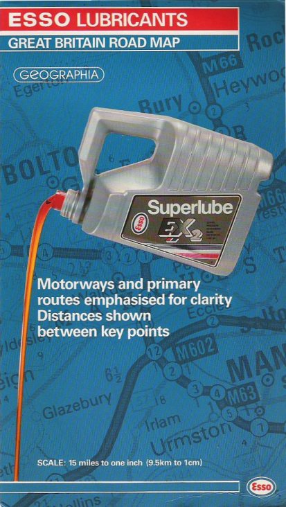
Esso's Lubricare business also produced maps and atlases during this period. In 1988 it mounted a Geographia sheet map into card covers . Covering all of Britain at 1:1 million, the rear cover had space for a dealer stamp, suggesting it was purely seen as a promotional item. In 1994 Lubricare issued a large format softback atlas with 158 pages of Philip's maps (including indexes) for use as an on-pack promotion. More deatil about this is shown o0n the Esso UK Atlaspage. A couple of years later Philip's produced a medium format spiral bound atlas for Esso Lubricants (not shown), described as being a Superplanner Road Atlas Britain & Ireland. After Esso discontinued UK maps, its Irish subsidiary commissioned a map of Ireland from Bartholomews.
1988 map image courtesy Stan DeOrsey
Sizes: A-Z 9.5 x 6 in; AA 10.8 x 5.3 in; atlas 12 x 9 in.
 |
In common with most other UK petrol companies, after 1992 Esso abandoned producing maps for general distribution, but in 2008 it produced a special map for its commercial cardholders. Taking the form of a small (A5) spiral bound atlas in light card covers, the "Esso Card Guide to UK Service Stations" has a 28 page map section followed by a directory of all Esso sites, highlighting those suitable for trucks and distinguishing between Esso company-owned, dealer and Tesco Express sites. (Tesco branded Express locations are not included, but Shell motorway sites are separately listed.) The main maps, by Collins, are at 1:1,000,000 with five double pages of urban areas at a larger scale, using the same cartography as on similar issues by Collins for Total and Texaco. |
Special maps
") Image 2/3rds relative size |
 |
 |
 |
 |
Esso also produced a number of hard cover road atlases [follow link for more examples] of which the first edition (1971) has a cover showing a motorway junction similar in general design to the sheet map of the same year. Esso's 1971-82 road atlases were hardback, without dust covers, and used the new cartography prepared by Philip's - although the flysheet still named Edward Stanford Ltd as the publisher. Ireland and London were included and there was a full index on blue paper for the road maps and pink paper for London streets.
Edward Stanford also drew a series of cruising guides starting with the Norfolk Broads in the early 1950s and culminating in a complete guide to the English Channel, dating from 1965 (above). The cover is of Honfleur Harbour, France. Three different cover designs are known for the Airport map specially prepared by Sampson Low & Co, which included a plane-spotters' guide to airlines using the airport on the reverse.
|
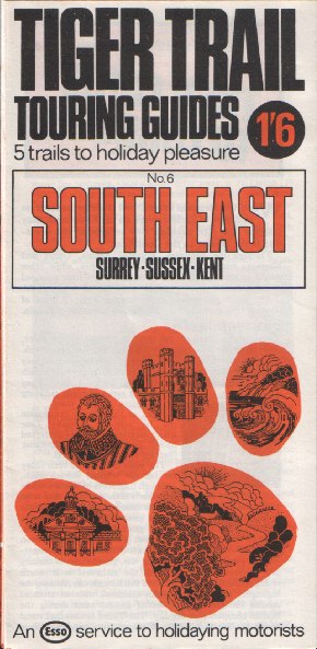
The remaining items are not really maps, but include sketch maps of recommended sightseeing routes. The Tiger Trail of Cornwall dates from the mid 1960s and is one of a number known to exist for the county. Other Tiger Trails were probably also available from Esso dealers in other areas. In 1966 Esso published two 20 page booklets each with 16 full-page tours under the name "Off the Beaten Track". Volume 1 contained tours in Scotland, Northern England, the Midlands & East Anglia; Volume 2 concentrated on the Thames Valley, Wales, Southern & Western England. Each trip was augmented by attractive pen and ink drawings of sights passed. The final Tiger Trails were published in 1968 in a series of seven regional titles, each illustrating 5 scenic trips and listing opening hours of key local attractions. Number 6 covered South East England (Kent, Sussex & Surrey). |
 |
 |
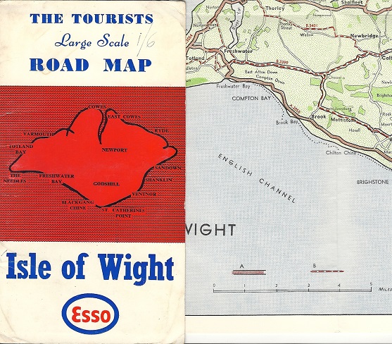
This map is unusual in that it appears to have been produced for sale by Esso dealers on the Isle of Wight, off England's South Coast, sometime between 1967 and 1971. All known copies carry a handwritten price of 1/6. The front & rear covers are identical and measure just 170x93mm; inside there's a full colour map of the island at around 1.6 miles to the inch. Although no cartographer is credited, other "Tourists Road Maps" are known to have been published by the local firm of G.Dean, of Sandown - earlier maps of the island without the Esso logo are known from as far back as 1947. G Dean & Co survive as a corporate entity, but no longer publish maps, concentrating instead of property development and self storage. |
The 1930s Esso Pictorial Plan of the West Country formerly shown and described here has now been moved to a page dedicated to Pratts and Esso Pictorial Plans; this also shows a pictorial map produced by Esso for the 1951 Festival of Britain.

Text and layout © Ian Byrne, 2000-16
All original copyrights in logos and map extracts and images are acknowledged and images are included on this site for identification purposes only.