 George Philip & Son atlases for Shell, BP and National
This page provides a detailed look at the many atlases produced by George Philip & Son Ltd for Shell, BP and National Benzole over the 25 years or so from 1963 to 1989. Around 1960, Shellmex-BP commissioned a new series of sectional maps of the British Isles with clearer cartography and a distinctive house style. Notable features included a plain white background as used on American maps (and Esso's UK maps followed this convention), and trunk roads highlighted by being drawn around twice the width of other classified roads. The maps were initially drawn at a scale of 5 miles to the inch; from 1965 they were redrawn with more detail at 4 miles to the inch and then in 1974 photographically enlarged to a metric scale of 1:200,000.
However many customers still preferred the alternative format of a road atlas and, from 1963, Philip's recycled the maps into hardback or softback atlases carrying one of the three oil company names. Although the sheet maps from the three brands were usually identical, the atlases included some different selection of content as described below. The atlases also retained the non-metric scale of 1:316,800 (5 miles to the inch), with the 4 miles to the inch or metric maps being photographically reduced to the atlas scale.
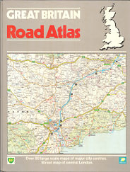
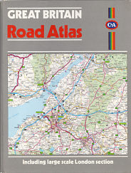
Unlike most other pages on this website, this page will focus on the map not the covers. However the six atlases shown represent the various brands and an atlas that Philip's produced for C&A, the large clothing retailer, in 1987, presumably to allow it to compete with Marks & Spencer which had begun to sell AA-produced road atlases as a seasonal gift item.
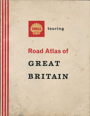 |
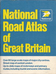 |
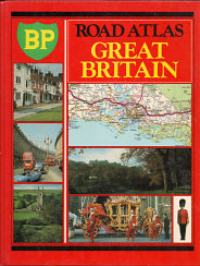 |
From L-R: |
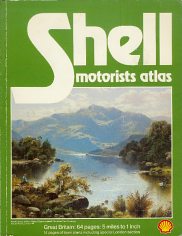 |
 |
 |
1981 softback Shell/Philip's atlas of Britain; |
 Main Maps
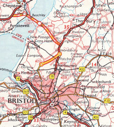
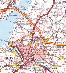
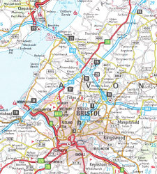
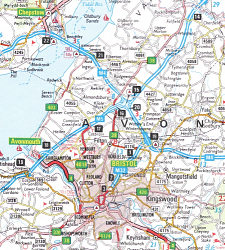
All map extracts are scaled so as to display at actual size if displayed on a screen at 72dpi; the extracts below are thus approximately 88mm high by 71mm across.
 |
 |
 |
| A1 - 1963 | A2 - 1968/9 | A3 - 1982 |
 |
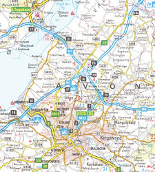 |
A1 & A2 are similar except for the motorway junction style and use 1:316,800 base mapping. |
| A4 - 1989 | A5 - 1985 |
 London maps
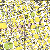
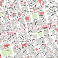
The first row are large scale maps of central London at 5 inches = 1 mile (approx. 1:12,500), although C3 is at 2 inches = 1 mile (1:31,680).
 |
 |
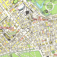 |
| C1 - 1987 (used since 1963) | C2 - 1981 | C3 - 1968/9 |
The Central London maps varied little, with the grey blocks replacing the clearer yellow and white design on some, but not all, 1980s maps. The congested design at a smaller scale (C3) was used for a few years in the 1960s just called "London".
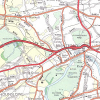
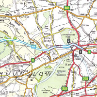
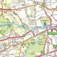
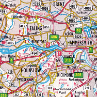
The lower rows of Approaches to London are at ¾ inches = 1 Mile (1:84,480), with the exception of L5 which is at the metric scale of 1:200,000 (and drawn from Philip's sectional mapping).
 |
 |
 |
| L1 - 1968/9 | L2 - 1982 | L3 - 1987 |
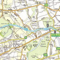 |
The Approaches to London maps were also relatively constant; the later ones showed dual carriageways in red like the smaller scale maps. The 1985 BP-National atlas (L4) also used yellow trunk and primary A roads, but was visually unappealing with primary routes less prominent than minor A roads. |
 |
| L4 - 1985 | L5 - 1981 |
Other city maps
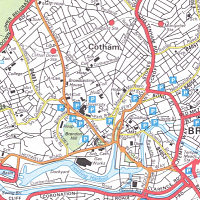
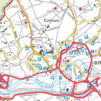
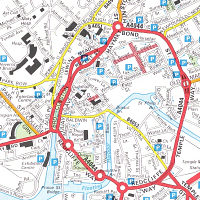
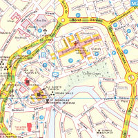
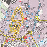
Philip's added in selected town plans into National Benzole atlases and occasional other titles in a variety of styles, often drawn from Philip's Navigator series sheet maps at 1:100,000, which had inset town plans. These had also been used on two National Benzole sheet maps published in 1967 & 1968, although Milton Keynes was added in the later atlases. With the exception of B7 below, all the examples are of Bristol (or "Approaches to Bristol"). The dimensions of each map in the National atlases varied, with between one and five on each page.
 |
 |
 |
| B1 - 1968/9 | B2 - 1982 | B3 - 1982 | 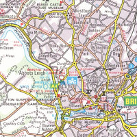 |
 |
 |
| B4 - 1985 | B5 - 1985 | B7 - 1985 | 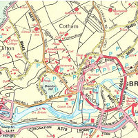 |
On the top row the map of Bristol comes from a 1968-9 National atlas; by 1982 minor roads had been removed (top centre) and an environs map at 1:100,000 added. The middle row are all from the 1985 BP-National atlas (which retained the town plans); larger city centres were now in an unattractive red/yellow style, with smaller cities - including Newcastle - in the basic Navigator city style at about 1:18,500. Towns were arranged NW to SE, starting with Glasgow and ending at Brighton. |
| B6 - 1981 |
Summary of Atlas contents
The table below is not exhaustive, but includes selected atlases for which the content is known. Print runs are taken from Philip's day books, but these are often a little ambiguous as they list order and billing dates, but not the copyright date (if any) used on the final atlas.
Brand |
Year |
Board/ Paperback |
Total map pages |
Main map style |
London map pages |
London map style |
Other map nos. |
Other map styles |
Print Run |
BP |
1978 |
Board |
80 |
A3 |
8 + 8 |
C1 + L2 |
None |
n/a |
16,000 |
BP |
1980 |
Paper |
80 |
A3 |
8 + 8 |
C1 + L2 |
None |
n/a |
6,000 |
BP |
1982 |
Board |
80 |
A3 |
8 + 8 |
C1 + L2 |
None |
n/a |
10,000 |
BP National |
1985 |
Board |
112 |
A5 |
8 + 8 |
C1 + L4 |
80 |
B4, B5 + B7 |
5,000? |
BP Visco |
1989 |
Paper |
68 |
A4 |
2 |
L5 |
None |
n/a |
unknown |
C&A |
1987 |
Board |
80 |
A4 |
8 + 8 |
C1 + L2 |
None |
n/a |
unknown |
Century Oils (National atlas) |
1976 |
Plain Board |
120 |
A3 |
8 + 8 |
C1 + L2 |
85 |
B1 + B3 + B8 |
2,000? |
National |
1963 |
Paper |
88 |
A1 |
8 + 8 + 8 |
C1 + L3 + L2 |
None |
n/a |
8,600 |
National |
1968/9 |
Board |
120 |
A2 |
8 + 8 + 8 |
C1 + L3 + L2 |
83 |
B1 + B3 + B8 |
2,500? |
National |
1976 |
Board |
120 |
A3 |
8 + 8 |
C1 + L2 |
85 |
B1 + B3 + B8 |
2,000? |
National |
1982 |
Board |
120 |
A2 |
8 + 8 |
C1 + L2 |
86 |
B2 + B3 + B8 |
2,100 |
Shell |
c1965 |
Paper |
88 |
A1 |
8 + 8 + 8 |
C1 + L3 + L2 |
None |
n/a |
20,000 |
Shell |
1971 |
Board |
88 |
A3 |
8 + 8 + 8 |
C1 + L3 + L2 |
None |
n/a |
8,000 |
Shell |
1973/4 |
Board |
88 |
A3 |
8 + 8 + 8 |
C1 + L3 + L2 |
None |
n/a |
16,000 |
Shell |
1974 |
Board |
88 |
A3 |
8 + 8 + 8 |
C1 + L3 + L2 |
None |
n/a |
15,000? |
Shell |
1975 |
Board |
88 |
A3 |
8 + 8 + 8 |
C1 + L3 + L2 |
None |
n/a |
20,000? |
Shell |
1981 |
Paper |
79 |
A4 |
2 + 4 |
C2 + L2 |
15 |
B6 |
50,000 |
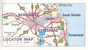 The later National atlases pad out the urban map pages with features such as a one page motorway planning map of the British Isles, lists of tourist offices, ferries, toll bridges, motorway service areas and local radio stations. All National atlases also have brief gazetteer descriptions of the towns and cities mapped. Included in the total number of town/city plans are six "locator maps" at various scales (right - B8 in the above table), but always smaller and less detailed than the main atlas maps. These appear to have been selected mainly for their ability to fill blank space rather than for any usefulness.
The 1989 BP Visco atlas uniquely includes a planning map of Northern Ireland at 8 miles to the inch, in a quite different style again.
Some atlases are believed to have been produced in 3 versions - softback, board (with oil company advertising) and board in plain leatherette covers. The last of these could then be overprinted in gilt by Philips, usually for use as a promotional gift. So for example as well as the regular National cover, the 1976 National atlas can also be found in plain green covers, overprinted for Century Oils Ltd (as listed above), but still carrying the National logo on the flysheet. Century was an independent lubricant specialist, later bought by Germany's Fuchs, with no connection to National or BP, which was by then National's parent company.
The main maps were also used in the hardback Shell Touring atlas sold by Philip's (and reprinted in very large numbers for BCA Book Club edition). This was prefaced by an extensive gazetteer and touring section, illustrated with black & white photos. Philip's are not thought to have used this style of cartography on atlases for any other petrol companies, although they did use it on sheet maps for Gulf, Jet and Total.
![]()
All original copyrights in logos and map extracts and images are acknowledged and images are included on this site for identification purposes only.
