BP
Maps from Great Britain
The origins of the BP brand name lie with a German-controlled company which was formed in 1906 under the name Europäische Petroleum Union. Before the First World War it had gained over a third of the rapidly growing market for petrol in Britain, ironically distributing products on behalf of Shell. Classified as an enemy concern, it was it was taken over by the Government then sold to the Anglo-Persian Oil Company in 1917. Anglo-Persian, which was established by William D'Arcy in 1901 to exploit oil properties in Persia (Iran) and become a major supplier of oil to the navy, had itself sold a 50% stake to the British Government earlier in the War. Lacking its own domestic distribution, Anglo-Persian soon adopted the B.P. brand name, although the official name of the parent company did not become British Petroleum until 1954, after its Iranian interests had been nationalised.
|
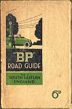
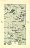
BP's first maps of Britain were a series of booklets, described as the "BP" Road guide. Although they are undated they must come from the 1920s, and were "designed for the use of motorists with full particulars of roads and places of interest, together with a complete set of sectional maps showing the position of "BP" pumps". Published by the British Publishing Co. Ltd of Gloucester, which was established in 1923 (and went out of business in 2009), each section was sold for 6d. Advertisements for local businesses such as tea rooms, garages and hotels faced most of the maps. |
|
|
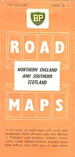
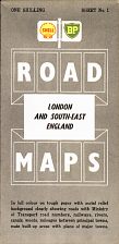
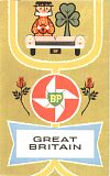
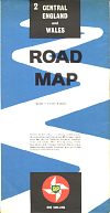
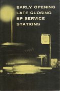
The first BP sheet maps of Britain date from the mid 1950s (probably 1954 in Shell-BP covers, and 1956 in BP covers, with a BP atlas in a plain dark green cover from the same year). All had cartography by George Philip & Son at 5 miles to the inch, except for the small scale touring map by John Bartholomew. Strangely, Philip's also included a Great Britain and Ireland map in their 1961 series with a cover design similar to the sectional maps. The 1950s maps used green and brown shading to indicate topography, but after 1960 a simpler white landmass was used. The booklet opened out to include 12 pages of two-colour maps at 13½ miles to the inch, overprinted with the green shield of BP for service stations with extended hours; address details and services available at these 212 locations were also listed.
|
|
|
|
|
|
|
6 sections used 1954-1959. Colours vary with section. These maps appear in Shell, BP and Shell-BP versions. A separate London map (1b) was introduced ca1957. |
1961 planning map for touring service |
1960-1 Colours vary with section 6 sections |
1960 Early Opening Late Closing Map booklet |
|
|
|
|
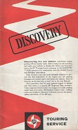
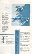
In 1962 BP published a 32 page booklet on semi-gloss paper with the title "Discovery". It contained 19 suggested tours produced in conjunction with the British Travel and Holidays Association. Printed in two colours, each tour showed an outline map with a strip map below, briefly listing places on interest along the route - the first part of Itinerary No. 3 Wales is shown here, covering the 100 miles from Bristol to Swansea. An alternative route avoiding the Aust-Beachley ferry was shown in reverse colours to its left. |
In 1962 George Philip & Son updated the cartography at an enlarged scale of 4 miles to the inch for the sectional maps, with Ireland 6 miles to the inch. The two planning maps used the lesser scale of 16 miles to the inch; two versions of the 1966 map have been found. The one with the regular paper cover has pale blue sea and blue motorway signs, but the same year's map in a vinyl cover has a light green sea and black motorway signs. This map was treated rather poorly by the cartographer - as late as 1967 it still showed the old British road signs which had been superseded by the international style in 1965.
|
|
|
|
|
|
|
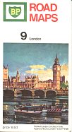
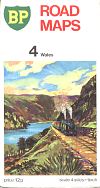
1963-7 10 sections |
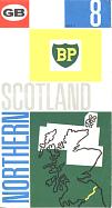
1968-70 and 1971-3. Again 10 sections, but with Scotland rearranged so the Western Isles had a section of their own. The same pictures were used for each series. |
The 1966 planning map had a green vinyl cover; it can also be found with the paper cover design of 1963-7. The 1970 planning map had a card cover pasted over a grey cover, to a continental design not used in Britain. |
||
From 1974, George Philip introduced a metric cartography at 1:200,000 (3.16 miles to the inch) except for Northern Scotland at 1:300,000 and London at the imperial 1:84,480. By using a larger sheet size the number of maps fell to nine.
|
|
|
|
|
|
|
1974-78 - same 3 photos on reverse |
1975 Motorway strip maps |
1981 - Single large photo on reverse |
1984-5 joint BP/National -
small photo on reverse; cover shows part of actual map
|
|
|
No BP maps are known dated 1972, 1979-80, 1982-3 or 1986. It is possible that maps were not made for all sections in each of the years 1974-8, with only those titles needing updating or that had sold out being reprinted.
|
||||
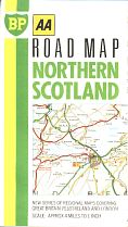
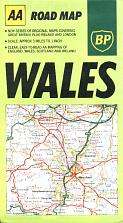
In 1987 it became the first UK petrol company to move to the Automobile Association's new computer cartography, keeping nine sections at the same scales as before. The set was reissued with the same covers the following year, but on semi-gloss paper, which was kept for the 1990 series using the modified shield on the cover. No sheet maps have been produced since 1990. The AA sheet map designs show a section of the actual map inside; they are only numbered on the reverse.
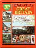
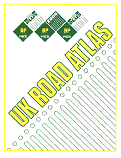
Now that BP no longer produced updated maps each year, atlases became more popular. The white 1989 paperback atlas shown below was for a BP Visco oil promotion and retained the older George Philip designs at 5 miles to the inch, but unlike the red hardback edition (dating from 1982) omitted maps of London as a cost-saving exercise. More detail about the maps inside BP atlases is given on the Philip's atlases page.
|
 |
(shown at 2/3rds scale)
|
(shown at 2/3rds scale)
|
Non-road maps
|
|
|
|
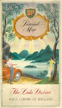
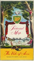
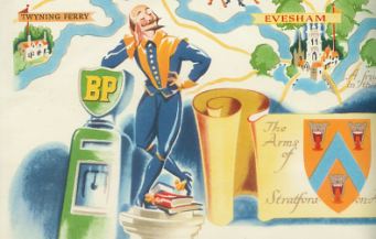
Above are two BP "Pictorial Maps", probably dating from the early or mid-1950s. Each unfolds to reveal a illustrated map, 42x26cm in size, of key sights to see in the area described; they are not useable as a road map. Similar in concept to the pictorial guides on the reverse of many 1950s Esso maps, only two examples are known - The Lake District "Poets' Corner of England" and The Vale of Avon "Shakespeare's Country". No publisher is credited, although they are marked No. 160 and No. 97 respectively. The Lake District's cover was by Goetz, but in each case the style of the interior map differs from the cover. It is not known if other titles were produced, either for BP or other customers.
|
|
In 1963 the BP Motor Boat Service sold a Waterways map prepared by George Philip & Son, with one side showing the Norfolk Broads and the other a small scale (16 miles to the inch) overview of inland waterways, similar to a Shell version. Shell & BP also issued a joint map of airfields called Where to Refuel in 1966. |
|
|
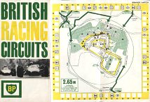
This later map of British Racing Circuits is thought to date from around 1965. Printed on glossy paper, it opens out to 76cm wide by just 17cm tall, and in addition to Brands Hatch (shown here) includes Mallory Park, Snetterton, Crystal Palace, Cadwell Park, Oulton Park, Silverstone and Goodwood. Each circuit map is shown on two folds and lists the lap records for cars and motorcycles. It was published for BP by Newman Neame Ltd and is only printed in green, yellow and black. |
|
|
For the 1966 season, BP issued a series of maps of individual circuits. It is clear that they were printed during the season, as higher numbers note that the first meeting had been cancelled due to poor weather. The circuits covered are Oulton Park (1, 3), Goodwood (2), Silverstone (4, 6), Crystal Palace (5) & Brands Hatch (7 - for the F1 British Grand Prix right, 8). |
|
Text and layout © Ian Byrne, 2000-14
All original copyrights in logos and map extracts and images are acknowledged and images are included on this site for identification purposes only.

