SHELL
Road maps from Britain and Ireland
Brief History
Shell has sold motor spirit (petrol) in Britain for almost 100 years, but in order to compete more effectively with the Anglo-American Oil Company (the Standard Oil subsidiary), it entered into a joint venture with BP in 1931. This lasted until 1975, although the chains had been functionally split a few years earlier. For most of the past century it has vied for market leadership with Esso, but has perhaps maintained a slightly more up-market image.
Early Maps to 1954 | Sectional Maps: 1954-91 | Atlases (new page)
Early Road Maps - before 1954
Shell's US affiliate began to issue road maps in the 1920s, so it is perhaps surprising that none were produced in Britain until the late 1930s, when Shell followed the lead of its French company and began to market Foldex maps.
|
|
|
|
|
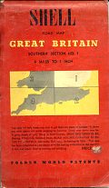
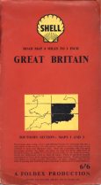
Shell/Foldex maps are never dated. The first one above, with no pecten symbol, is known to date from the late 1930s, as the rear cover lists Shell County guides on sale and these can be matched against publication dates in the British Library. It covered Southern Section 1 (roughly the East Midlands) at 4 miles to the inch.
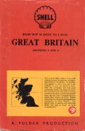
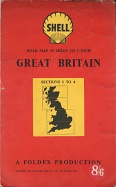
The next three maps are all post-war. The one with no colouring in the pecten is probably late 1940s; it cost 3/6d for two section of Britain at 10 miles to the inch. In common with most Foldex productions, it had a red card cover and used very thin paper with two "miracle folded" sections pasted back to back on one panel, so it unfolded like a double concertina. The next map contained all four sections of Britain at the same scale; it printed them on both sides of a lower grade paper, so enabling the double concertina style to be maintained. However the cost had risen to 8/6d following post-war paper shortages. This map is also available with a slightly different cover design at 7/6d and with no price sticker, to be given away free by Godfrey Davis Car Hire.
Shell/Foldex maps continued to be sold at 4 miles to the inch as in the final example. This contained two sheets (Southern sections 1 & 3) on the fine paper - but the sheet numbering had changed since the pre-war map. Shell/Foldex sold many arrangements of the Southern Britain maps with covers specific to the selection; each of the six sheets could be bought singly at 3/6d, or with its neighbour at 6/6d, or as East or West groups of three (I have never seen these, but guess they would have cost 7/6d) or as a set of four (numbers 1 to 4) or finally as the complete set of 6 - in other words in 17 different combinations.
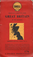
Northern Britain was split into six horizontal bands across the country. These were presumably also sold singly or in various combinations, but the example above is the complete set of maps 7-12 in a single card cover, billed as being Great Britain in two sections at 4 miles to 1 inch. This was a generous scale given the large area covered and was maintained right up to the very North of Scotland, but came at a substantial price - 17/6d to be exact. This compares to the 1/6d it would have taken to buy Esso's three sheets covering much the same area - only slightly more than one-twelfth as much. (It would also have bought more than 4 gallons of fuel, equivalent to map costing around £23 at today's petrol cost). One odd editorial choice was to include the Isle of Lewis on the Northernmost sheet (12), but to omit Harris, Benbecula, North & South Uist completely - so providing only partial coverage of the Western Isles; the Orkneys and Shetlands were also missing, but the Isle of Man was included, uniquely at a smaller scale. Although carrying no copyright date, a copy is known to have been bought by its original user in 1954.
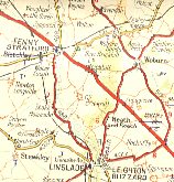
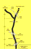
Foldex maps were known for their attention to detail and were advertised as more than a map; a well-informed survey. For example, 18 different symbols were used to denote historical periods of buildings or events and the map discriminated between railway stations with camping coach sidings and those with motor coach connections! This led to congestion in many areas of the map, exacerbated by excessively small type-faces. Amongst many others, unique symbols were used for tithe barns, rocking stones, places with rowing boats for hire, houses with fine art collections and sites associated with Arthurian legends. The example (right) is at actual size of a quiet part of the map. |
|
|
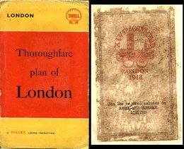
Shell did arrange for at least one map to be in the new corporate image of red and yellow covers, as was commonly used on European, Asian and African maps. This was a "Thoroughfare Plan of London", again with cartography by Foldex. It's not known if these maps were ever sold in the UK, or whether Shell commissioned them for international use in connection with the 1948 Olympic Games, as the only copy known was given away by Shell-mex Uruguay, and so lacks an English cover price. A sheet pasted onto the rear cover shows the logo of the XIVth Olympiad. |
|
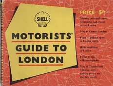
Shell sold this spiral bound Motorists' Guide to London in 1951, designed for use by provincial motorists coming to see the Festival of Britain. Its 40 pages included two on "The Art of driving in London", four of "Difficult spots in London traffic" including perspective views of the eight most complex junctions, a gazetteer section illustrated with black & white photos and eight pages of colour maps from George Philip & Son at the back. The rear cover referred to the continuing monopoly of unbranded (pool) petrol with the rhyme: "THE FESTIVAL SPIRIT: Let's be gay/Goodbye to sorrow/Pool today -/But Shell tomorrow". |
Sectional Maps - 1954-1991
|
|
 |
 |
|
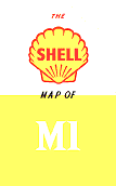
The 1959 Shell map of the M1 was issued for the motorway's opening; it thanked the builders (John Laing & Tarmac) for their help in its production and included a list of motorway driving DOs and DON'Ts. |
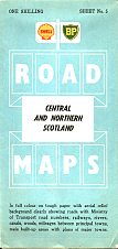
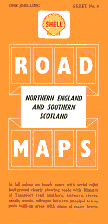
Possibly recognising that its Foldex maps were uncompetitive against cheaper offerings from Esso and Regent, in 1954 Shell switched to George Philip & Son for its cartography. Shell had worked with the company on a number projects before, including ship's bunker maps and possibly a 1939 map of Scotland (although this has never been seen in recent years and only 700 copies are believed to have been printed). Card covers were dropped; instead the UK & Ireland were covered on 6 sheets "on tough paper" with aerial relief background, mainly at 5 miles to the inch. The price was slashed to a shilling, but even so they cost twice Esso's 6d. All maps were produced in three versions for Shell-BP (1954; used at the still common multi-branded stations), Shell and BP (both 1956) - each section had a different coloured cover. A separate Central London map was added in 1957. George Philip also prepared the national map for use by the newly established Shell touring service.
|
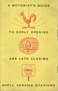
In 1959 Shell published A Motorist's Guide to Early Opening and Late Closing Shell Service Stations. It listed 371 Shell stations (just under 5% of the network) that were open from 7am to 11pm or longer hours. In keeping with the old name of Service Station, facilities listed were Light Repairs, Breakdown Service, 2-stroke (for motorcycles) and Clean Toilets. The booklet also had 12 pages of two colour maps locating these service stations, unfolding to twice the booklet width (approx 25cm), prepared by George Philip & Son at 13½ miles to the inch. |
|
In January 1966 the Shell and BP Aviation Services published a map showing where to refuel. One side comprised a two colour (yellow and black) map of the British Isles that only marked Airfields at which Shell-BP products could be bought, rivers and, oddly, county boundaries. No roads, railways, towns or other physical features (or county names) were included. Shell's usual cartographer of George Philip & Son prepared this map at the scale of 1:2,250,000 (36 statute miles to the inch). The rear was given over to a list of the airfields, showing grades of Shell or BP products available, the name of the supplier and a telephone number. No information was provided that could enable the map to be used for aerial navigation.

|
|

|

|
|
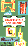
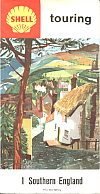
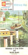
For 1960-1, the cover size was reduced and new clearer cartography was introduced, highlighting trunk roads and omitting relief shading. The left map is the first with the new style, still at 5 miles to the inch; again each section had a different colour cover. Later in 1961 a new cover design was introduced, based on local landmarks. These were used until 1964, although few final year versions are found. In 1965, George Philip changed the cartography again, introducing blue trunk roads and green motorways and increasing the scale to 4 miles to the inch, and now taking 8 sections to cover Britain, plus one each for London and Ireland. The new covers were similar, but replaced a single large image with 3 or 4 smaller ones and moved from side to top folding. The final maps are a touring service country map from 1962, which matches the basic design of the six sectional maps from that period, and a 1963 waterways guide.
|
|
|
|
|
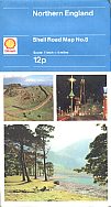
From 1966 onwards, Shell maps may also occasionally be found with red vinyl covers, possibly for sale through booksellers, not service stations. In 1968, George Philip again changed the cartography, introducing more conventional red trunk roads and blue motorways and rearranging the alignment of sections. The covers switched to three photographs, used from 1968-70. These maps were also sold though bookshops with a single design of card cover featuring a Wolseley in a forest for more than three times the price. This cover has later variants with a red top with first the old then newer Shell logos. (Ireland was numbered 9 in card covers and 10 in paper, as there was no card version of London.)
The same three pictures were used with blue above, dropping the words Touring Service, in 1971-2 and - with the new logo - 1973. (Section 6, shown second right, is unique as the only British Shell map to have ever shown a filling station - in the lower photo there are 3 Shell pumps outside the Spittal of Glenshee Hotel.)
|
This map is something of a mystery, as it is the only regular British Shell road map known that was produced for the company by the Scottish cartographer, John Bartholomew & Son. Produced in 1968 at the metric scale of 1:1,000,000, the country was split across both sides of the map, which - compared to the regular Philip's productions - looked quite old fashioned. The cover was extremely basic; there was no price indicated, nor any illustrations. The map is also very rarely seen; it may possibly have been inserted into a Shell guide or used by the Touring Service as no equivalent single sheet Shell map of the country is known from Philip's in the late 1960s. (Barts did later produce two souvenir historical maps for Shell, and collaborated on the Shell map of Oman.) |

|

|

|

|

|
In 1974 George Philip provided a larger metric (1:200,000) cartography, very similar in appearance to the previous version. The British Isles now took only 9 sheets as the paper size was increased. The first cover design was used for 4 years (1974-7), to be replaced by a single design varying only in the colour and area highlighted in 1978-9. No maps were dated 1980, but a new design was used for 1981 with each section having two Victorian artists' images of the region covered. The next set came in 1985 minus Ireland for the first time and used computer generated images. Finally, the last large scale Philip's series was dated 1987 and used attractive pastel paintings on a white background - not a very practical design to keep in a car!
Although the first metric series is commonly found, sales volumes of subsequent series dropped sharply, as the selling price rose from 12p to 95p in just 15 years.
The early 1970s Shell series covers purported to show an aerial view of a section of the map, together with the map itself. There is a page looking at just how accurate were the map and image of Husbands Bosworth shown here.
|
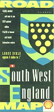
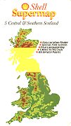
In 1990, the Automobile Association (AA) created a fine series of 9 maps including Ireland and London for Shell, still at 1:200,000. These featured county arms on the covers (SW England shows Cornwall), but were not commercially successful. The AA had worked with Shell in the late 70s/early 80s, producing two sets of "Supermaps" at 5 miles to the inch. The first series had card covers and the second paper; they appear to have been largely sold by the AA, not Shell as they were more expensive than Shell's regular (Philip's) maps. |
|

|
Finally (above right) in 1991 George Philip produced a small format series of 3 maps covering Britain at 8 miles to the inch. Some were given away by the Scottish Tourist Board, but it's not known why this set was initiated. | |||
The next page considers Shell Road Atlases from Great Britain
Text and layout © Ian Byrne, 2000-14
All original copyrights in logos and map extracts and images are acknowledged and images are included on this site for identification purposes only.

