1930s Diesel Road Maps of Great Britain
Although Rudolf Diesel demonstrated a compression engine (using groundnut oil, not mineral oil) as early as 1900, it was only in 1923 in Germany that the first trucks were fitted with a diesel engine; the first British lorries with a diesel engine were manufactured in 1927. Diesel fuelled lorries soon began to replace steam lorries for heavy haulage but, as these maps show, it was some years before diesel fuel was widely available.
|
|
|
|
|


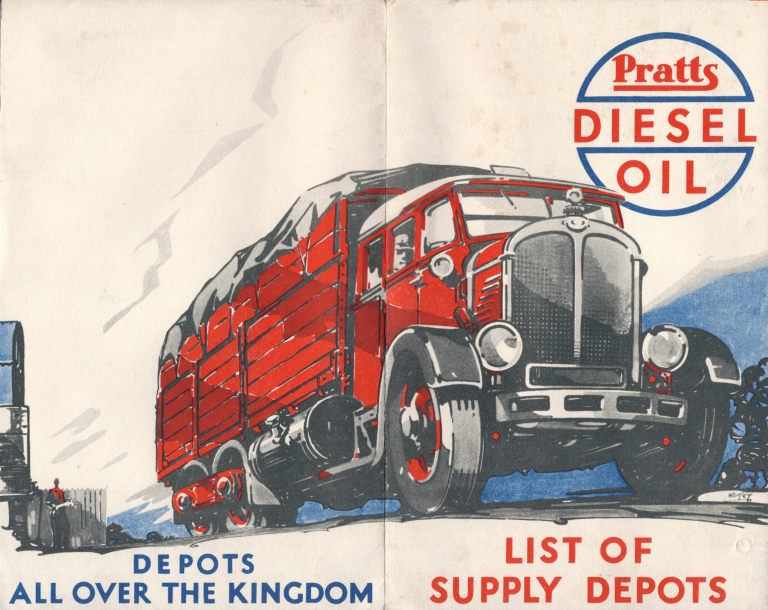
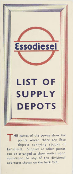
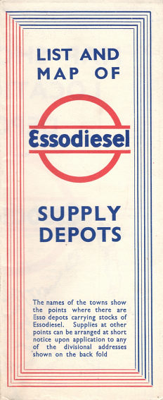
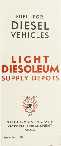
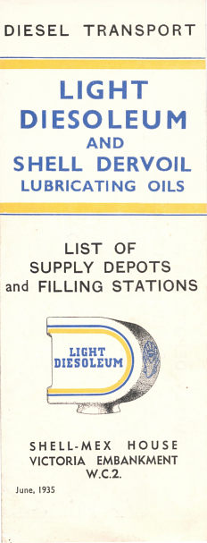
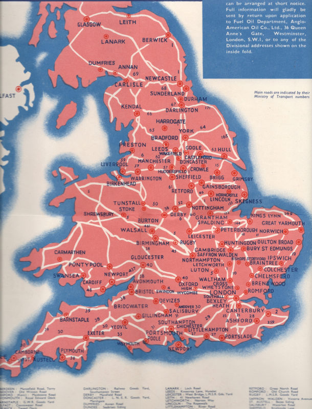
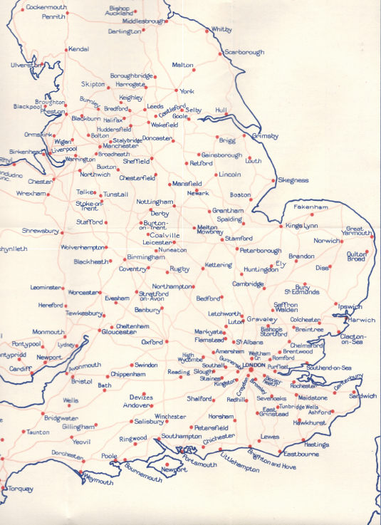
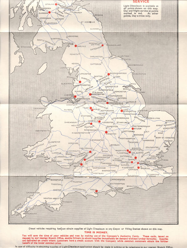
The five maps above come from the two main fuel marketing groups in the 1930s: Anglo-American Oil Co (Pratts then Esso), and the Shellmex and BP joint venture. The Pratts & Esso maps are undated, but assumed to come from roughly 1933, 1935 and 1937. The Shell-BP maps are from September 1933 and June 1935; 4,000 copies were printed of the latter. All the maps opened out to reveal a basic map of Britain on the reverse; they all also included inset maps of Greater London and an address list of all depots including, except for the Pratts version, telephone numbers. Extracts from the actual maps are shown below.
It's worth saying a little more about the term "Light Diesoleum". BP's Scottish subsidiary, Scottish Oils, mined shale from which oil be pressed out and filtered. Although much was then refined at the nearby Pumpherston refinery to produce petrol and other products, the unrefined filtered oil (a bit like virgin olive oil) could also be used directly in diesel engines. The cover of the 1935 map shows a Light Diesoleum pump globe; this is in the shape of a letter D and carried the Shell-BP logo on its edge.
|
|
|
Southeast England from the Pratts map |
Southeast England from the later Esso map |
Southeast England from the 1935 Shell-BP map |


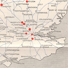
All the maps were basic locator maps, marking only those towns and villages where the company's diesel fuel could be found. None credited a cartographer or gave a scale, or mileages between points on the map; only the Pratts edition showed some road numbers. Although visually the most interesting, the Pratts map is rather congested and at its very small scale could not accommodate many more towns with diesel supply depots before the lettering became impossible - several names have had to use a smaller font size and Bexley Heath appears as prominent as London. It's no surprise then that after Anglo-American Oil Company switched to the Essodiesel brand, it redrew the map, at a larger scale with a much more flexible arrangement of place names including several that curve to fit the space available. In contrast, the Shell-BP map uses a small fixed font that is less clear but consistently laid out. This map differs in that it marks depots with day and night service with a red spot. The coast is much more carefully drawn than on the Pratts map — that appears to have both the Isle of Thanet and Foulness drifting off into the North Sea, rather than being firmly part of the UK mainland.
One interesting feature is in the overlap. Petrol stations commonly sold several brands of fuel in the 1930s, and some of the diesel fuel depots handled both Essodiesel and Shell-BP products. Note how both the Essodiesel and Shell-BP maps mark the small villages of Flamstead and Markyate. These lie on the A5 trunk road NW of London, and despite the double marking it appears that for both villages diesel was obtained at Watling St Filling Station. It's possible that the site operated on both sides of the road in different parishes, although the successor site (which sold Shell until about 2012 and now sells Esso) is only on the North side of the road. However few sites were at public filling stations; most were at specialist fuel depots, often off the main roads. A significant proportion of these were at railway goods yards: GWR, LMS and LNER were all represented as well as the GNR in Northern Ireland, which is only covered by the Essodiesel map.
It is unlikely that other companies produced diesel maps of Britain, as all had significantly smaller market shares. Diesel maps of Germany are also known from the 1930s.
![]()

All original copyrights in logos and map extracts and images are acknowledged and images are included on this site for identification purposes only.