Petrol company road maps from France |
The French petrol industry to 1939
As far back as the 1870s, the French had insisted on building their own refineries to import US crude oil, but they failed to develop their industry further. When Lord Curzon was able to claim that "the Allies [in the First World War] had floated to victory on a wave of oil", it became clear that France needed to build up its oil industry, and in 1924 they created the Compagnie Française des Pétroles (CFP). In 1928, the so-called Red Line Agreement gave the French (through CFP) significant exploration and production rights in the Middle East, and this was followed by the French Government taking a 25% stake in CFP in 1931. At the same time, the French Government started protecting the downstream market by imposing a system of strict import licences that lasted for almost 50 years.
|
|
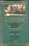
Although no sheet maps are known that can be firmly dated to the 1920s, this 1926 Guide "BP" to Paris and its environs includes 14 double page spreads of colour maps of the city and its suburbs. Like a companion volume to the Lyon-Marseille region published in the following year, it also includes street plans that mark the location of BP pumps. |
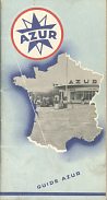
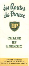
Up to 1939, the downstream industry remained dominated by the international groups of Standard Oil of New Jersey (through L'Economique), Shell and BP-Energic (in the form of the Société générale des Huiles de Pétrole). In 1929, the Standard and Esso names were introduced to replace the Eco at L'Economique outlets. Despite this, there were also a significant number of independent names in the 1920s and 30s, including RPN (Raffineries de Pétroles du Nord, controlled by the Belgian Petrofina), the Compagnie Industrielle des Pétroles (CIP, believed to have been absorbed by Mobil), Azur (Desmarais Frères) and Socaline (Société Alsacienne de Pétrole, also linked to Petrofina, but later to become part of Elf-Antar).
 |
 |
 |
 |
The four maps above all come from the 1930s. From left is a 1934 CIP map of South-West France based on a Michelin design, but printed by a firm in St Ouen. It marked all CIP outlets in the region. Next is an Esso-Standard booklet from the same year. This listed all Standard locations and had some maps interspersed, as well as photos of Standard stations. Standard also issued sheet maps during the 1930s.
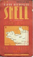
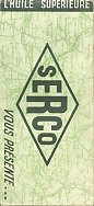
Shell issued a thinner booklet with the title "Le Beau Voyage" (not shown), using a format slightly smaller than A5, and including 24 map pages each facing a description of the region; all Shell locations were listed at the back of the booklet. The first maps linked to Shell had just carried graphic advertisements for the brand on maps issued by Société EPOC using cartography by the Service Géographique de l'Armée. However in the mid 1930s Shell was persuaded to enter into a joint venture with a cartographer called Foldex which had patented a unique mapping system, and it soon produced a series of 10 sectional maps, including the Brittany one (no. 2) shown from 1936. Finally, a late 1930s map from Serco, a company that after the war became part of Antar.
1940s and 1950s: From Occupation to the EEC
After the occupation of the Second World War, it took some time to return France to its pre-war state. Assets that had belonged to US or British companies (including Esso, Mobil, Shell and BP) were returned to their former owners, and oil refineries reconstructed. It became clear that the Compagnie Française de Raffinage, one of the country's largest refiners and a subsidiary of the partially state-owned CFP, would need to develop it own marketing assets. It did this first by franchising its new TOTAL brand to existing large independents such as OZO (Omnium Française des Pétroles), and Azur, but then also by developing its own network of service stations.
France was also conscious that it lacked its own oil reserves, and put considerable effort into exploration for hydrocarbons. Esso Standard was the first firm to discover commercially exploitable quantities in Parentis (1954) and later in the 1950s more oil was found near Lacq.
 |
 |
 |
 |
 |
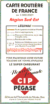
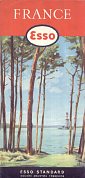
France is a large country, so there are several ways of trying to fit it onto an inexpensive map. Azur and BP opted for booklets of maps in the 1950s; Azur's was a smaller format by Roger Graindorge and BP used tall narrow sections created by Blondel la Rougery. The same cartographer also drew maps for Esso, but using its international style, keeping France to a single sheet, backed by a pictorial guide to the country. The cover used in 1956 proudly shows an Esso drilling rig, almost hidden behind the trees surrounding the lake at Parentis.
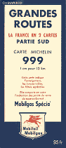
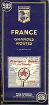
The Mobilgas and Caltex maps were both prepared by Michelin. Mobilgas split France into two sections (keeping Michelin's 998 & 999 sheet numbers), but the relatively small Caltex chain used the same maps (at 1:1,000,000) on reverse sides to keep costs down. Mobilgas also worked with Blondel la Rougery in the mid-1950s to produce a map showing the main exit roads from Paris (as well as all its filling stations in the city). All the examples shown, except the Esso map, marked principal stations for the company concerned.
Total had hardly started issuing maps in the decade, and Shell kept to Foldex designs until 1958, when it introduced the first of its famous cartoguides, shown below.
1960s: Rapid Growth
As elsewhere in Europe, France's economy grew rapidly in the 1960s, and its oil industry expanded fast on a tide of cheap Middle Eastern and North African oil. Tourism was becoming important, especially in the South, and all the main companies expanded their "relais" network along the routes nationales; France was quite slow to build motorways. This meant that by the end of the decade France had more service stations than any other country in the world except the USA, with almost 65,000 in operation.
The French Government continued to be involved in the oil industry, setting a target for 50% of petrol sales to come from French-owned companies.
|
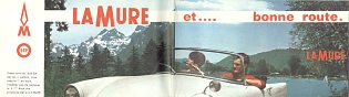
To facilitate this, in 1960 it created l'Union Générale des Pétroles by merging the formerly US-owned Caltex chain with a number in regional independents including La Mure and RAP, and also affiliating the long-standing independent Antar to the group. |
1965 La Mure map: image courtesy of Pascal Pannetier
|
Total was concerned by this and, feeling that it was in danger of losing out to this newcomer, it bought out the marketing companies of OZO in 1960 and Azur soon after, to ensure a downstream demand.
As part of the protection of the refining industry, import licences for refined products were hard to obtain. This led to there being very few genuinely independent petrol distributors. However, one effect hardly noticed at the time was that this lack of competition allowed supermarkets to start selling fuel. They had the resources to fight for import licences, and then to undercut the prices of conventional retailers at the pump. Carrefour opened the first hypermarket in 1963 and other early names included Suma (replaced by ATAC), Auchan, GRO (later bought by Cora) and the Coop's OK brand.
 |
 |
 |
 |
 |
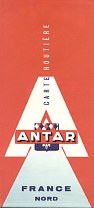
Total's early maps were all drawn by Michelin, located their service stations and had quite stark covers, as in this 1962 example. Antar used Blondel la Rougery cartography, and accompanied this 1962 map by a booklet listing their outlets. Elf also marked filling station locations on their 1967 Recta-Foldex maps, but split France into four quadrants.
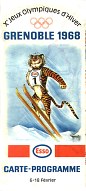
In contrast Shell ran a much more extensive mapping programme, with fourteen regional cartoguides, a planning map and - from time to time - special maps of Paris, camping sites and principal waterways. Single cartoguides were free, although they were also sold as a complete set in a plastic wallet. Although it did not credit the cartographer, the maps were still prepared by Foldex France. At the other extreme, Esso just issued a single map of the country for most of the decade. However it broke this rule in 1968 when it issued a special map of Grenoble for the Winter Olympic Games.
1970s: difficult times
The 1973 oil price shocks affected France as they did the rest of Europe. France had already had the highest petrol prices on the continent, and French motorists were much more interested in finding the cheapest fuel than in protecting the French oil industry. A small independent importer in SW France, Picoty - which used the AVIA co-operative brand - decided to ignore the limits on its E10 import licences. It bought in as much low price fuel as its customers wanted - which was enough to grow its business several times over. The courts attempted to intervene, but the floodgates were open; what Picoty started the supermarkets took up in a big way. Leclerc became the next cause célèbre for cheap petrol; its service stations were allied to, but not controlled by, the supermarkets of the same name.
It's not surprising then that the French Government tried to bring more order to the market, merging Elf and Antar in 1975. But the damage was done, and smaller filling stations started to close in large numbers.
 |
 |
 |
 |
 |
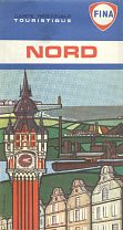
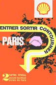
Although much smaller than Shell, Fina also offered an extensive map programme in the late 1960s and 70s, as exemplified by this sectional map "Nord" (one of 12 titles) dating from 1972. Prepared by Recta, it located all Fina stations by numbers on the map linked to addresses. Shell's Paris and environs map from the same year complemented its cartoguides.
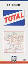
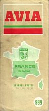
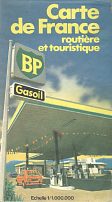
Avia used Michelin to prepare its maps; this one shown above comes from 1977 but - apart from the modernised logo - essentially the same design had been used for several years. Other companies were beginning to look at issuing more carefully targetted maps. TOTAL issued an updated version of its autoroute strip maps each year with different coloured covers; this orange booklet dates from 1977 again, and clearly marks all TOTAL autoroute locations. BP's Recta-Foldex map of the following year covers all of France at a generous 1:1,000,000, allowing the locations of all BP stations selling diesel to be marked. Note how it is described as Gasoil, a word almost eliminated in the following decade as sounding too American, to be replaced by the French alternative Gazole.
1980s: more difficult times
The trends of the 1970s continued into the new decade, especially with the establishment of SIPLEC to import fuel on behalf of Leclerc supermarkets. Many of the bigger companies took the opportunity to trim their chains, sometimes withdrawing from parts of the country completely. But at the end of the decade there was a surprise move when Casino announced that it was selling its hypermarket filling stations to Agip and Shell - a move not copied by its competitors. And French motorists were deserting petrol in droves to buy diesel cars, taking advantage of the fact that it was much cheaper at the pump. Indeed the search for cheaper fuel led some to switch to gas as well...
 |
 |
 |
 |
 |
With the tougher domestic market, the main companies chose to cut expenditure on map programmes, although Shell's cartoguides were still on sale as a complete set as late as 1980. The 1983 Esso and 1988 BP maps are among the latest known for France from these two companies. Note how the Esso map sports a tiny Exxon symbol. Both were at 1:1,000,000; Esso now used IGN cartography but BP stayed loyal to Recta-Foldex, although it no longer marked its much reduced chain of service stations.
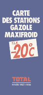
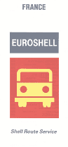
As maps were harder to justify, a higher proportion were for specialist audiences. Both the Total and Euroshell maps were for truck drivers, locating their diesel (gazole) sites, with little attempt to give them an attractive cover design: the map was now utilitarian. Shell used the same scale and cartographer as BP, but Total's effort was much more basic at the small scale of 1:2.3million.
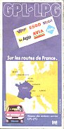
Another new development was the arrival of auto-LPG (GPL). VIFF were the leading name in this new niche market and at the time owned by Picoty, demonstrating its continuing ability to innovate. The map shown is as early as 1983 when there were still only a few hundred LPG stations spread across France.
1990s: consolidation starts
The 1990s were perhaps a slight respite; although the market share of supermarket filling stations was nudging 50%, the traditional oil companies had cut their networks down to a more sustainable level. Elf finally set about phasing out the Antar name it had controlled for many years, and brought regional firms such as Glorex and Miroline into its fold, under a special Elf-Contact identity for smaller stations. Elf also started experimenting with biofuels made from RME as the proportion of diesel cars continued to climb.
Consolidation started in earnest after 1995, when BP merged its downstream operations across Europe with those of Mobil; a short-lived arrangement which led to BP gaining full control of the former Mobil sites when Exxon (Esso) bought Mobil in 1998. This bolstered BP's French operation, although it was still highly concentrated in a few main urban areas.
Domestic consolidation was mainly in the supermarket sector, with regional names such as PG and Cedico selling out to stronger competitors, Casino gaining control of Rallye, Auchan acquiring Mammouth/ATAC and Carrefour buying the parent of the Continent and Champion chains. The previously low-cost hypermarket stations began to add more facilities, looking more like their major oil company competitors. The 1990s also saw a rise in the number of "white pumps" - marginal filling stations without a brand selling fuel at prices midway between major brands and supermarkets.
 |
 |
 |
 |
 |
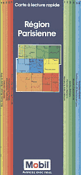
At the very start of the 1990s, Mobil unexpectedly issued a series of regional maps that did not quite fully cover the country. All had similar cover designs and were prepared by Recta-Foldex using a QuickMap fold; the Paris regional map is shown.
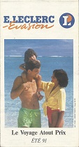
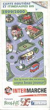
As low cost operators, the supermarket chains have only sporadically issued maps. The Leclerc map comes from 1991 and the Intermarché one from 1999 - the latter is based on the popular Bison Futé maps issued each year showing ways of avoiding the worst holiday traffic jams.
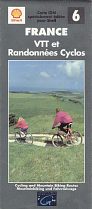
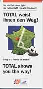
Major companies were more likely to issue maps if they could be used as a marketing tool. Shell commissioned IGN to prepare a series of six national maps marking special sporting features in 1995/6; the map shown is a cycling and rambling map - possibly the only one known from an oil company! Total's map is a special issue (in English and German, although an English/French version was also printed) for visitors to France for the 1998 World Cup football matches. It shows inset maps for each of the football stadiums - and conveniently located Total stations.
2000s - The story continues...
The new century started with two major mergers. First Total merged with Belgium's Petrofina, but Total gained the upper hand, reversing the roles of 75 years earlier when Petrofina had a stake in the nascent CFP. Then two years later, in 2002, TotalFina merged with (in reality took over) Elf, finishing the domestic consolidation that had started back in 1960, when Total had failed to be included in l'Union Générale des Pétroles. (Elf was vulnerable in part due to a series of political scandals and bribery allegations that had rocked the company.) The Fina name was discontinued in France, but because the new TotalFinaElf controlled a quarter of the market, the Elf brand will stay in use for the foreseeable future. Nonetheless it was required to sell some sites, mainly on autoroutes, to smaller players including Carrefour (the hypermarket chain), Avia and Agip.
|
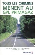
Few road maps of France have been issued by petrol or similar companies in France in the last few years. One rare exception has been from Primagaz, the largest LPG chain and successor to VIFF. It has given away glossy booklet maps to the rapidly growing number of motorists using this fuel to help them find their nearest outlets. GT Gabelli drew the maps, which identify locations by number and also the brand of petrol sold (if any) from the same location. |
There are many other French maps shown on this site. The largest selection are on the pages devoted to Azur, Aero, Ozo and Stellis (four predecessor brands of TOTAL), Elf and Antar, Total, Mobil France and Shell Cartoguides.
Other brands with French maps included on this site, but not shown on this page, include the lubricant brands of Celor, Igol, Motul, Valvoline and Yacco, the supermarket chains Euromarché and Système U. The large German company Aral (now owned by BP) also marked its few French stations on its road maps of France that were generally sold as part of a set in Germany.

Thanks to Richard Horwitz for the image of the Esso Grenoble map and Wilhelm Feuer for the Avia.
All original copyrights in logos and map extracts and images are acknowledged and images are included on this site for identification purposes only.