ESSO
Road Maps from 1962 to 1975
The uniform cover map decade
In 1962 the two European Offices of the Esso Touring were closed. This did not lead to a loss of uniformity in map design, but rather the contrary. With the exception of Britain (which replaced its watercolour images with local photographs), Esso abandoned scenic covers in favour of a uniform turquoise cover with an outline map of the country or region covered.
|
|
|
For the first time Yugoslavia was welcoming tourists, so it was added onto an expanded Austria map. The Innsbruck map is a special for the 1964 Winter Olympics and is allowed one small drawing on the cover as well! Only the Main Europe map lacked an outline of the continent, opting for a rather plain design with a description in eight languages. This map was designed by Germany's Karl Thiemig to a scale of 1:3,500,000, but printed in Great Britain. |
|
In 1965, the background changed from turquoise to white, although some countries used turquoise for a final year.
|
|
|
Although they conformed to the standard design, both the 1965 Greece and 1967 Spain & Portugal maps were prepared in London by George Philip, who had replaced Thiemig as Esso's preferred cartographer. Some countries, where Esso had a greater presence, also sold sectional maps, such as the 1972 Sudjylland & Fyn map from Denmark, using Geodætisk Institut's designs and printed by Møller & Landschultz. |
|
Not quite all Esso maps conformed to the common design principles, although even exceptional maps were the same dimensions and used a standardised cartographic style, based on designs by the General Drafting Company.
|
|
|
British and Irish maps were the only ones with consistently non-standard cover designs. Three series of photographic maps (using two sets of images) took Esso from 1962 to 1968; from 1969-71 they moved to blue sketches of landmark buildings, such as Abinger Hammer in Surrey. In Germany, a mid 1960s series of regional maps, backed by Panorama maps, were allowed a touch of colour to creep onto the cover - almost suggesting that the Ruhr might be a holiday destination! |
|
|
Unlike Shell with its cartoguides, Esso did not regularly produce regional maps of France. However at the start of the era of plain cover maps, it distributed the two issues shown here. The Paris map is a continuation of the title from the 1950s, but the South East map appears to be a new and short-lived sectional map. It is not known if it was one of a set of four regional maps using the common scale of 1:500,000, or whether it was a unique title produced to cover the popular holiday areas of the Mediterranean coast and Alps. |

|

|
|
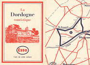
For the 1964 season Esso published the small format (160x110mm) leaflet shown here called La Dordogne touristique, and this is likely to be one of a series covering main tourist areas. It opened out to reveal a rudimentary map above descriptions of the sights in the three main towns; the reverse contained description of the five suggested tours marked on the map. Compagnie Française d'Études et de Réalisations produced the leaflet for Esso. |
 |
|
|
|
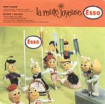
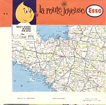
Esso France also produced a distinct oddity in the mid 1960s: a series of around a dozen EPs titled "La Route Joyeuse". Each one consisted of a thin vinyl record to be played at 33rpm with three folk songs from the region shown on the map extract on the rear cover. Number 8, shown here, was from Bretagne/Maine-Anjou, and the tracks included the Breton War zu an heol performed by the ensemble "Kevrenn". |
In 1972 there was the first of the oil price shocks, coupled with an Arab oil embargo on the Netherlands, which included Europe's largest refining centre at Rotterdam. Local Esso companies were no longer expected to produce maps to a uniform design, or indeed at all. Since then there has been a much wider variety of Esso maps, but often produced in relatively small quantities.
Next...>> The next page looks at the wide variety of maps produced since the late 1970s.
Text and layout © Ian Byrne, 1999-2014
All original copyrights in logos and map extracts and images are acknowledged and images are included on this site for identification purposes only.


