ESSO

Road Maps from Germany
Pre-1939 Road Maps
Esso appears to have started issuing sectional maps in Germany around 1933 when the first Standard maps were issued. All dates on this page are provisional, but based upon careful sequencing and matching, where possible to external events.
|
|
|
|
|
|
|
|
1933 |
1934 |
1935-6 |
1937 |
1938 |
1937 |


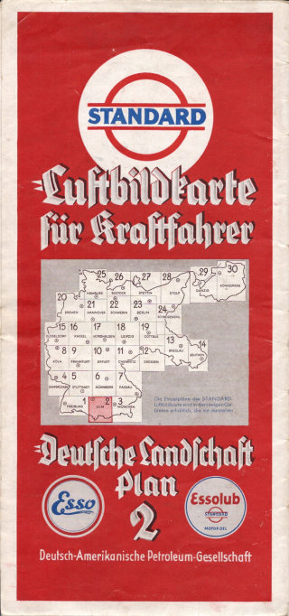
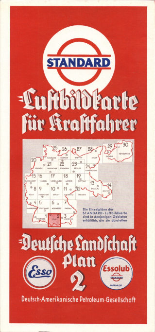
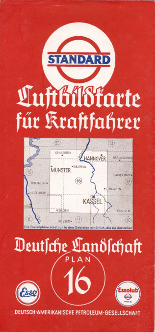
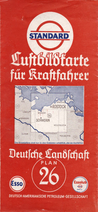
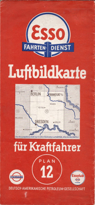
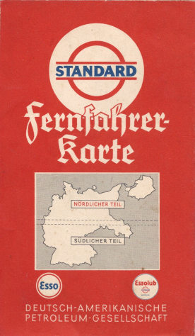
Deutsche-Amerikanische Petroleum was the local Standard company and it issued a series of 30 sectional "Luftbildkarten" - in effect, "aerial picture maps". A fully zoomable scan of Plan 1 from this series (covering most of Baden-Wurttemburg including Stuttgart and Freiburg) can be seen at the bottom of this page. All plans were printed on a semi-gloss paper, although only earlier editions have the white borders. Standard also issued a single sheet map of Germany (right) with simpler clearer cartography; this is known with cover variations that suggest it was issued during the period 1935-8.
|
|
|
The arrangement of the 1933 to 1938 maps can be seen on the key provide on the front of the 1933 and 1934 maps. |
 |


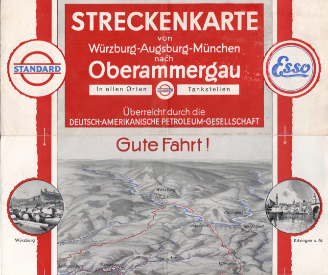
In 1934 Standard also published a "Streckenkarte" showing strip maps of the main routes from Würzburg, Augsburg and Munich to Oberammergau, for visitors to the famous Passion Play. This showed the route as a red line superimposed on an aerial view of the countryside; the full map unfolded into 5 leaves with only the top two shown here, covering the Northernmost portion of the route from Würzburg to the start of the Romantische Straße.
|
|
|
|
|
|
|
|
|
|


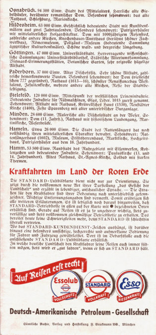
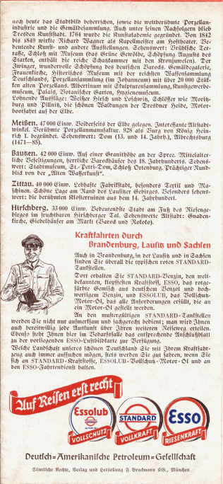
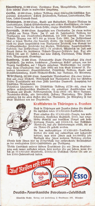
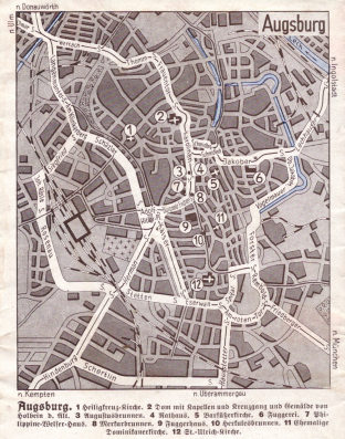
The reverse of each map contained a gazetteer of points of interest. These were always printed using the fraktur script popular in Germany at the time, and the arrangement varied slightly over the years. From left to right, the covers are typical of those from 1933-5, 1936, and 1937-8. The Standard/Esso pump attendant was shown in a number of different poses on the 1937-8 maps. The gazetteer and front cover generally covered the top half of the reverse side of the physical map; the bottom half was normally devoted to street maps of some of the cities covered:
|
|
|
|
|
|


The inset of the centre of Augsburg, believed to be from a 1933 map, shows how quickly the Führer managed to get his name onto the map. The other three extracts are taken from 1933, 1934 and 1939 maps, showing the planned autobahn in 1934 and the result on a totally new map style for the 1939 Esso series.
|
|
|
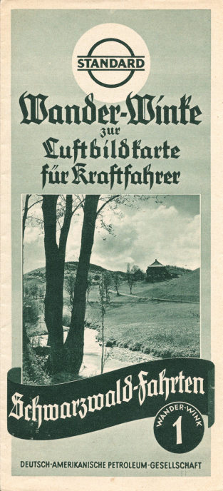
In the mid 1930s Standard added a series of 15 "Wander-Winke" describing scenic tours. Although these were also numbered, the numbers did not match the Luftbildkarte, although no. 1 (shown far left) did overlap Plan 1, and covered a circular route around the Black Forest (Schwarzwald). All were printed on low quality paper using dark green ink. Around the same time Standard also issued an unnumbered Lutbildkarte - Rund um Berlin showing roads and waterways around Berlin at a scale of 1:250,000, larger than the normal Luftbildkarte centred on the city. |
|


 (Front)
|
 (Rear)
|
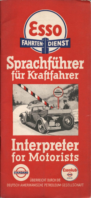
A phrase book for tourists leaving (or visiting Germany) was added; this was reprinted around 1938 in Esso covers (above). |
|
|
|
|
|
|


In 1938 or 1939, Esso moved to a new style of sectional map, with conventional cartography rather than the distinctive aerial views. The first two images above show section 1 from this series - the country was now covered in just 14 sheets and numbered North to South (not South to North). After the war, reasonable road maps of Germany for use by the Allies were scarce, and Esso reprinted this series, but was a large warning overprinted stating that they are a 1938 edition. Inside, it also proved necessary to remove some embarrassing references to the Nazis. These have been defaced by overprinting adverts for Essolub - there are 5 in all. On the section shown here, the advert obliterates Munich and Wasserberg on the pictorial map, presumably because the coat of arms for Munich incorporated a small swastika. Strangely though, Esso did not feel a need to reinstate the border between Germany and Austria, so in one very important aspect the map still reflects Hitler's ambition for a greater Germany.
Fully zoomable Luftbildkarte
Please note that this feature is not compatible with all browsers. I'm trying to locate one that works universally!
The map above is the ca1934 Luftbildkarte Plan 1 - Zwischen Bodensee und Rhein. To zoom in or out use the + or - buttons, or the scroll wheel on your mouse. To pan the image, click anywhere on the map and drag with the mouse.
The next page looks at post-war maps.

Text and layout © Ian Byrne, 2012-9
All original copyrights in logos and map extracts and images are acknowledged and images are included on this site for identification purposes only.