 SHELL
SHELL
Street atlases (Stratenboeken) from the Netherlands
In 1963, a Philips laboratory technician named John Suurland was also working as a part-time reporter for newspaper Eindhovens Dagblad. Suurland spotted that the names, addresses and phone numbers of cultural, recreational and care institutions in Eindhoven were hard to find, so created the Suurland Vademecum - the first of over 400 regularly updated municipal guides.
 |
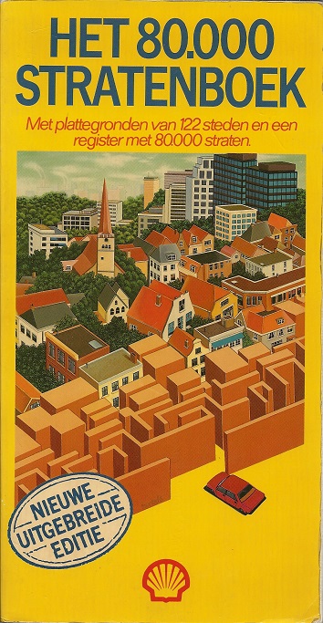
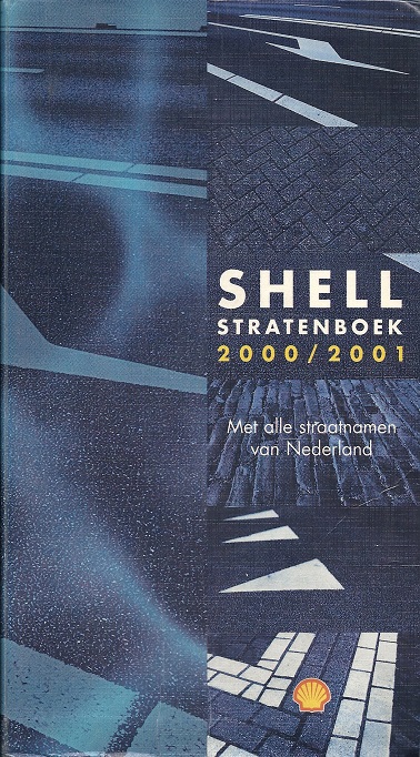
Twenty years later, he realised that addresses were not enough, so came up with the concept of a comprehensive street atlas. After a deal with a national newspaper fell through, he approached Shell and eventually 75,000 copies of a "70,000 Streets" atlas were printed. This was an unexpected success and sold out in just six weeks. The cartography was new and largely prepared from aerial photographs; interviewed in 1996 Suurland revealed each map had 7 tiny errors to trap copiers. By the sixth printing in July 1984 (left), the coverage had been extended to 80,000 streets in 122 towns covering much of the Netherlands: it is described as a new comprehensive edition. There were 128 maps across 220 pages, as most extended across both pages of the atlas which measured approximately 240x123mm when closed. At this stage, however, the community of Leek, to the West of Groningen was still not covered by the atlas. |
 |
 from 1994 Shell Stratenboek") |
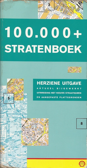
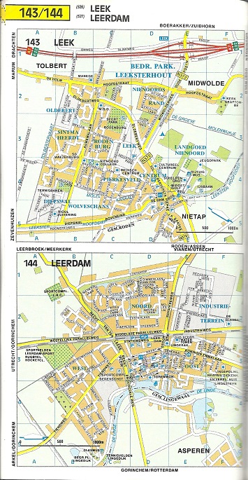
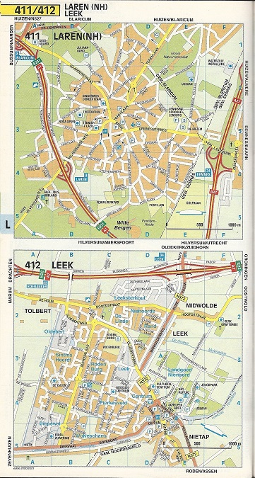
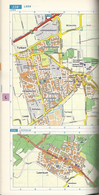
Ten years later, in 1994, the title on the 28th edition had changed to 100,000+ Stratenboek: in fact there were 115,000 streets shown on some 278 maps across 315 pages. Many of the additional plans only covered a half page, including Leek, which shared a page with Leerdam, as can be seen in the enlarged map image. The cartography was clear, distinguishing between most built-up areas (residential or commercial), industrial estates, open agricultural land and woods. Around 20 different symbols were used for facilities or points of interest, including three types of parking (open, garages, P+R). Most, but not all, towns were aligned to North - Leer was around 30° off. |
 |
 from 2000 Shell Stratenboek") |
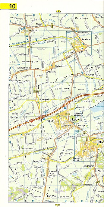
The 1994 street book lacked an oversight map showing the towns covered. By 2000, 99 double pages of sectional maps had been added covering the entire country, and showing the areas covered by the town plans - the page including Leek is shown left. The 44th edition (April 2000) came out in special covers for the millennium. Internally the town plans were unchanged in design from 1994, although there wee now 636 maps, including many smaller communities. The book's binding had been changed to allow it to be opened flat for the towns that spread across two pages. |
 |
 from 2000-1 Shell Stratenboek") |
The next (45th) edition from June 2000 heralded a minor change in cartography with suburbs no longer named in capitals. Although on the face of it, more town plans were added, taking the total to 657, in some cases this was done to decrease the space allocated to smaller places. So although, Maasland now had its own map, this was done to permit Maassluis to just occupy the bottom half of a double page, and created a space for Margraten to be inserted. Doing this meant that Markelo, Marum and Maurik now fitted onto a single page; previously they had had a half page each, with Margraten completing the double spread. |
 |
 from 2008 Shell Stratenboek") |
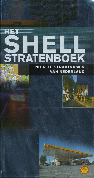
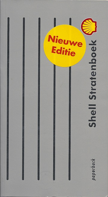
With the rise of GPS and online mapping, such as Tom-tom, sales fell rapidly. Shell/Suurland's response was to reduce costs by moving to cheaper paper and perfect binding, creating a less durable product, sold at a higher price. The 55th edition (2008) claimed to be a new edition; the maps were broadly the same as before but showed more complex street patterns in suburban developments. All towns, including Leek, were now aligned on a North-South axis, but the number had dropped to 468, and the sectional maps were omitted. |
Suurland had started the street books in competition to Falkplan, which had for many years issued folding maps of major Dutch cities. However as early as 1986 the two firms had combined and although most editions credit Suurland-Falkplan, by 2008 the Suurland name had been dropped. In 2010 the final edition was printed, limited to just 2,000 copies. At the time it was reported that sales had fallen sharply since 2008 owing to GPS; cumulative sales figures are not known but were quoted as being 3.3 million in 1996.
A competing atlas from BP
 |
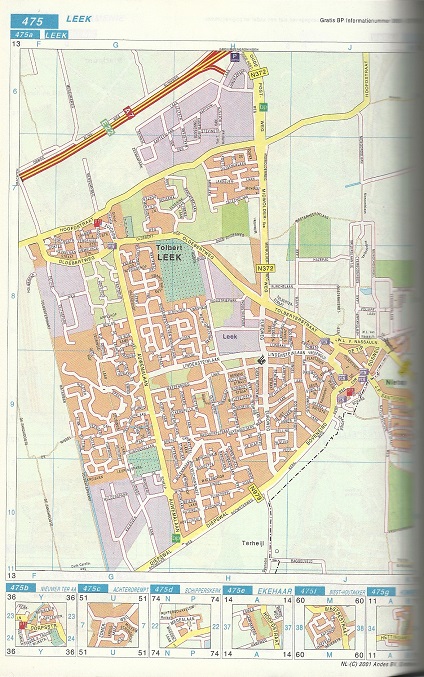
 from 2001 BP Stratenboek") |
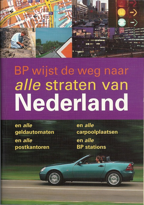
The success of the Shell stratenboek led BP, one of the main competitors in the Dutch petrol market, to issue its own version. Cartographically quite similar to the Shell-Suurland atlas, it was produced for BP by Andes BV of Eindhoven. It started with 77 pages of sectional maps, marking communities with town plans, spread over 703 pages, again on quite cheap paper. Differences included marking all public cash machines (geldautomat), BP filling stations (there's one on the top right of the extract) and showing adjacent villages on the main town map page - the six with Leek included Achterdrempt and Ekehaar. |
BP's atlas was not apparently a commercial success. Launched too late, at a time when Tom-tom was already driving paper maps off the market, although a second edition was published, it ceased publication several years before the Shell street books.

Text and layout © Ian Byrne, 2020
All original copyrights in logos and map extracts and images are acknowledged and images are included on this site for identification purposes only.