Oil company road maps from the Netherlands |
The retail petrol industry in the Netherlands to some extent reflected its importance as a petrol refining centre. An above average number of filling stations and dense network of small filling stations in the 1960s has been replaced by a market with fewer larger stations and an increasing number of unmanned sites. The influence of hypermarkets has been low.
1920 & 30s - The first maps
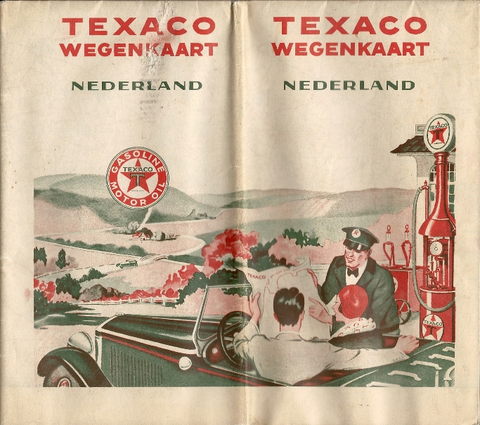
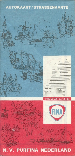
The first service stations appeared in Holland around 1920 under names such as Autoline. However, the Dutch oil industry was soon dominated by Shell (which was majority owned by the Royal Dutch Petroleum Company) and Standard Oil. During the 1920s foreign companies such as Texaco, BP, Sinclair and Purfina (which operated in a joint venture known as Sinfina after 1935) entered the market. Maps from these early years are only rarely found, but the example shown right dates from around 1929-30 as it shares a common design with US and Belgian maps of the period, explaining the atypical scenery. Printed locally by Casparie & Zn of Groningen it has 15 town plans on the reverse. |
 |
 |
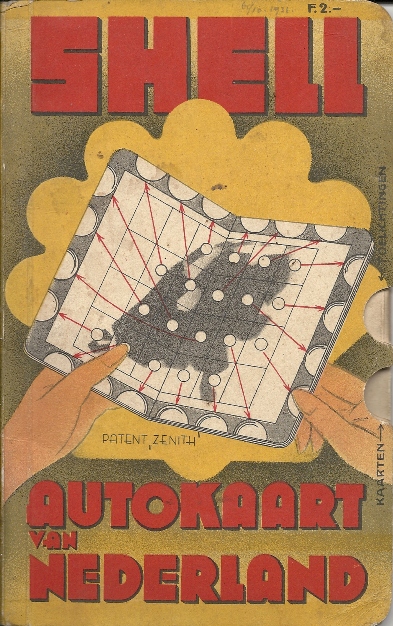
This Shell atlas (left) is the earliest known dated branded Dutch map, dating from July 1931. Sold for Fl2,- the map uses the "Zenith" patent of de Uitgevers, where thumb indexes allow each of 31 sectional pages at 1:200,000 to be found from a central key page. A second key page links to information about traffic signs, street plans from 19 cities, international routes and Shell advertising. The Texaco map (right) has a design similar to 1935 US maps. This was a local production by J Smulders & Co at a scale of 1:400,000. |
 |
1940s-50s - Rebuilding after the war
After initial postwar reconstruction, the city of Rotterdam developed Europe's leading petrol refining centre at Europoort. It was ideally located as a natural transhipment site, giving easy access to both ocean going tankers carrying crude and Rhine barges to take refined products inland to the industrial heartlands of Western Europe.
 |
 |
 |
 |
 |
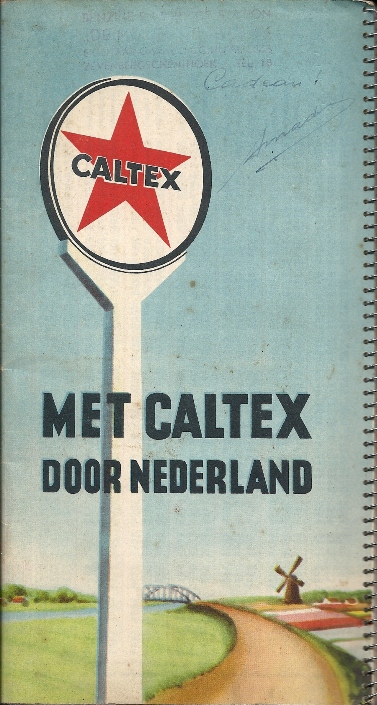
The spiral bound small format atlas from Caltex is likely to be next oldest. This had 5 double spreads of rather unattractive anonymous maps, slicing the country into narrow E-W strips at 1:440,000. Below each map were very basic city plans, and descriptions of the main features of each province. These continued onto pages between each map spread, augmented by an illustration of a Caltex station and, at the back, a town index and mileage chart.
The BP map dates from the mid 1950s. BP was alone in breaking the country into two sheets, available separately. However it had anonymous cartography at a smaller scale (1:400,000) than Esso's single sheet.
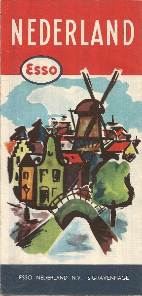
Esso's 1959 map is by Topografische Dienst, using designs from General Drafting Co, at 1:387,000. The rear includes a typical pictorial plan of the country.
Finally the Gulf map dates from around 1959-60. As with a number of other firms with smaller operations, it saved on costs by including Belgium on the same map, using Falkplan's innovative folding system.
1960s
In the 1960s the Netherlands had more filling stations per square kilometre than any other country of Europe - and indeed, probably any other in the world. Many of these were small streetside stations with minimal facilities attached to a small repair garage. To help identification, the Netherlands was the last country in continental Europe to use globes on pumps - only in the British Isles did they stay in regular use for a longer period. Small stations often mean fewer maps, and it is fair to say that Dutch petrol maps are not as numerous as those from many other countries.
 |
 |
 |
 |
 |
Mobil's map is perhaps a year younger. It is an early Falk/Bootsma design at the larger scale of 1:350,000.
Shell's is a typical touring series map of the period, drawn in Germany by Mairs at the distinctly ungenerous scale of 1:600,000. Dated 1965, a couple of years later Shell would move over to Falkplan to start a long running series of larger scale maps.
Pam was a substantial national chain of filling stations owned by SHV, a large trader of coal. It used the later Falkplan cartography at 1:300,000 on this mid 1960s issue.
Finally, a Caltex map prominently marked as gratis - probably unusual for the Netherlands. It used ECI for its maps and, uniquely from those maps shown in the 1950s and 60s, marked all its service station locations with a star.
1970s and 80s
The Netherlands was singled out for an Arab oil embargo at the start of the 1970s owing to its position as the main refining centre of Northern Europe. With its high bicycle use, the resultant car-free Sundays were welcomed by many Dutch people, and no long-term damage was done to the Dutch oil industry. But in common with other countries, it did lead to a cutback in the map programmes by some of the petrol companies.
 |
 |
 |
 |
") |
Aral moved into the Netherlands around 1960, but never developed an especially large chain. Its Dutch maps were of the same design as its German ones, right down to utilising Busche cartography. Although the name "Aral-Kaart" on this 1970 map is in Dutch, the price (1- DM) is German! Next comes something of a curiosity, undated but probably from around 1970. It is a map of the Maas estuary, naming the docks in what was later to become Europoort, but overprinted by BP to mark the exact location of its refinery and nautical installation. Esso have also produced occasional navigation maps.
The Chevron and Texaco maps are more typical. Chevron's 1976 issue takes the common Falkplan/CIB (Bootsma) 1:300,000 map and places inside custom card covers. The only unusual feature is in the way the map is folded to fit Chevron's typically wide format. Texaco takes the same basic map and uses the normal Falkplan folding to produce a tall, narrow map. Total and Mobil had identical maps (shown on the Total and Mobil pages), which also forms the basis of the 1960s Pam map and the Shell, Avia and BIM maps shown below.
Shell sells a popular and comprehensive street atlas (also shown below). Not wishing to be outdone, Esso commissioned a much smaller book of Stadsgids. Initially containing 50 town plans, it had crept up to 52 by 1979, when the Cito-plan version shown above was issued.
The 1990s
The Netherlands probably lost a greater proportion of its filling stations in 1975-2000 than any other main European market. The small streetside stations almost all closed, and the Dutch government embarked on a major programme replacing the old narrow dyke-roads with fast straight routes segregating cars from bicycles. These had only officially designated locations for new filling stations at intervals considerably greater than the old roads passing through the villages. At a corporate level, Tamoil entered the country by buying up the OK co-operative, although neither firm appears to have issued maps.
 |
 |
 |
 |
 |
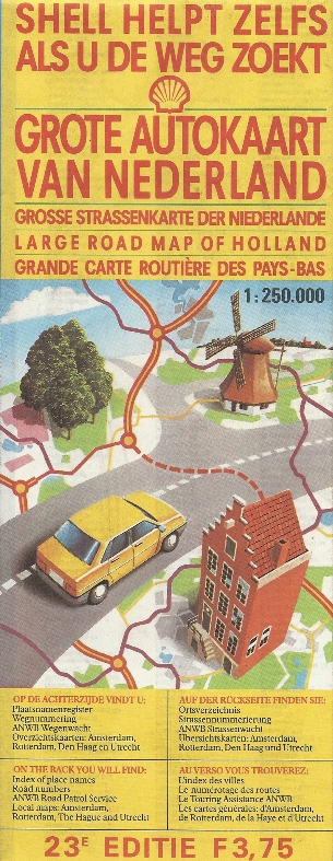
Maps in the 1990s showed a wide variety of styles and formats, although only two firms (Shell and Esso) maintained a full map programme. Shell continued issuing regularly updated versions of its large map based on Falkplan-Suurland cartography (at 1:250,000). The example shown left is clearly marked as the 22nd edition, but carries no date: it is almost certainly from 1990-1. Dutch Shell stations also sell similarly sized maps of Belgium, Germany and France, as well as a softback atlas of Europe.
Esso mainly sold standard maps by Ravenstein or others with Esso glossy card covers pasted onto them. However it has also produced small basic maps marking the locations of its service stations, such as the 1996 example shown above. In contrast BP's 1998 offering was a square booklet containing 23 maps of the same basic Falkplan design as on Shell's sheet map. A full index is included, together with the addresses of all BP sites and - in neighbouring Belgium - Aral and Burmah stations, too.
Smaller names occasionally issued maps. AVIA added its own cover to a 1998 stock Falk map of the country, but possibly the least likely map issuer in the decade was BIM, a small brand controlled by Shell, but sold in 2004 to Gulf. It has added its own standard card covers to typical Suurland Falkplan maps for a number of years - examples from 1998 and 2002 are known.
...and into the new century
The start of the decade saw a further rationalisation of brands, with five names dominant: Shell, Esso, Texaco, BP (which had acquired Mobil, which in turn had previously taken over Aral in the country) and Total, which added the former Fina, Elf and about one third of the smaller BP stations. This created an opportunity for growth by some of the smaller names, such as Argos Oil, Berkman, Brand Oil and a reformed Gulf, franchising the brand from its Indian owners. But the most interesting arrival was TanGo, owned by the refining company Petroplus, which started rapidly building unmanned outlets, but later sold its chain to Q8 (which continues to use the name). Shell responded with its Tinq chain, later sold to Gulf, and even the ANWB (Dutch automobile club) got in on the act, operating 27 unmanned locations before selling its own chain to Gulf in 2007-8. Of course, the new low cost operators didn't produce any maps...
 |
 of the Netherlands") |
 |
 |
Showing a new found confidence after its acquisitions, Total issued a map in 2001 that was notable for using the Patent Falk fold system - a combination of folds and slits that allows all the map to be seen without opening it fully.
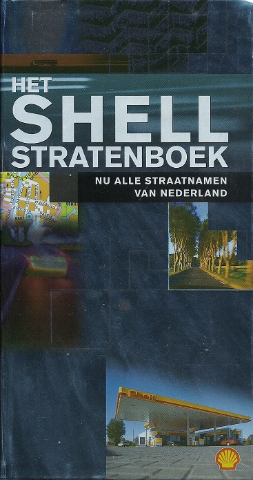
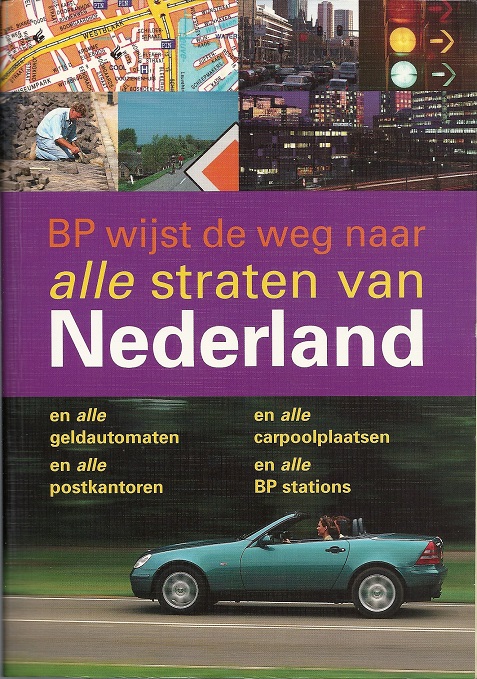
Shell's most popular map is probably the thick Stratenboek (street atlas) published annually. This has over 1,000 pages including its gazetteer, and the silvery example above was a special cover for the Millennium - but another special cover was produced in 2003 to celebrate its 50th edition. BP also tried its hand at a street atlas, with a customised version of the Post Office's book. Larger than the Shell atlas, it has over 1,200 pages, but was let down by being printed on poor quality paper. The 782 pages of Andes maps show every BP station in the country - even though within a year of its publication (May 2001) many were sold off to Total and other companies. BP does not appear to have sold any branded maps since the second edition of this atlas. There is a page devoted to the Shell and BP street atlases.
The 2005 Total issue shown here has reverted to a more conventional folding system, and dropped the scale to 1:300,000, but lists all Total stations on the reverse, below the index of place names. Amazingly Total produced a second 2005 map for free distribution (shown on the Total page), but the one here was pasted in card covers and sold for €3,95.
 |
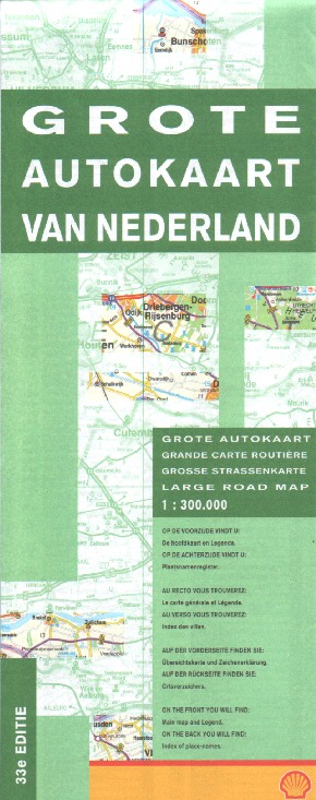
Few branded maps have been produced over the past decade. Shell's April 2008 map was marked as its 33rd edition (); like Total, to cut costs the map had been reduced to 1:300,000, and unlike earlier editions with a similar cover at a larger scale, no town plans were shown on the rear. Shell continued to sell similar maps of France, Belgium and Germany at its Dutch service stations and its stratenboek until 2010 when the latter was discontinued; sheet maps of the Netherlands continued until at least 2014. |
 |
There are other Dutch map images on this site. Several 1950s/60s scenic Esso maps shown, as well as 1960 and 1998 Esso navigation maps. Other maps not shown here can be found on the pages for Caltex, the independent brands Haan and Snijders, Mobil, Shell (1973-95), and Total.

Text and layout © Ian Byrne, 2001-20
All original copyrights in logos and map extracts and images are acknowledged and images are included on this site for identification purposes only.