Road maps from Portugal |
Brief History
Until it joined the EU in the 1980s, Portugal was often seen as being outside the European mainstream, isolated by Spain and looking more to its African colonies and Brazil than to the rest of Europe. This isolation is to some extent reflected in its oil industry; the main players were initially just Standard Oil (later becoming Mobil, not Esso) which started in the country in 1896, and Shell, which operated there from 1910, initially through The Lisbon Coal & Oil Fuel Co. Ltd. With the country under the control of the Salazar dictatorship, it is no surprise that national oil companies were encouraged in the 1930s. The first of these was SONAP (Soc. Nacional de Petróleos) established by private interests in 1933, and followed in July 1938 by state-controlled SACOR, initially set up to build a refinery near Lisbon.
Sacor was entitled to a 50% market share, but never took more than about a third in its independent existence. After the war, Mobil, Shell, Sacor & Sonap were joined by BP in 1954 (although its roots go back to 1919, in the form of Costa & Ribeiro which was later bought by the US company Atlantic Refining). These five brands operated a perfect oligopoly for the next 20 years, until the Portuguese revolution of 1974 which led to the nationalisation of much of the industry in 1975. Petrogal was formed in the following year from Sacor, Sonap, Cidla (which distributed bottled gas) and Petrosul (which owned a refinery at Sines). For the next 15 years, Petrogal's marketing subsidiary - Galp - dominated the market:

In the late 1980s the market began to liberalise, with multinationals Repsol, Esso (1988), Total (1988) and Elf (1989) starting up small chains, as well as a local brand called Anka. In 1992, Petrogal was partly privatised, with shares being acquired by major Portuguese utilities as well as Total. New service stations were constructed throughout the decade by the new entrants, with older street-side pumps closing. Cepsa (part owned by Elf) built a substantial chain, and Italy's Agip and Japan's Idemitsu (Apollo) also entered the fray.
In 1999-2000 Petrogal was reorganised into a new holding company, Galp Energia, with one third of the shares sold to ENI, the parent of Agip. Total no longer had any involvement with Galp, although in mid-2002 it gained 111 former Galp stations in a swap exchange for assets in Spain and in 2008 merged its operations with Cepsa. In 2004 Shell sold its outlets to Repsol allowing the Spanish company to take third rank in the country and four years later Esso and Agip sold their chains to Galp, leaving four major players. |
 |
Maps
 |
Oddly, the first oil company map issues date from during the First World War, when in 1915 and 1916 Vacuum Oil Company issued a sheet map of Portugal dissected and backed on cloth. It was described as a "Carta Itineraria de Portugal...especial para Automoveis" and printed in three colours, using the now standard red for roads. |
 |

|
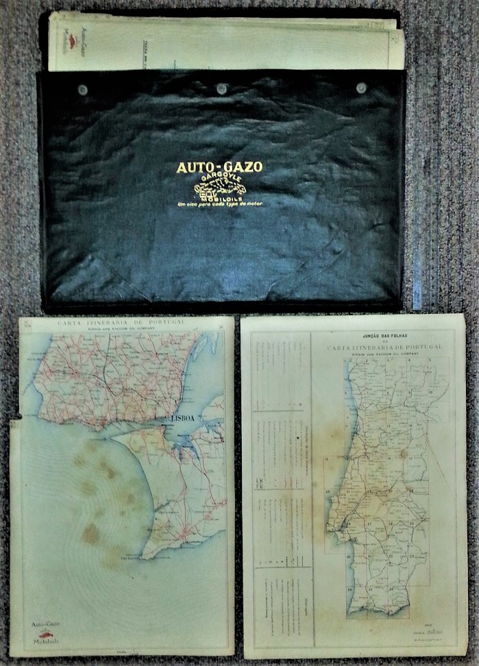
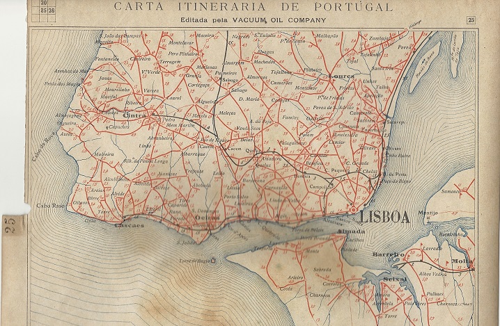
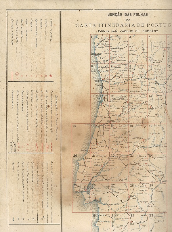
Auto-Gazo's next production was altogether more ambitious. It consisted of 36 cloth-backed, thumb-indexed sheet maps, each measuring 380x250mm, in a black leatherette wallet, with a window on one side allowing the map to be seen without removing it. Maps were at the uniform scale of 1:200,000 with an additional index sheet at 1:2 million. Dated 1918, they were edited for Vacuum Oil Company, apparently by M.Dinix. |

 |
This late 1920s map of Portugal was specially prepared for motorists by the Vacuum Oil Company; it promotes their Mobiloil lubricants and Auto-Gazo motor fuels. Internally it was printed on four sections at 1:200,000 in a card slip case. Note how a hunched chauffeur sits in the front looking at the road signs sponsored by ACP/Mobiloil/Auto-Gazo, while a lady sitting behind him appears to be looking at a map. |
 |
No other maps issued by oil companies are known from before the Second World War.
|
The first postwar oil company maps of Portugal are this series from 1948 by Mobiloil (not Mobilgas). They divided Portugal into four sections North to South (left) with only the final section dated. Right is a May 1960 map of Portugal produced in English and French for intrepid tourists! Only 20,000 copies were printed by Bertrand (Irmãos) Limitada of this rare map which marked Mobil outlets and had inset maps for Porto and Lisbon. The reverse cover was in French with a photo of a lady in Portuguese national costume (shown on Mobil page). |
|


| This 1985 map of Portugal features a colour photograph of a Mobil "Mini Mercado" convenience store on its cover. The service station also shows the typical round stainless steel pumps, designed some 20 years earlier by Eliot Noyes for the company. |

|
Shell's earliest map from Portugal is not actually a road map, but promotes a planned aerial circumnavigation in a Dornier seaplane named "Argos", conceived to repeat the maritime journey made by Magellan in the sixteenth century. Three pilots left Portugal in March 1927 and stopping at Casablanca made the first night crossing of the South Atlantic. However in June, on a flight from Belem, Brazil, a badly repaired door came loose in flight, tearing a wing and disabling the aircraft. Although it later reached Rio, the trip was abandoned and the crew returned to Lisbon by boat. The trip was to have been made exclusively on Shell petrol and oils, and the map still carries the name of The Lisbon Coal & Oil Fuel Co. Ltd; note how the UK is missing from the Western corner of Europe! |

| This undated Shell map of Portugal probably dates from the late 1940s. Although it is entirely in Portuguese, in common with most other European Shell maps of the era it was produced for them by Foldex in London (and printed in England by Bradbury Wilkinson). The inside cover explains how to use the patent Foldex system, but this map was actually pasted into the card covers in a more conventional arrangement, unfolding to a single large sheet. This allowed for national coverage at 1:600,000. |
 from ca1948 Shell map of Portugal")
|
Shell maps of Portugal, like BP below, are most commonly found in the touring service version on a single sheet with Spain. However national maps with insets for Porto and Lisbon can be found, generally at 1:700,000 using local cartography. The two examples here date from 1959 and 1965 credit Papelaria Fernandes and Litografica de Portugal respectively, but are essentially the same map - although only the earlier one marks Shell Touring station locations. The 1959 print run of 20,000 copies had doubled by 1965, although when the later design was first used in 1964, only 15,000 copies were printed. |
|
|


 This Shell map of Portugal is undated, but as it marks locations expected to sell Shell branded LPG in '97 or '98, and from the road construction in the area of Lisbon's Expo 98, it almost certainly dates from 1997. All stations are marked with large Shell logos on a good quality map at 1:600,000; the reverse includes larger scale maps of the Algarve and Lisbon. The focus on tourist areas was possibly due to it being a co-production for Shell and Auto Jardim rent-a-car (which had the other cover). Two insurance companies and Zoomarine had smaller adverts inside; the entire map was produced by Guia Turistico do Norte, Lda.

|

|

|

|

|
BP has been a regular issuer of maps in Portugal. The earliest example shown here (left) is a 1958 city plan of Porto (Oporto) produced by Lito de Portugal. Only 5,000 copies were printed, with the same quantity of a plan of Lisboa (Lisbon). Neither carried a scale; the maps opened out to just 37.5x25cm, four times the cover size, but the reverse side included a list of main hotels, cinemas, museums and other sights. Each city map marked just four BP stations. |
Next in age is a tall format atlas booklet consisting of just four double pages dividing the country North to South. Two years later, BP's Portuguese operation had fallen in line with the international style, covering the country on a single sheet map, and the grey covered map from the mid 1970s was very similar. All three maps were at 1:600,000 and marked principal BP stations, using local cartography and printing (Lito de Portugal, Pedroso da Costa and Orbis respectively. They were also notable for typically small print runs - just 20,000 copies for the atlas and 30,000 for each of the sheet maps. The final maps dates from 1988 and was a joint production with the commercial cartographer Turinta, still at the same scale.

|

|
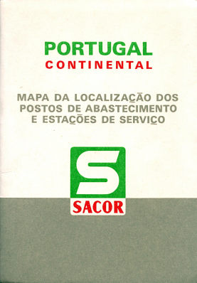
Portuguese maps of any generation are hard to find. The first two examples here are a 1970 Sacor map and a 1974 Sacor, printed by Lito de Portugal, Lisboa/Lito Nacional, Porto. Both locate Sacor petrol stations and marine fuelling points, with the latter at a scale of 1:700,000. |
 |
1970 image courtesy Richard Horwitz |
|||
|
 |
 In 2009 Galp produced this map of Iberia, pasted into light card covers and marking all towns with Galp service stations. Portugal was shown on one side at the scale of 1:600,000, with Spain on the reverse at 1:1.5mn. Cartography and design was by Forways, and the map also listed the addresses of Galp's outlets.
ACP (Touring Club) maps
The Automóvel Club de Portugal has regularly published maps of Portugal. They have often carried advertising from petrol companies, and a 1980 map from the Algarve with an advert from Galp as shown on the adverts page.
 |
 |
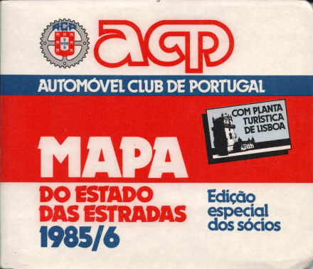
This 1985/6 map is described as Edição especial dos sócios (special edition for partners) and carries advertising from nine different businesses, again including Galp which has a double spread when the card covers are first opened (and also the compass rose on the main map). The map of Portugal at 1:550,000 is backed by a plan of Lisbon. |
Although produced for the Automóvel Club de Portugal (ACP) this 2006/07 map opens up to reveal two internal panels promoting Repsol including a photo of a service station. All towns with a Repsol station are also marked, although the logo used is so small it tends to get lost among the other detail shown (far right, Porto). The map was produced for ACP by GraphicsLeader and is at the scale of 1:350,000. It is printed on thin paper inside light card covers. |
") |
 |
As noted above, the most commonly found maps of Portugal are those that cover the entire Iberian peninsula. These were produced for touring service operations as Spain lacked commercial brands of petrol until 1990. Examples are shown on the Spain page: companies known to have produced such maps include Aral, BP, Caltex, Esso, Fina, Shell and the tiny Belgian firm Pollet.

Text and layout © Ian Byrne, 2003-20
All original copyrights in logos and map extracts and images are acknowledged and images are included on this site for identification purposes only.