ESSO & STANDARD
Road Maps from 1920 to 1951
Pre-Standard Maps
No-one is certain when the first sheet map was issued in Europe by an affiliate of the Standard Oil Co of New Jersey, which later became Esso, but it was probably in the late teens or early 1920s. The earliest maps from any subsidiary of the company known are small format atlases dated 1904 from the Anglo-American Oil Company using its Pratt's Perfection Motor Spirit brand. These were followed by a series of pairs of hardback road atlases of Britain, dating from 1905 to 1931, also using the Pratt's (or later, Pratts) name. Other local names were used across Europe, including Krooks (then Pratts) in Scandinavia, Eco (l'Economique) in France and Dapolin in Germany. At the end of the 1920s the name was standardised to Standard, except in Britain.
 |
 |
 The map's most interesting feature is the way all distances are quoted to the nearest 0,1 kilometre so, for example, it's 52.6km from Celle to Braunschweig. These 3 images are at 5/3rds relative scale. |
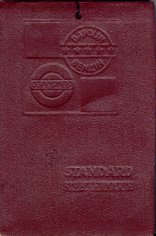
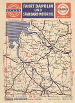
The earliest known map from Deutsche-Amerikanische Petroleum was a simple sheet of Germany (shown on the Germany page) dated Summer 1922 marking its main depots. By the end of the decade, it had moved on to a promotional series of postcards (Streckenkarten), each measuring 15 x 9 cm with a sectional map at 1:2,000,000 on one side, printed in just 2 colours. These cards were either issued singly, with a postcard reverse, or in a pad of the full series of 19 cards and plain reverses. The pad version had an embossed burgundy cloth cover; the maps were illogically numbered from 1 to 17, with an unnumbered map still at the same scale centred on Berlin at the start, and two sections 7 (a and b) covering the routes to Königsberg.
Standard maps from the 1930s
In 1934 Deutsche-Amerikanische Petroleum, now using the Standard name, commissioned a series of 30 Luftbildkarte covering the whole of Germany. The word Luftbildkarte can be loosely translated as Aerial picture map, and the designs from H Bruckmann of Munich certainly justified the appellation.
|
|
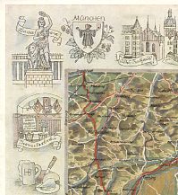
The covers were plain and this map "Rund um Berlin" carried no section number as it was centred on the city - section 23 also including Berlin. Note the small script Esso logo on the bottom left. Inside they had densely coloured maps, with pastel scenic drawings around the borders - the example shown right comes from section 3, North of München - note the beer hall with political flags and stein. More 1930s Standard/Esso maps, including one section that can be poanned and zoomed, are shown on the page devoted to Luftbildkarten. |
|
|
|
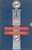
Esso Standard in France also commissioned maps in the 1930s. Left is a thumb-indexed atlas entitled Nos itineraires published in 1934. It runs to 235 A5 pages, showing main routes as strip plans (and indicating Standard stations along them). There are also small plans of major cities, 6 double pages of maps locating the itineraries described, and photos of selected Standard stations. This was the third edition; the 1933 version had a very similar cover, but was much thinner, with 124 pages, no station photos and a fold out map of Paris pasted into the rear. |
|
On the first map (1933?) shown near right, Standard proclaims "Toute la France en une seule carte de petit format" (All of France on a single small format map). The next map (1936?) has a can of Essolube bursting through a black and white photo of the map itself, a design that was retained a couple of years later when the branding had become exclusively Esso (although the corporate name was still Standard Française des Pétroles). These small format maps divide France between the two sides using cartography by Blondel La Rougery at 1:1.5mn. |
|
|
|
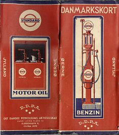
Standard also issued maps through its Scandinavian companies. The left-hand image below shows the rear and front covers of a 1935 or 6 Standard map of Denmark. However it is much more than a basic map. It consists of two booklets, each with a card cover, linked by a folding map from Möller og Landschultz at a scale of 1:500,000. The map is in colour and locates towns and villages with Standard stations by a red dot. The front booklet is 40 pages long and thumb-indexed, revealing sections showing details of Essolube, a mileage chart, a list of official Parking places, road signs, the complete traffic laws of 14 April 1932, a picture of a car chassis showing lubrication points and lubrication charts for cars, commercial vehicles and motor cycles. The section is completed by 92 town plans spotting Standard (DDPA) stations and a quadruple width pull-out map of Copenhagen. The rear booklet is printed on pink paper and lists Standard agents and around 3,800 dealers which sell DDPA (Standard) products.
|
|
|
|
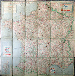
The undated 1930s Standard map of France (centre) was dissected and pasted onto cloth, in the way that British Ordnance Survey maps were frequently mounted. It marks towns with at least one Standard Service Station with a black disc, and lists their addresses on panels on the reverse (which however cannot be read as they are underneath the cloth!). These were company run stations; dealers are not listed, explaining the absence of cities such as Le Mans or Calais from the list. Drawn to a scale of 1:1,250,000 by L. Bergelin, it also marks all aerodromes and "hydravions" for sea planes; the rear cover (also hidden under the cloth backing) promotes Stanavo aviation gasoline.
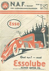
By comparison the 1939 map of Norway is simpler, being an A4 size map that unfolds to a two colour map six times that size printed on quite poor quality paper. Produced by NAF, the Norwegian automobile club, for free distribution at Standard stations (by the Norwegian companies: Ost- and Westlandske Petroleumscompagni A/S) it covers both Norway and Sweden. Around the margins, it has inset town plans for 152 localities showing, inter alia, the Standard service stations.
 |
 |
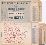 |
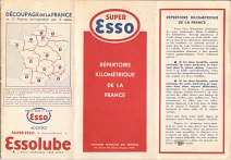
In the 1930s Esso's French arm (Standard Française de Pétroles) produced a Répertoire Kilométrique. Essentially this consisted of a number of distance charts, with each accompanied by a very basic outline map of the area showing the towns on the chart. The first two examples above divided the country into 13 regions (Corsica was missing); each chart had 58 towns plus Paris. They were constructed as a three fold booklet; the "Super Esso" one is datable to 1938, but the one in the middle is undated although probably from the following year, with its centre spread promoting Essolube instead. The final example is of a quite different format; it consists of just 8 mileage charts, on card slides in a five pocket folder, listing many fewer towns. Also undated, it is probably just post-War from its use of "Les Routes de France" on the cover.
Standard maps (but lacking a cover) are also known from Belgium and (separately) Luxembourg, and it is likely that there were small numbers of Standard or Esso maps produced before 1939 for other countries.
Esso maps from the immediate post-war era
Esso became the main brand just before the war, and more pre-war Esso maps are shown on the Esso Germany page. After the war, Europe was busy re-constructing, but there were a growing number of tourists, often visiting war graves, or from the neutral countries in the war. Individual Esso companies continued to issue maps on an uncoordinated basis.
|
|
|
|
|
|
The first three 1940s examples come from neutral countries. The 1948 map of Switzerland looks very much like its US equivalents, but was drawn to a scale of 1:500,000. Again as for US maps, the following year's issue lost the "red top". Both maps appear to have been drawn by General Drafting Co in the US using cartography by Kümmerley & Frey, although neither firm is credited on the map.
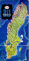
Also in 1949, Esso issued a series of four maps in Sweden, splitting the country North-South. Each had a card cover pasted over a generic map.
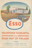
It would be wrong to assume that Esso maps only came from countries unaffected by the war. The French map continued and there were new ones for Germany. Perhaps more surprisingly, considering the devastation suffered by countries, there were issues in the late 1940s in Finland (cartography by Maanmittaushallitus) and Belgium (cartography by Mercedes).
In February 1952, the Esso Touring Service in New York opened a "Foreign department" and suddenly all Esso maps started to look much more alike, with the General Drafting Company setting an international standard for cartographic design. The similarities extended to cover designs too, with most having an Esso logo in a red band above a scenic image of the country covered. The next decade was truly the golden era for Esso maps in Europe as it was in North America.
Next...>>
Text and layout © Ian Byrne, 1999-2011
All original copyrights in logos and map extracts and images are acknowledged and images are included on this site for identification purposes only.


